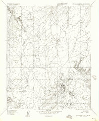
1955 Map of Zith-Tusayan Butte 1 NW
USGS Topo · Published 1958About this map
The Navajo Indian Reservation landscape is defined by the high elevations of the Defiance Plateau during the mid-1950s. The settlement of Sawmill serves as the focal point for local activity, featuring a concentrated cluster of structures supported by a Millpond, Marsh, and Water Tanks. This industry-aligned layout reflects the resource management necessary for processing timber in this wooded highland environment. To the north and west, the map details traditional land-use patterns with scattered Ruins and numerous water sources such as Tohnalchuh Spring and Covered Spring. A small portion of the Canyon De Chelly National Monument is visible in the northwest corner, while distinctive terrain markers like Fluted Rock Lookout and Red Butte provide critical orientation points across the plateau.
Find a feature on this map
20 named features on this map. Tap any name to fly to it.
Don’t see what you’re looking for? This feature index may not catch every label — zoom into the map to look around manually.
Map Details
Editions of this 1955 Zith-Tusayan Butte 1 NW Map
This is the sole edition of this map. No revisions or reprints were ever made.
Other maps of this area

1886 · Fort Defiance
USGS Topo · 1:250,000

1892 · Fort Defiance
USGS Topo · 1:250,000

1892 · Canyon De Chelly
USGS Topo · 1:250,000

1954 · Shiprock
USGS Topo · 1:250,000

1954 · Gallup
USGS Topo · 1:250,000

1955 · Zith-Tusayan Butte 2 SE
USGS Topo · 1:24,000

1955 · Zith-Tusayan Butte 2 NE
USGS Topo · 1:24,000

1955 · Zith-Tusayan Butte 1 SE
USGS Topo · 1:24,000

1955 · Sonsala Butte 4 SE
USGS Topo · 1:24,000

1955 · Sonsala Butte 3 SE
USGS Topo · 1:24,000