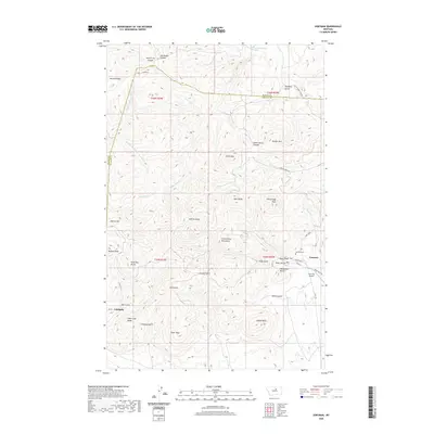
2020 Map of Zortman
USGS Topo · Published 2020About this map
Zortman and Landusky anchor this detailed study of the Little Rocky Mountains, where the landscape is defined by high peaks and deeply cut gulches. The terrain rises sharply to summits like Silver Peak, Antoine Butte, and Beaver Mtn, while the drainage network includes Lodge Pole Cr and Beaver Cr. The arrangement of town sites and roads, such as Main St and Thompson St, reflects a settlement pattern closely tied to the topography of the range. Local history is marked by features like the Zortman Cem and names that hint at the region's prospecting past, including Ruby Gulch, Alder Gulch, and Gold Bug Butte. The map provides a clear picture of the boundary between Blaine Co and Phillips Co as it runs along the western ridges.
Find a feature on this map
55 named features on this map. Tap any name to fly to it.
Don’t see what you’re looking for? This feature index may not catch every label — zoom into the map to look around manually.
Map Details
Editions of this 2020 Zortman Map
This is the sole edition of this map. No revisions or reprints were ever made.
Other maps of this area

1943 · Landusky
USGS Topo · 1:125,000

1953 · Havre
USGS Topo · 1:250,000

1954 · Lewistown
USGS Topo · 1:250,000

1957 · Havre
USGS Topo · 1:250,000

1958 · Havre
USGS Topo · 1:250,000

1959 · Lewistown
USGS Topo · 1:250,000

1971 · Bear Mountain
USGS Topo · 1:24,000

1971 · Hays
USGS Topo · 1:24,000

1971 · Robinson School
USGS Topo · 1:24,000

1971 · Hays SE
USGS Topo · 1:24,000