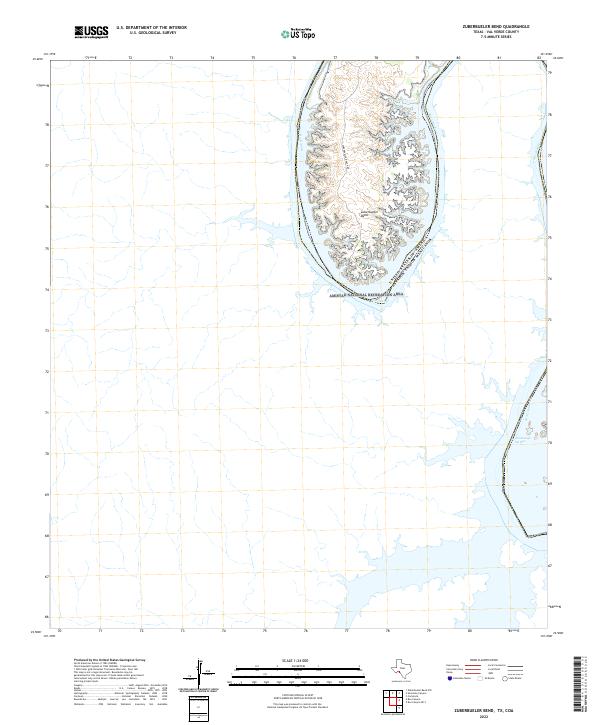
2022 Map of Zuberbueler Bend
USGS Topo · Published 2022About this map
The Rio Grande carves a dramatic oxbow through this desert landscape, forming the prominent Zuberbueler Bend along the international border between the United States and Mexico. This section of Val Verde County is characterized by deep canyons and the impounded waters of the Amistad National Recreation Area, where the river's path is constrained by steep limestone walls. A singular corridor of human access, Zuberbueler Ranch Rd, winds through the interior of the bend, hinting at the long-standing ranching heritage of this isolated terrain.
Find a feature on this map
6 named features on this map. Tap any name to fly to it.
Don’t see what you’re looking for? This feature index may not catch every label — zoom into the map to look around manually.
Map Details
Editions of this 2022 Zuberbueler Bend Map
This is the sole edition of this map. No revisions or reprints were ever made.
Other maps of this area

1941 · Feely
USGS Topo · 1:62,500

1943 · Devils River
USGS Topo · 1:62,500

1944 · Devils River
USGS Topo · 1:62,500

1944 · Mouth Of Pecos
USGS Topo · 1:62,500

1958 · Del Rio
USGS Topo · 1:250,000

1964 · Del Rio
USGS Topo · 1:250,000
1972 · Zuberbueler Bend NW
USGS Topo · 1:24,000

1972 · Seminole Canyon
USGS Topo · 1:24,000
1972 · Zuberbueler Bend
USGS Topo · 1:24,000
1972 · Box Canyon
USGS Topo · 1:24,000