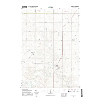
2016 Map of Zumbro Falls
USGS Topo · Published 2016About this map
The rolling terrain of the Driftless Area is captured here at the boundary of Goodhue Co and Wabasha Co during the mid-2010s. The landscape is defined by the small settlement of Oak Center, situated atop a high ridge overlooking a network of deep-cut stream valleys. This geography illustrates a late-stage agricultural pattern where farmsteads and access roads are constrained by the sharply dissected topography of southeastern Minnesota. The transition between these two counties is marked by a sudden shift in the township and range system, highlighting the complex surveying history that governed the division of these fertile uplands and their adjacent wooded coulees.
Find a feature on this map
2 named features on this map. Tap any name to fly to it.
Don’t see what you’re looking for? This feature index may not catch every label — zoom into the map to look around manually.
Map Details
Editions of this 2016 Zumbro Falls Map
This is the sole edition of this map. No revisions or reprints were ever made.
Other maps of this area

1935 · Rochester
USGS Topo · 1:48,000

1939 · Rochester
USGS Topo · 1:62,500

1951 · Lake City
USGS Topo · 1:62,500

1953 · Saint Paul
USGS Topo · 1:250,000

1959 · Saint Paul
USGS Topo · 1:250,000

1965 · Oronoco
USGS Topo · 1:24,000

1968 · Goodhue East
USGS Topo · 1:24,000

1968 · Mazeppa
USGS Topo · 1:24,000
1972 · Zumbro Lake
USGS Topo · 1:24,000
1972 · Millville
USGS Topo · 1:24,000