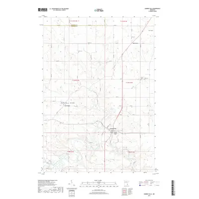
2019 Map of Zumbro Falls
USGS Topo · Published 2019About this map
Zumbro Falls sits at the confluence of the Zumbro River and its North Fork, serving as a focal point for this section of Wabasha County. The landscape is defined by the deep incisions of Buckman Coulee and Hell Coulee, which contrast with the agricultural plateaus found near Oak Center. Transportation routes like Dreamwald Blvd and the Zumbro Parkway Bridge highlight the infrastructure connecting these river valley communities.
Find a feature on this map
56 named features on this map. Tap any name to fly to it.
Don’t see what you’re looking for? This feature index may not catch every label — zoom into the map to look around manually.
Map Details
Editions of this 2019 Zumbro Falls Map
This is the sole edition of this map. No revisions or reprints were ever made.
Other maps of this area

1935 · Rochester
USGS Topo · 1:48,000

1939 · Rochester
USGS Topo · 1:62,500

1951 · Lake City
USGS Topo · 1:62,500

1953 · Saint Paul
USGS Topo · 1:250,000

1959 · Saint Paul
USGS Topo · 1:250,000

1965 · Oronoco
USGS Topo · 1:24,000

1968 · Goodhue East
USGS Topo · 1:24,000

1968 · Mazeppa
USGS Topo · 1:24,000
1972 · Zumbro Lake
USGS Topo · 1:24,000
1972 · Millville
USGS Topo · 1:24,000