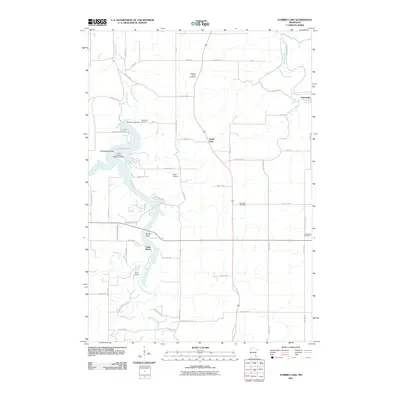
2011 Map of Zumbro Lake
USGS Topo · Published 2011About this map
Zumbro Lake serves as the central focal point of this landscape where the Middle Fork Zumbro River and South Fork Zumbro River converge. The intricate shoreline is marked by prominent features like Rattlesnake Point and Sandy Point, supporting residential clusters such as Cedar Beach and recreation at Kings Park. The Zumbro Lake Dam controls the flow near Woodland Camp, while the Zumbro River continues its course toward the settlement of Hammond in the northeast. This 2011 survey reveals a mix of riverside leisure and traditional rural life, evidenced by the Lake Zumbro Seaplane Base and several upland burying grounds including Pleasant Prairie Cemetery and Farm Hill Cemetery. The grid of county highways and local roads provides access to the small community of South Troy and private aviation sites like Nietz Airstrip.
Find a feature on this map
54 named features on this map. Tap any name to fly to it.
Don’t see what you’re looking for? This feature index may not catch every label — zoom into the map to look around manually.
Map Details
Editions of this 2011 Zumbro Lake Map
This is the sole edition of this map. No revisions or reprints were ever made.
Other maps of this area

1935 · Rochester
USGS Topo · 1:48,000

1939 · Rochester
USGS Topo · 1:62,500

1951 · Lake City
USGS Topo · 1:62,500

1953 · Saint Paul
USGS Topo · 1:250,000

1959 · Saint Paul
USGS Topo · 1:250,000

1965 · Oronoco
USGS Topo · 1:24,000

1966 · Douglas
USGS Topo · 1:24,000

1968 · Mazeppa
USGS Topo · 1:24,000
1972 · Zumbro Lake
USGS Topo · 1:24,000
1972 · Rochester
USGS Topo · 1:24,000