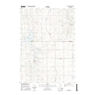
2016 Map of Zumbro Lake
USGS Topo · Published 2016About this map
The Zumbro River and its varied forks dominate this landscape on the boundary of Wabasha and Olmsted counties. The winding river system widens significantly into Zumbro Lake, a reservoir characterized by prominent landforms such as Rattlesnake Point and Sandy Point. Residential and recreational development is clustered near the water at Cedar Beach, while the village of Hammond occupies a bend in the river to the northeast. Small, rural service centers like South Troy and specialized landmarks like the Nietz Airstrip reflect the region's inland character away from the shore. Genealogists will find several notable burial sites scattered across the township grids, including Pleasant Prairie Cem, Farm Hill Cem, and Greenland Cem. The terrain is deeply carved by the Middle Fork Zumbro River and S Fork Zumbro River, creating a complex network of ridges and valleys typical of the region's topography.
Find a feature on this map
85 named features on this map. Tap any name to fly to it.
Don’t see what you’re looking for? This feature index may not catch every label — zoom into the map to look around manually.
Map Details
Editions of this 2016 Zumbro Lake Map
This is the sole edition of this map. No revisions or reprints were ever made.
Other maps of this area

1935 · Rochester
USGS Topo · 1:48,000

1939 · Rochester
USGS Topo · 1:62,500

1951 · Lake City
USGS Topo · 1:62,500

1953 · Saint Paul
USGS Topo · 1:250,000

1959 · Saint Paul
USGS Topo · 1:250,000

1965 · Oronoco
USGS Topo · 1:24,000

1966 · Douglas
USGS Topo · 1:24,000

1968 · Mazeppa
USGS Topo · 1:24,000
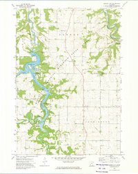
1972 · Zumbro Lake
USGS Topo · 1:24,000
1972 · Rochester
USGS Topo · 1:24,000