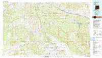
1981 Map of Zuni
USGS Topo · Published 1991About this map
The Zuni Indian Reservation and the Ramah Navajo Indian Reservation dominate this high-desert landscape of western New Mexico, revealing a complex intersection of tribal lands, military history, and public forests. The terrain is defined by the prominent ridge of The Hogback and the heights of the Zuni Mountains, where the Continental Divide winds through the Cibola National Forest. Transportation corridors follow ancient paths and modern engineering, with the Atchison Topeka and Santa Fe railroad and Interstate 40 skirting the northern boundary near settlements like Manuelito and Coolidge. Water management is critical in this arid environment, evidenced by the Nutria Reservoirs, Black Rock Reservoir, and Bluewater Lake. To the south, the presence of El Morro National Monument and the historic Fort Wingate Army Depot emphasize the area's long-standing strategic and cultural importance.
Find a feature on this map
50 named features on this map. Tap any name to fly to it.
Don’t see what you’re looking for? This feature index may not catch every label — zoom into the map to look around manually.
Map Details
Editions of this 1981 Zuni Map
2 editions found
Other maps of this area

1883 · Mt. Taylor
USGS Topo · 1:250,000

1886 · St Johns
USGS Topo · 1:250,000

1886 · Wingate
USGS Topo · 1:250,000

1886 · Mt. Taylor
USGS Topo · 1:250,000

1886 · Fort Defiance
USGS Topo · 1:250,000

1892 · Fort Defiance
USGS Topo · 1:250,000

1892 · St Johns
USGS Topo · 1:250,000

1892 · Wingate
USGS Topo · 1:250,000

1892 · Mt. Taylor
USGS Topo · 1:250,000

1899 · Mt. Taylor
USGS Topo · 1:250,000