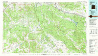
1981 Map of Zuni
USGS Topo · Published 1981About this map
The Hogback and the volcanic terrain of the Zuni Mountains dominate this 1981 landscape, where the high desert meets the forested slopes of the Cibola National Forest. The map documents a complex cultural and administrative geography, illustrating the distinct boundaries of the Zuni Indian Reservation and the Ramah Indian Area. Human settlement is concentrated along the northern corridor of Interstate 40 and the Atchison Topeka and Santa Fe railroad line, connecting hubs like Gallup and Thoreau.
Find a feature on this map
60 named features on this map. Tap any name to fly to it.
Don’t see what you’re looking for? This feature index may not catch every label — zoom into the map to look around manually.
Map Details
Editions of this 1981 Zuni Map
2 editions found
Other maps of this area

1883 · Mt. Taylor
USGS Topo · 1:250,000

1886 · St Johns
USGS Topo · 1:250,000

1886 · Wingate
USGS Topo · 1:250,000

1886 · Mt. Taylor
USGS Topo · 1:250,000

1886 · Fort Defiance
USGS Topo · 1:250,000

1892 · Fort Defiance
USGS Topo · 1:250,000

1892 · St Johns
USGS Topo · 1:250,000

1892 · Wingate
USGS Topo · 1:250,000

1892 · Mt. Taylor
USGS Topo · 1:250,000

1899 · Mt. Taylor
USGS Topo · 1:250,000