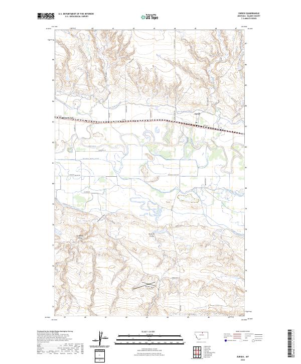
2024 Map of Zurich
USGS Topo · Published 2024About this map
The Milk River corridor defines the geography of this northern Montana landscape, where the settlement of Zurich sits along the BNSF Railway. This area is characterized by an extensive network of irrigation infrastructure essential to the regional cattle and grain economy, including the Fort Belknap Canal, Paradise Valley Canal, and Hillside Ditch. North of the river, the terrain rises into breaks drained by Coal Creek and Battle Creek, while the southern expanse is marked by distinct topographical depressions like Lonetree Coulee and Ninemile Coulee. The presence of the Maddox Ranch Co Airport and the tiny village of North Fork illustrates the sparse, ranch-oriented settlement pattern of Blaine County. This map preserves the contemporary layout of remote prairie roads such as Cherry Ridge Rd and Haystack Rd, providing a precise look at the rural intersections and water management systems of the 21st-century American West.
Find a feature on this map
33 named features on this map. Tap any name to fly to it.
Don’t see what you’re looking for? This feature index may not catch every label — zoom into the map to look around manually.
Map Details
Editions of this 2024 Zurich Map
This is the sole edition of this map. No revisions or reprints were ever made.
Other maps of this area

1904 · Chinook
USGS Topo · 1:62,500

1905 · Harlem
USGS Topo · 1:62,500

1912 · Zurich
USGS Topo · 1:125,000

1913 · Cherry Ridge
USGS Topo · 1:125,000

1953 · Havre
USGS Topo · 1:250,000

1956 · Cleveland
USGS Topo · 1:62,500

1957 · Havre
USGS Topo · 1:250,000

1958 · Havre
USGS Topo · 1:250,000
1964 · Big Coulee
USGS Topo · 1:24,000

1964 · Rabbit Hills
USGS Topo · 1:24,000