Old Maps of Anna's Retreat, Saint Thomas - Saint John District for Hiking & Exploration
Hike through history with 6 historic maps of Anna's Retreat. Explore old trails, ghost towns, and forgotten backroads — perfect for outdoor adventurers and local explorers.
- Rediscover forgotten places: Map out old mining camps, roads, and footpaths that no longer exist on modern maps.
- Layer with modern tools: Combine with LiDAR or satellite views to plan hikes through historical terrain.
- Made for exploration: Popular among hikers, overlanders, and local history lovers.
Use these maps to find adventure and explore the hidden past of Anna's Retreat.
Anna's Retreat, Saint Thomas - Saint John District maps
(6)- 1954 Map of Eastern St. Thomas, 1956 Print
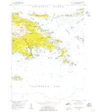 1954 Eastern St. Thomas1956 Print · USGSThe eastern half of St. Thomas is captured here in the mid-1950s, detailing a period of established island settlements and maritime navigation. Trace the early road networks connecting Mandal, Mt Zion, and Nazareth, or locate the Lighthouse and coastal landmarks like Mangrove Lagoon.4 unique versions available
 - 1955 Map of Central St. Thomas, 1956 Print
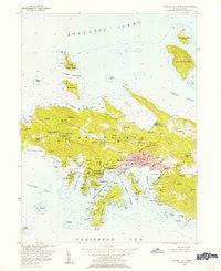 1955 Central St. Thomas1956 Print · USGSSt. Thomas was undergoing a period of significant postwar growth when this mid-century survey was conducted. Researchers can trace the layout of Charlotte Amalie and locate historical landmarks like Fort Christian, Nisky Mission, and the Bluebeard Castle estate.5 unique versions available
 - 2013 Map of Charlotte Amalie, 2013 Print
 2013 Charlotte Amalie2013 Print · USGSCovers Anna's Retreat, including Charlotte Amalie, Charlotte Amalie West, and other nearby areas
 - 2013 Map of Cruz Bay, 2013 Print
 2013 Cruz Bay2013 Print · USGSCovers Anna's Retreat, including Cruz Bay, United States Virgin Islands, and other nearby areas
 - 2024 Map of Cruz Bay, 2024 Print
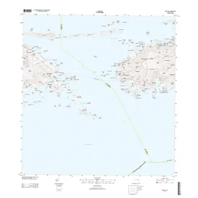
 2024 Cruz Bay2024 Print · USGSThe waters and hills of Saint John and eastern Saint Thomas are shown in their current form, including the entire Virgin Islands National Park boundary. Trace the heritage of the islands through old estate names and burial sites like L'Esperance and the Beverhoudt Cem.
 - 2024 Map of Charlotte Amalie, 2024 Print
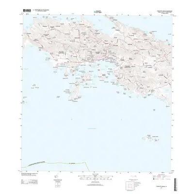
 2024 Charlotte Amalie2024 Print · USGSSaint Thomas comes into sharp focus during the 2020s, showing the intricate layout of its capital and surrounding bays. Researchers can pinpoint historic locations like Nisky Moravian Cem, the Danish Cem, and the defensive ruins at Cowell Battery.
End of results
Showing maps 1-6 of 6
Top cities near Anna's Retreat
Frequently asked questions
- What are the different types of historical maps available for Anna's Retreat?
- What is the oldest map of Anna's Retreat?
- Where can I purchase historical maps of Anna's Retreat for my home or office?
- Where can I download high-res historical maps of Anna's Retreat?
- Are there historical topographic maps available for Anna's Retreat?
- Is there historical aerial imagery available for Anna's Retreat?
- Where are historical maps of Anna's Retreat sourced from?