1990s Maps of Bay Minette, Alabama
Explore 2 historic maps of Bay Minette from the 1990s. These maps offer a rare glimpse into what life looked like during the 1990s — showing old roads, neighborhoods, homes, and landmarks that have changed or disappeared over time.
Whether you're researching your family's past, planning a metal detecting trip, or studying how Bay Minette's landscape evolved across the 1990s, these high-resolution maps are a powerful tool for exploring the history of this region.
- Focus on a specific era: All maps on this page are from the 1990s, giving you a focused view of this time period.
- See what’s changed: Compare century-old streets, trails, and buildings to today's modern landscape using overlays and satellite layers.
- Research with precision: Use these maps for genealogy, historical research, land use analysis, or educational projects.
- View, download, or print: Maps are fully viewable online in high resolution, and can be downloaded or printed for your own records.
Start exploring Bay Minette's history through authentic maps from the 1990s. This is your window into the past.
Bay Minette, AL maps
(2)- 1994 Map of Dyas, 1998 Print
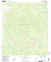
 1994 Dyas1998 Print · USGSBaldwin County at the Florida border in the mid-1990s shows a landscape of creek-side settlements and rural crossroads. Genealogists and local historians can trace the Old Pensacola Road or locate the Cain Cem and Horseneck Ch.
 - 1994 Map of Dogwood Creek, 1998 Print
 1994 Dogwood Creek1998 Print · USGSCoastal Alabama's timberlands and river bottoms are captured here in the mid-1990s just as the landscape remained deeply rural. Genealogists and historians can trace family locations near Pine Grove, High Pine Cem, and the historic Wiggins Still.2 unique versions available
End of results
Showing maps 1-2 of 2
Top cities near Bay Minette
- Mobile historical maps
- Daphne historical maps
- Spanish Fort historical maps
- Loxley historical maps
- Stapleton historical maps
- Creola historical maps
See more
Top neighborhoods of Bay Minette
Frequently asked questions
- What are the different types of historical maps available for Bay Minette?
- What is the oldest map of Bay Minette?
- Where can I purchase historical maps of Bay Minette for my home or office?
- Where can I download high-res historical maps of Bay Minette?
- Are there historical topographic maps available for Bay Minette?
- Is there historical aerial imagery available for Bay Minette?
- Where are historical maps of Bay Minette sourced from?