1900s (20th Century) Maps of Chilton County, Alabama
Explore 46 historic maps of Chilton County from the 1900s (20th Century). These maps offer a rare glimpse into what life looked like during the 1900s — showing old roads, neighborhoods, homes, and landmarks that have changed or disappeared over time.
Whether you're researching your family's past, planning a metal detecting trip, or studying how Chilton County's landscape evolved across the 1900s, these high-resolution maps are a powerful tool for exploring the history of this region.
- Focus on a specific era: All maps on this page are from the 1900s, giving you a focused view of this time period.
- See what’s changed: Compare century-old streets, trails, and buildings to today's modern landscape using overlays and satellite layers.
- Research with precision: Use these maps for genealogy, historical research, land use analysis, or educational projects.
- View, download, or print: Maps are fully viewable online in high resolution, and can be downloaded or printed for your own records.
Start exploring Chilton County's history through authentic maps from the 1900s. This is your window into the past.
Chilton County, AL maps
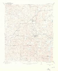
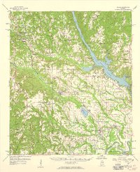
(46)- 1901 Map of Wetumpka
 1901 Wetumpka1901 Print · USGSCentral Alabama at the dawn of the twentieth century was a landscape of river ferries and emerging rail lines. Genealogists and local historians can trace family-named river crossings like Knights Ferry and Nobles Ferry or early community centers such as Nixburg and Eclectic.
 - 1903 Map of Wetumpka
 1903 Wetumpka1903 Print · USGSCentral Alabama at the turn of the century remains a landscape of river ferries and emerging rail lines along the Coosa River. Genealogists and researchers can trace the early locations of Sykes Mills, Liberty Church, and river crossings like Nobles Ferry.3 unique versions available
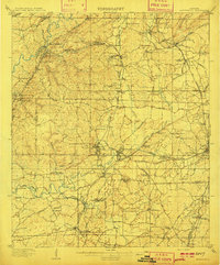
 - 1909 Map of Columbiana, 1968 Print
 1909 Columbiana1968 Print · USGSShelby County at the start of the twentieth century was a vital junction for the Southern and L&N railroads. Local researchers can locate family landmarks like Watson Ford, several rural schools including Summer Hill School, and early churches like Lyon Church.
 - 1910 Map of Montevallo
 1910 Montevallo1910 Print · USGSCentral Alabama’s coal and iron corridor is captured here at a peak of industrial expansion. Researchers can trace the heritage of vanished mining camps and family landmarks from Boothon to the Bibb Furnace (RUINS) and Sessions Chapel.4 unique versions available
 - 1911 Map of Columbiana
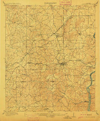 1911 Columbiana1911 Print · USGSCentral Alabama's industrial landscape is captured here just after the first decade of the century, showing a region deeply connected by rail and river. Genealogists can trace family names at Woods Ferry or locate old community hubs like Summer Hill School and Kingdom Church.2 unique versions available
 - 1953 Map of Montgomery, 1964 Print
 1953 Montgomery1964 Print · USGSCentral Alabama's river-and-rail corridor is mapped here in the mid-fifties, showing the vital connections between the capital and the Black Belt. Genealogists and historians can trace rail depots and crossroads from Marion Junction to Wetumpka, alongside landmarks like Craig AFB.4 unique versions available
 - 1953 Map of Birmingham, 1964 Print
 1953 Birmingham1964 Print · USGSCentral Alabama at mid-century shows a landscape defined by industrial expansion and the iron-rich ridges surrounding Birmingham. Researchers can trace the extensive rail networks of the L & N RR or locate historic federal sites like the Anniston Ordnance Depot.4 unique versions available
 - 1956 Map of Birmingham
 1956 Birmingham1956 Print · USGSCentral Alabama in the mid-fifties exhibits a landscape of growing cities and deep-rooted industrial corridors. Genealogists and historians can trace the development of suburban Mountain Brook or locate regional hubs like Sylacauga and Jasper.
 - 1956 Map of Montgomery
 1956 Montgomery1956 Print · USGSCentral Alabama in the mid-1950s shows a landscape defined by its great river systems and a booming military aviation presence. Genealogists and historians can trace the rail corridors of the Southern Railway and locate tactical bases like Maxwell AFB and Craig AFB.
 - 1957 Map of Birmingham
 1957 Birmingham1957 Print · USGSNorth-Central Alabama in the mid-fifties is an industrial powerhouse centered on the steel valleys and sprawling iron ridges. Genealogists and historians can trace the rail-linked growth of Birmingham and Tuscaloosa, or locate rural landmarks like Talladega College and the Anniston Ordnance Depot.
 - 1957 Map of Montgomery
 1957 Montgomery1957 Print · USGSCentral Alabama in the mid-fifties is defined by the winding Alabama River and a strategic network of military bases and rail lines. Trace family roots in Montgomery and Selma, or locate landmarks like Craig AFB and the State Capitol before the interstate era.
 - 1959 Map of Plantersville
 1959 Plantersville1959 Print · USGSDuring the late fifties, the rural communities of central Alabama thrived along the Southern and Mobile and Ohio rail lines. Researchers can trace the heritage of vanished landmarks and family churches like Little Zion Ch, Vine Hill, and the Evergreen Lookout Tower.2 unique versions available
 - 1959 Map of Billingsley, 1960 Print
 1959 Billingsley1960 Print · USGSBillingsley and the surrounding Alabama countryside are captured here in the late fifties as a landscape of rural crossroads and rail-side settlements. Researchers can trace the Gulf and Ohio rail line to find Old Kingston, Vida Junction, and Locust Bluff Sch.3 unique versions available
 - 1959 Map of Summerfield, 1960 Print
 1959 Summerfield1960 Print · USGSPerry and Dallas counties appear here in the late fifties, showcasing a landscape of timber stands and river-bottom settlements. Researchers can trace the locations of family landmarks and rural centers like Cleveland Mills, Lovelady Cem, and Suttle Sch.2 unique versions available
 - 1959 Map of Elmore, 1960 Print
 1959 Elmore1960 Print · USGSElmore County during the late fifties reveals a landscape shaped by the Coosa River and the bustling Louisville and Nashville railroad. Genealogists can trace family names at Zeigler Cem, visit the Union Rosenwald Sch, or locate the aviation footprint of the Elmore Landing Field.2 unique versions available
 - 1971 Map of Richville, 1973 Print
 1971 Richville1973 Print · USGSCoosa County in the early seventies shows a landscape of rural crossroads and creek-fed valleys. Genealogists and local historians can trace family-named sites like Murchison Cem and the small settlements of Richville and Welona.2 unique versions available
 - 1971 Map of Mitchell Dam NW, 1973 Print
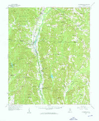
 1971 Mitchell Dam NW1973 Print · USGSThe Coosa River shoreline and the rural border of Chilton County appear here in the early seventies. Genealogists and local historians can locate early settlements like Quinsey and Dollar, or trace family sites such as Duke Cem and McSwain.
 - 1971 Map of Mitchell Dam, 1973 Print
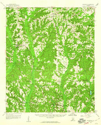
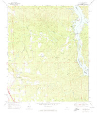
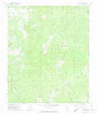
 1971 Mitchell Dam1973 Print · USGSThe Coosa River valley is captured here in the early seventies, dominated by the waters of Mitchell and Jordan Lakes. Researchers can trace rural life through landmarks like Corinth Ch, Williams Cem, and the massive hydroelectric works at Mitchell Dam.2 unique versions available
 - 1971 Map of Lay Dam, 1974 Print
 1971 Lay Dam1974 Print · USGSThe river-driven landscape of the Coosa River is captured in the early seventies, marking the industrial importance of Lay Dam. Genealogists and historians can trace local landmarks like Jumbo, Mims Ferry, and numerous rural churches including Cane Creek Ch.2 unique versions available
 - 1971 Map of Maplesville East, 1974 Print
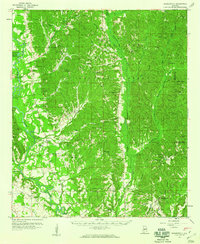
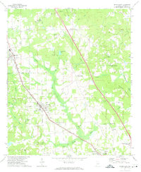
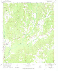 1971 Maplesville East1974 Print · USGSChilton County at the start of the seventies reveals a landscape where rail transport and river drainage shaped every settlement. Researchers can trace the junction of three major railroads near Maplesville or locate family roots at Old Maplesville Cem and Mulberry Ch.2 unique versions available
 - 1971 Map of Jemison West, 1974 Print
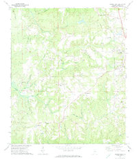 1971 Jemison West1974 Print · USGSChilton County's rural character is on full display in the early seventies as small crossroads communities thrive alongside the railroad. Genealogists and historians can trace family roots at Old Mars Hill Cem and local landmarks like Poseys Crossroads or Pates Chapel.2 unique versions available
 - 1971 Map of Maplesville West, 1974 Print
 1971 Maplesville West1974 Print · USGSChilton and Bibb Counties appear here in the early 1970s, showing a landscape defined by the expansive Talladega National Forest. Researchers can trace the Southern railroad line through Maplesville and locate rural landmarks like Rehobeth Ch and Nix Lake.2 unique versions available
 - 1971 Map of Jemison East, 1974 Print
 1971 Jemison East1974 Print · USGSChilton County in the early seventies is defined by the busy Louisville and Nashville rail corridor and rural crossroads. Local historians can trace family locations through numerous landmarks like Collins Chapel, Thorsby, and the Cedar Grove Ch Cem.2 unique versions available
 - 1971 Map of Randolph, 1974 Print
 1971 Randolph1974 Print · USGSBibb County in the early 1970s reveals a landscape of dispersed settlements and timberland connected by the Southern and Illinois Central Gulf railroads. Genealogists and historians can trace local landmarks like Howison Sch, Bibb Mill, and Oakley.2 unique versions available
 - 1972 Map of Clanton West, 1974 Print
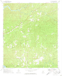
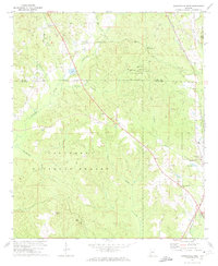
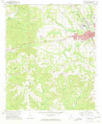 1972 Clanton West1974 Print · USGSChilton County centers on the growth of Clanton in the early seventies as the rail lines and local creeks shaped its development. Genealogists can trace family names at Old Mt Nebo Cem and Friendship Cem or locate community hubs like New Bethel Ch.
Showing maps 1-25 of 46
Top cities of Chilton County
Frequently asked questions
- What are the different types of historical maps available for Chilton County?
- What is the oldest map of Chilton County?
- Where can I purchase historical maps of Chilton County for my home or office?
- Where can I download high-res historical maps of Chilton County?
- Are there historical topographic maps available for Chilton County?
- Is there historical aerial imagery available for Chilton County?
- Where are historical maps of Chilton County sourced from?