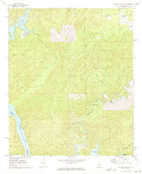
1971 Map of Mitchell Dam NW
USGS Topo · Published 1973About this map
Mitchell Lake and the winding Weogufka Creek dominate this 1971 landscape along the Coosa and Chilton County border. The map reveals a transition between established rural settlements and recreational development, evidenced by the Horse Stamp Campground and a Golf Course near Lake Paint Creek. Small hamlets like Quinsey and Dollar remain central to the local geography, alongside family-named landmarks such as McSwain and Duke Cem.
Find a feature on this map
22 named features on this map. Tap any name to fly to it.
Don’t see what you’re looking for? This feature index may not catch every label — zoom into the map to look around manually.
Map Details
Editions of this 1971 Mitchell Dam NW Map
This is the sole edition of this map. No revisions or reprints were ever made.
Other maps of this area

1890 · Bessemer
USGS Topo · 1:125,000

1890 · Talladega
USGS Topo · 1:125,000

1891 · Clanton
USGS Topo · 1:125,000

1892 · Talladega
USGS Topo · 1:125,000

1892 · Bessemer
USGS Topo · 1:125,000

1901 · Wetumpka
USGS Topo · 1:125,000

1903 · Wetumpka
USGS Topo · 1:125,000

1909 · Columbiana
USGS Topo · 1:62,500

1911 · Columbiana
USGS Topo · 1:62,500

1915 · Gantts Quarry
USGS Topo · 1:48,000