1970s Maps of Colbert County, Alabama
Explore 8 historic maps of Colbert County from the 1970s. These maps offer a rare glimpse into what life looked like during the 1970s — showing old roads, neighborhoods, homes, and landmarks that have changed or disappeared over time.
Whether you're researching your family's past, planning a metal detecting trip, or studying how Colbert County's landscape evolved across the 1970s, these high-resolution maps are a powerful tool for exploring the history of this region.
- Focus on a specific era: All maps on this page are from the 1970s, giving you a focused view of this time period.
- See what’s changed: Compare century-old streets, trails, and buildings to today's modern landscape using overlays and satellite layers.
- Research with precision: Use these maps for genealogy, historical research, land use analysis, or educational projects.
- View, download, or print: Maps are fully viewable online in high resolution, and can be downloaded or printed for your own records.
Start exploring Colbert County's history through authentic maps from the 1970s. This is your window into the past.
Colbert County, AL maps
(8)- 1971 Map of Pride, 1972 Print
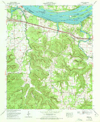 1971 Pride1972 Print · USGSColbert County in the early seventies shows the industrial evolution of the Tennessee River valley alongside its traditional rural settlements. Researchers can trace family sites and infrastructure from the Colbert Steam Plant to quiet landmarks like New Bethel Sch and Rutland Cem.2 unique versions available
 - 1971 Map of Florence, 1972 Print
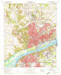 1971 Florence1972 Print · USGSFlorence and the Shoals region thrive along the Tennessee River in the early 1970s, as urban expansion meets massive federal infrastructure projects. Researchers can trace family history through local landmarks like Florence State College, Wilson Dam, and Jerusalem Ch.3 unique versions available
 - 1971 Map of Tuscumbia, 1972 Print
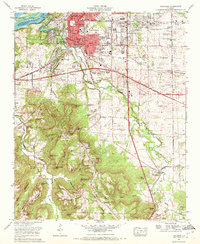 1971 Tuscumbia1972 Print · USGSColbert County's tri-cities area comes to life in this early 1970s survey of the bustling Tennessee River valley. Family historians and researchers can locate landmarks like Oakwood Cem, Deshler High School, and the tracks of the Southern Railway.
 - 1971 Map of Leighton, 1973 Print
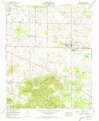 1971 Leighton1973 Print · USGSLeighton and the foothills of the Tennessee Valley are captured here in the early 1970s. Researchers can trace genealogical roots through dozens of local landmarks, from Colbert County High School to historic sites like the La Grange Cem and Blythe Memorial Ch.2 unique versions available
 - 1971 Map of Wheeler Dam, 1973 Print
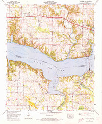 1971 Wheeler Dam1973 Print · USGSIn the early 1970s, the Tennessee River valley near the tri-county border was shaped by hydroelectric power and rising lakes. Genealogists and local historians can trace family landmarks like Fosters Mill, Hennigan Cem, and Center Star across this evolving landscape.2 unique versions available
 - 1971 Map of Russellville, 1973 Print
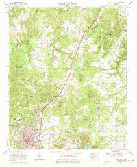 1971 Russellville1973 Print · USGSFranklin County's transition from rural agriculture to post-war industrial growth is visible here in the 1970s. Researchers can trace ancestral roots at the Knights of Pythias Cem and locate schools like the Mountain Star Jr High Sch.3 unique versions available
 - 1971 Map of Killen, 1973 Print
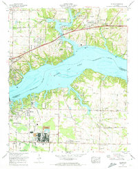 1971 Killen1973 Print · USGSThe Tennessee River shoreline at Wilson Lake underwent significant industrial and residential growth by the early 1970s. Researchers can trace family history at Huff Cem and Brick Sch or locate the specialized industrial settlements of Listerhill and Nitrate City.3 unique versions available
 - 1974 Map of Town Creek, 1975 Print
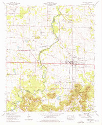 1974 Town Creek1975 Print · USGSThe community of Town Creek is captured in the mid-1970s, flourishing along the Southern Railway at the Colbert and Lawrence county line. Local historians can trace dozens of family landmarks, from Winston Quarters and Hazlewood High School to the quiet Stanley Cem.2 unique versions available
End of results
Showing maps 1-8 of 8
Top cities of Colbert County
- Muscle Shoals historical maps
- Sheffield historical maps
- Tuscumbia historical maps
- Littleville historical maps
- Cherokee historical maps
- Leighton historical maps
Frequently asked questions
- What are the different types of historical maps available for Colbert County?
- What is the oldest map of Colbert County?
- Where can I purchase historical maps of Colbert County for my home or office?
- Where can I download high-res historical maps of Colbert County?
- Are there historical topographic maps available for Colbert County?
- Is there historical aerial imagery available for Colbert County?
- Where are historical maps of Colbert County sourced from?