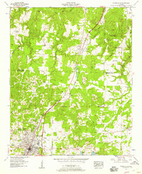
1950s Maps of Colbert County, Alabama
Explore 30 historic maps of Colbert County from the 1950s. These maps offer a rare glimpse into what life looked like during the 1950s — showing old roads, neighborhoods, homes, and landmarks that have changed or disappeared over time.
Whether you're researching your family's past, planning a metal detecting trip, or studying how Colbert County's landscape evolved across the 1950s, these high-resolution maps are a powerful tool for exploring the history of this region.
- Focus on a specific era: All maps on this page are from the 1950s, giving you a focused view of this time period.
- See what’s changed: Compare century-old streets, trails, and buildings to today's modern landscape using overlays and satellite layers.
- Research with precision: Use these maps for genealogy, historical research, land use analysis, or educational projects.
- View, download, or print: Maps are fully viewable online in high resolution, and can be downloaded or printed for your own records.
Start exploring Colbert County's history through authentic maps from the 1950s. This is your window into the past.
Colbert County, AL maps
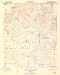
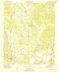
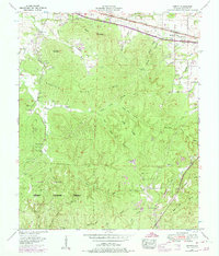
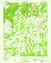
(30)- 1950 Map of Town Creek
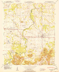 1950 Town Creek1950 Print · USGSNorth Alabama's rail and river corridor comes alive in the late 1940s, centered on the activity at Town Creek. Genealogists and local historians can trace rural family life through landmarks like Winston Quarters, Old Mt Zion Church, and numerous burial grounds including Madding Cem.2 unique versions available
 - 1950 Map of Belmont, 1971 Print
 1950 Belmont1971 Print · USGSTishomingo County at mid-century shows a landscape of ridge-top settlements and growing infrastructure like the Natchez Trace Parkway. Researchers can trace the path of the Illinois Central Railroad through Belmont or locate rural landmarks like Liberty Ch and Russell Cem.2 unique versions available
 - 1950 Map of Bishop, 1974 Print
 1950 Bishop1974 Print · USGSWestern Colbert County at mid-century shows a landscape of border-town settlements and river-valley farms just as the modern parkway was arriving. Trace the old community footprints at Allsboro, Maud, and Bishop, or locate family sites like Twitty Cem and Asphalt Rock Church.2 unique versions available
 - 1950 Map of Tishomingo, 1974 Print
 1950 Tishomingo1974 Print · USGSTishomingo and the surrounding hill country of northeast Mississippi are captured here in the mid-twentieth century. Researchers can trace the development of the Natchez Trace Parkway and locate rural landmarks like Boggs Chapel, Petertown, and the Illinois Central rail line.3 unique versions available
 - 1950 Map of Pleasant Site, 1987 Print
 1950 Pleasant Site1987 Print · USGSNorthwestern Alabama is shown at mid-century as a land of creek-side settlements and forested ridges. Researchers can locate Pleasant Site, trace the Natchez Trace Parkway, and find family history at Freedom Hills Church or Lower Pleasant Site Cem.
 - 1951 Map of Hatton
 1951 Hatton1951 Print · USGSLawrence County at mid-century reveals a rural landscape defined by the transition from Black Ground Mountain to the Moulton Valley. Genealogists can trace family roots through numerous sites like Beavers Cem, Flat Rock School, and Old Okolona Church.2 unique versions available
 - 1951 Map of Pleasant Site
 1951 Pleasant Site1951 Print · USGSNorthwest Alabama is seen here in the early fifties, where the rugged terrain of the Freedom Hills meets the Alabama Wildlife Refuge. Genealogists and local historians can trace family locations through Freedom Hills Church, Patterson Cem, and the old lookout at Pope Lookout Tower.3 unique versions available
 - 1951 Map of Bishop
 1951 Bishop1951 Print · USGSThe Alabama-Mississippi state line and the historic Natchez Trace corridor are captured here during the mid-century. Researchers can locate family roots at Allsboro and Maud, or trace historic burial sites like Alsobrook Cem and Liberty Cem.2 unique versions available
 - 1951 Map of Belmont
 1951 Belmont1951 Print · USGSTishomingo County, Mississippi, and the Alabama borderlands come alive in the early fifties as the Illinois Central railroad links the rural south. Genealogists can trace family roots through numerous landmarks like Russell Cem, Forest Grove School, and the settlement of Belmont.
 - 1951 Map of Tishomingo
 1951 Tishomingo1951 Print · USGSThe Tennessee and Mississippi borderland comes into focus in the early 1950s as the Natchez Trace winds through the hills of Tishomingo. Researchers can trace the Illinois Central rail line, find the Indian mound near the state line, or locate family sites like Hodges Cem and Boggs Chapel.
 - 1952 Map of Wheeler Dam, 1957 Print
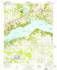
 1952 Wheeler Dam1957 Print · USGSThe Tennessee River corridor transformed in the mid-twentieth century as hydroelectric power and new state parks reshaped the Shoals region. Local historians can trace family roots through Hennigan Cem or explore the early layout of Wheeler Dam Village and Fosters Mill.
 - 1952 Map of Leighton, 1957 Print
 1952 Leighton1957 Print · USGSLeighton and the surrounding Colbert County countryside are captured here in the early fifties, from the Tennessee Valley flats to the heights of the southern ridges. Genealogists can locate family landmarks like La Grange Cem, Cole Cem, and the La Grange College Monument.
 - 1952 Map of Tuscumbia, 1958 Print
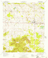
 1952 Tuscumbia1958 Print · USGSTuscumbia and Sheffield are shown in detail during a period of post-war expansion along the Tennessee River. Genealogists can locate family names and rural landmarks such as Isbell Chapel, Spring Valley Church, and the Helen Keller Home alongside several country cemeteries.
 - 1953 Map of Killen, 1957 Print
 1953 Killen1957 Print · USGSThe Tennessee River valley in the early fifties shows a landscape reshaped by industry and the waters of Wilson Lake. Researchers can trace the development of Nitrate City and Listerhill or find family landmarks like Old Brick Ch and Woodlawn Cem.
 - 1953 Map of Margerum, 1958 Print
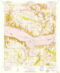
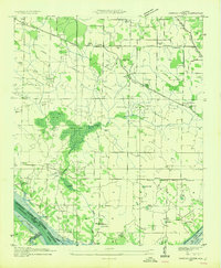
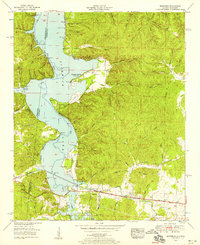 1953 Margerum1958 Print · USGSThe Colbert County shoreline and the community of Margerum appear here in the early fifties as Pickwick Lake reshapes the valley. Trace industrial sites like the Alabama Asphaltic Limestone Company and rural landmarks such as Douthit Ch and a covered bridge.4 unique versions available
 - 1953 Map of Wright, 1958 Print
 1953 Wright1958 Print · USGSLauderdale County's southern border met the waters of the Tennessee River in the early fifties, following the creation of Pickwick Lake. Genealogists can trace family landmarks through the numerous hollows and country churches like Oak Grove Ch and Murphy Chapel.3 unique versions available
 - 1953 Map of Waterloo, 1958 Print
 1953 Waterloo1958 Print · USGSThe Alabama and Mississippi borderlands meet at the Tennessee River in the mid-fifties, just as the regional economy shifted toward the new reservoir. Researchers can locate family landmarks like Richardson Cem, Barrett Mill, and the small riverfront town of Waterloo.3 unique versions available
 - 1953 Map of Barton, 1974 Print
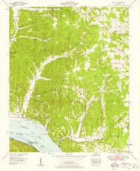
 1953 Barton1974 Print · USGSColbert County's corridor between Cherokee and Barton is shown here in the mid-1950s, highlighting the transition from railside commerce to the deep hollows of Mills Mountain Ridge. Researchers can find legacy sites like Mountain Mills School, the Old Newsom Springs Cem, and the Barton Compressor Station.4 unique versions available
 - 1954 Map of Sinking Creek
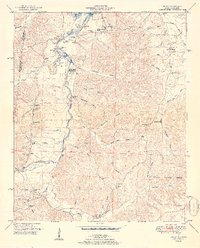
 1954 Sinking Creek1954 Print · USGSLauderdale County is captured here in the mid-1930s as the Tennessee Valley Authority began transforming the landscape. Researchers can trace ancestral locations like Oakland, the Lipscomb Cem, and the Lovelace Sch before the reservoir waters rose.4 unique versions available
 - 1954 Map of Pride, 1958 Print
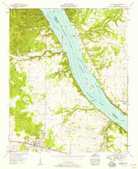
 1954 Pride1958 Print · USGSColbert County and the Tennessee River corridor are captured here during the mid-fifties industrial expansion. You can trace the rail-and-river economy near Pride and find rural landmarks like Zion Ch, Barton Sch, and the riverside Colbert Steam Plant.
 - 1954 Map of Cherokee, 1958 Print
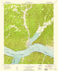
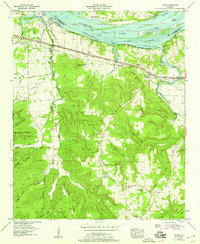
 1954 Cherokee1958 Print · USGSCherokee and the Tennessee River valley are documented here in the mid-fifties as the region balanced its rail-town roots with new shoreline developments. Local historians can trace old wagon routes and family landmarks like Monk Chapel, Smithsonia, and the historic Natchez Trace.4 unique versions available
 - 1956 Map of Gadsden, 1966 Print
 1956 Gadsden1966 Print · USGSNorth Alabama in the mid-1950s shows a region transformed by river engineering and federal industry. Genealogists and local historians can trace the development of the Tennessee Valley through the growth of Huntsville, the sprawling Redstone Arsenal, and the expansive Guntersville Lake.3 unique versions available
 - 1956 Map of Tupelo, 1967 Print
 1956 Tupelo1967 Print · USGSNortheast Mississippi and parts of Tennessee and Alabama are shown here during the mid-fifties, a time of major reservoir construction and forestry management. Researchers can trace the St Louis-San Francisco RR through Tupelo or locate historic sites like Tishomingo State Park and the University.2 unique versions available
 - 1957 Map of Old Bethel, 1958 Print
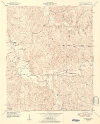
 1957 Old Bethel1958 Print · USGSThe rural uplands of Colbert and Franklin Counties come into focus in the late 1950s, showing a landscape of ridge-top farms and deep hollows. Genealogists can trace family footprints through numerous country congregations and schools, including Old Bethel Church, Saints Crossroads, and Rocky Glen School.3 unique versions available
 - 1957 Map of Russellville, 1958 Print
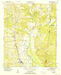
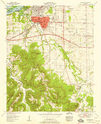
 1957 Russellville1958 Print · USGSMid-century Franklin County comes to life as the industrial and transit hub of North Alabama. Genealogists and researchers can trace local families through many sites like Young Cemetery and Wesley Memorial Church or locate the old Russellville Landing Field.
Showing maps 1-25 of 30
Top cities of Colbert County
- Muscle Shoals historical maps
- Sheffield historical maps
- Tuscumbia historical maps
- Littleville historical maps
- Cherokee historical maps
- Leighton historical maps
Frequently asked questions
- What are the different types of historical maps available for Colbert County?
- What is the oldest map of Colbert County?
- Where can I purchase historical maps of Colbert County for my home or office?
- Where can I download high-res historical maps of Colbert County?
- Are there historical topographic maps available for Colbert County?
- Is there historical aerial imagery available for Colbert County?
- Where are historical maps of Colbert County sourced from?