1930s Maps of Franklin County, Alabama
Explore 17 historic maps of Franklin County from the 1930s. These maps offer a rare glimpse into what life looked like during the 1930s — showing old roads, neighborhoods, homes, and landmarks that have changed or disappeared over time.
Whether you're researching your family's past, planning a metal detecting trip, or studying how Franklin County's landscape evolved across the 1930s, these high-resolution maps are a powerful tool for exploring the history of this region.
- Focus on a specific era: All maps on this page are from the 1930s, giving you a focused view of this time period.
- See what’s changed: Compare century-old streets, trails, and buildings to today's modern landscape using overlays and satellite layers.
- Research with precision: Use these maps for genealogy, historical research, land use analysis, or educational projects.
- View, download, or print: Maps are fully viewable online in high resolution, and can be downloaded or printed for your own records.
Start exploring Franklin County's history through authentic maps from the 1930s. This is your window into the past.
Franklin County, AL maps
(17)- 1935 Map of Pleasant Site
 1935 Pleasant Site1935 Print · USGSNorth Alabama rural life is captured here in the mid-1930s along the boundary of Colbert and Franklin Counties. Genealogists and historians can trace family roots through sites like Bates Hill Ch, Harmony Cem, and the settlement at Pogo.
 - 1936 Map of Russellville
 1936 Russellville1936 Print · USGSFranklin County in the mid-1930s shows a landscape of small agricultural settlements and nascent industrial infrastructure along the Southern Railway. Genealogists can trace family landmarks and schools like Mountain Star Sch, the Iron Mine (Abandoned), and Osborn Cem.
 - 1936 Map of Newburg
 1936 Newburg1936 Print · USGSFranklin County's rural ridge-and-valley landscape is captured here in the mid-1930s as the Black Warrior National Forest was being established. Family historians can locate specific community centers like Kimbrough Chapel, Newburg, and Little Trapp Sch among the winding hollows.
 - 1936 Map of Belmont
 1936 Belmont1936 Print · USGSNortheast Mississippi at the height of the New Deal era features the growth of Belmont and the establishment of Tishomingo State Park. You can trace rural schoolhouses and family cemeteries like Burnt Mill Sch and Russell Cem along the Illinois Central Railroad.
 - 1936 Map of Kinlock Spring
 1936 Kinlock Spring1936 Print · USGSWinston and Franklin Counties were transitioning into a new era of federal land management and infrastructure during the mid-thirties. Genealogists can locate family-named landmarks like Posey Mill, Carrolls Cross Roads, and the CCC Camp No F 3 near the National Forest boundary.
 - 1936 Map of Frankfort
 1936 Frankfort1936 Print · USGSNorthwest Alabama in the mid-1930s reveals a patchwork of small creek-side settlements and rural schools along the Chickasaw Boundary. Researchers can trace old family sites and crossroads like Frankfort, Hovaters Mill, and the Burnt Church Cem.
 - 1936 Map of Pleasant Grove
 1936 Pleasant Grove1936 Print · USGSNorthwestern Alabama's borderlands are captured here in the mid-1930s, showing a rural landscape of scattered homesteads and creek-side communities. Genealogists can trace family lines through numerous sites like Tick Hill Ch, Bond Cem, and the old school at Posey Sch.
 - 1936 Map of Hodges
 1936 Hodges1936 Print · USGSNorthwest Alabama at the height of the New Deal era reveals a rural landscape shaped by winding creeks and early industrial corridors. Genealogists can locate family landmarks like Mc Curley Cem, Old Lion Ch, and the historic Alabama Military Road.
 - 1936 Map of Red Bay
 1936 Red Bay1936 Print · USGSRed Bay and the Franklin County borderlands appear here in the mid-thirties as the Tennessee Valley Authority began its regional transformations. Genealogists and local historians can trace family sites at Patterson Chapel, Burgess Cem, and the old rail stops along the Illinois Central line.
 - 1936 Map of Isbell
 1936 Isbell1936 Print · USGSFranklin County's rural landscape is captured here in the mid-1930s as the Tennessee Valley Authority began its regional work. Researchers can trace family history through numerous landmarks including Marmon Cem, Pleasant Hill Sch, and the Old Chickasaw Bdy.
 - 1936 Map of Phil Campbell
 1936 Phil Campbell1936 Print · USGSNorthwest Alabama at the height of the mid-thirties shows a landscape of ridge-top settlements and creek-side industry. Genealogists can trace family roots through numerous rural landmarks like Morris Hill Ch, Phillips Sch, and the Lowler Mines.
 - 1936 Map of Hackleburg
 1936 Hackleburg1936 Print · USGSMarion and Franklin counties come into focus during the mid-thirties as the Tennessee Valley Authority began modernizing the rural landscape. Trace local heritage through landmarks like State Convict Camp D, the Jackson Military Road, and numerous family cemeteries including Grissom Cem.
 - 1936 Map of Spruce Pine
 1936 Spruce Pine1936 Print · USGSFranklin County enters a period of modern transformation in the mid-1930s as federal projects and industry reshape the land. Genealogists can trace family footprints at Sloss Chapel, Enterprise Sch, and the Sargent Cem near the town of Waco.
 - 1936 Map of Vina
 1936 Vina1936 Print · USGSThe area surrounding Vina in the mid-1930s is captured here during a period of infrastructure growth and rural transition. Researchers can locate family landmarks like Jones Cem and trace the path of the Illinois Central railroad.
 - 1936 Map of Halltown
 1936 Halltown1936 Print · USGSFranklin County in the mid-1930s is a landscape of creek-side settlements and rural crossroads connected by the Illinois Central railroad. Family historians can locate rural landmarks like Halltown Cem, Coker Sch, and the community of Burntout.
 - 1936 Map of Guinn Cross Roads
 1936 Guinn Cross Roads1936 Print · USGSFranklin County's rural highlands are shown here in the mid-1930s, documenting a landscape of ridge-top settlements and creek-side mills. Trace family roots at Bradley Chapel or locate the sites of Sparks Mill and Old Nauvoo.
 - 1936 Map of Old Bethel
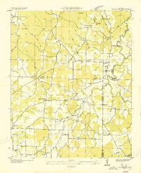 1936 Old Bethel1936 Print · USGSNorthwest Alabama at the height of the 1930s reveals a landscape of interconnected family farms and small rural hubs. Genealogists and local historians can locate early homesteads near Old Bethel, Clemments Mill, and community schools like Rocky Glen Sch.
End of results
Showing maps 1-17 of 17
Top cities of Franklin County
- Russellville historical maps
- Red Bay historical maps
- Phil Campbell historical maps
- Vina historical maps
- Hodges historical maps
- Spruce Pine historical maps
Frequently asked questions
- What are the different types of historical maps available for Franklin County?
- What is the oldest map of Franklin County?
- Where can I purchase historical maps of Franklin County for my home or office?
- Where can I download high-res historical maps of Franklin County?
- Are there historical topographic maps available for Franklin County?
- Is there historical aerial imagery available for Franklin County?
- Where are historical maps of Franklin County sourced from?