1990s Maps of Franklin County, Alabama
Explore 2 historic maps of Franklin County from the 1990s. These maps offer a rare glimpse into what life looked like during the 1990s — showing old roads, neighborhoods, homes, and landmarks that have changed or disappeared over time.
Whether you're researching your family's past, planning a metal detecting trip, or studying how Franklin County's landscape evolved across the 1990s, these high-resolution maps are a powerful tool for exploring the history of this region.
- Focus on a specific era: All maps on this page are from the 1990s, giving you a focused view of this time period.
- See what’s changed: Compare century-old streets, trails, and buildings to today's modern landscape using overlays and satellite layers.
- Research with precision: Use these maps for genealogy, historical research, land use analysis, or educational projects.
- View, download, or print: Maps are fully viewable online in high resolution, and can be downloaded or printed for your own records.
Start exploring Franklin County's history through authentic maps from the 1990s. This is your window into the past.
Franklin County, AL maps
(2)- 1994 Map of Corinth
 1994 Corinth1994 Print · USGSNortheast Mississippi and the Tennessee borderlands are captured in the mid-1990s as the region's modern industrial and recreational landscape took shape. Genealogists and historians can trace rail-to-river connections through Corinth, the old courthouse at Jacinto, and the route of the Natchez Trace Parkway.
 - 1998 Map of Hodges, 2000 Print
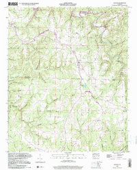 1998 Hodges2000 Print · USGSThe rural borderlands of Franklin and Marion counties are captured here in the late twentieth century, centered on the railroad town of Hodges. Researchers can trace family history through sites like Old Lion Cemetery, Mt Zion Church, and the Illinois Central Railroad line.
End of results
Showing maps 1-2 of 2
Top cities of Franklin County
- Russellville historical maps
- Red Bay historical maps
- Phil Campbell historical maps
- Vina historical maps
- Hodges historical maps
- Spruce Pine historical maps
Frequently asked questions
- What are the different types of historical maps available for Franklin County?
- What is the oldest map of Franklin County?
- Where can I purchase historical maps of Franklin County for my home or office?
- Where can I download high-res historical maps of Franklin County?
- Are there historical topographic maps available for Franklin County?
- Is there historical aerial imagery available for Franklin County?
- Where are historical maps of Franklin County sourced from?