1940s Maps of Franklin County, Alabama
Explore 15 historic maps of Franklin County from the 1940s. These maps offer a rare glimpse into what life looked like during the 1940s — showing old roads, neighborhoods, homes, and landmarks that have changed or disappeared over time.
Whether you're researching your family's past, planning a metal detecting trip, or studying how Franklin County's landscape evolved across the 1940s, these high-resolution maps are a powerful tool for exploring the history of this region.
- Focus on a specific era: All maps on this page are from the 1940s, giving you a focused view of this time period.
- See what’s changed: Compare century-old streets, trails, and buildings to today's modern landscape using overlays and satellite layers.
- Research with precision: Use these maps for genealogy, historical research, land use analysis, or educational projects.
- View, download, or print: Maps are fully viewable online in high resolution, and can be downloaded or printed for your own records.
Start exploring Franklin County's history through authentic maps from the 1940s. This is your window into the past.
Franklin County, AL maps
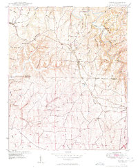
(15)- 1945 Map of Spruce Pine
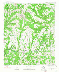
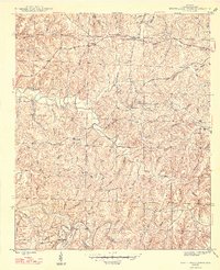
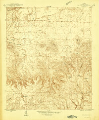 1945 Spruce Pine1945 Print · USGSSpruce Pine and the surrounding Franklin County countryside appear here just as the post-war era began, balancing industrial mining with deep-rooted rural communities. Researchers can locate family landmarks like Sargent Cem and Enterprise Sch, or trace the old Southern railroad line.3 unique versions available
 - 1945 Map of Isbell, 1960 Print
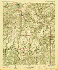
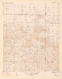
 1945 Isbell1960 Print · USGSFranklin County in the mid-1940s reveals a transition from remote hollows to an emerging industrial landscape. Genealogists can trace family names at McWright Cem and Lawler Cem or locate community hubs like New Friendship Ch.3 unique versions available
 - 1945 Map of Newburg, 1970 Print
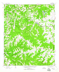
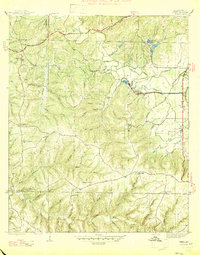
 1945 Newburg1970 Print · USGSThe northern reaches of the Bankhead National Forest are shown in the mid-1940s, documenting a landscape of rural communities and wooded ridges. Genealogists can locate family landmarks like Kimbrough Cem, Oak Grove Ch, and Piney Grove Sch.2 unique versions available
 - 1946 Map of Hackleburg, 1960 Print
 1946 Hackleburg1960 Print · USGSHackleburg and the surrounding Marion County countryside are captured here in the mid-1940s, centered on the Illinois Central Railroad corridor. Researchers can locate early family landmarks like Lawler Cem or trace the old Military Road as it crosses Bear Creek.3 unique versions available
 - 1946 Map of Phil Campbell, 1967 Print
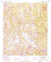
 1946 Phil Campbell1967 Print · USGSNorthwestern Alabama in the mid-1940s reveals a landscape defined by the SOUTHERN rail line and deep mining roots. Trace the locations of early rural schools and churches like Phillips High Sch and Shady Grove Ch, or locate old mines and the Donaldson Mill.3 unique versions available
 - 1946 Map of Guinn Cross Roads, 1970 Print
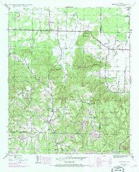
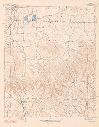
 1946 Guinn Cross Roads1970 Print · USGSFranklin County's rural interior is captured here in the mid-1940s, just as the TVA was planning the Little Bear Creek Dam (proposed). Genealogists can trace old family sites near Bradley Chapel, Old Nauvoo, and the Macedonia Cem.
 - 1947 Map of Phil Campbell
 1947 Phil Campbell1947 Print · USGSPhil Campbell and Bear Creek anchor this post-war survey of the Alabama hill country at a time when the Southern railroad still fueled local industry. Researchers can trace rural life through numerous sites like Phillips High Sch, Dime, and the Wilson Mine (Aband).2 unique versions available
 - 1947 Map of Spruce Pine
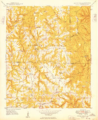
 1947 Spruce Pine1947 Print · USGSFranklin County at the dawn of the post-war era shows a landscape of industrial mining and deep-woods hollows. Genealogists can locate family landmarks like Sargent Cem, Enterprise Sch, and the community of Spruce Pine.2 unique versions available
 - 1947 Map of Isbell
 1947 Isbell1947 Print · USGSFranklin County in the late 1940s is captured here at a time when coal and limestone extraction shaped the landscape around Isbell and Rockwood. Researchers can trace old family names at Mc Wright Cem and locate rural landmarks like New Friendship Ch and the historical Military Road.2 unique versions available
 - 1947 Map of Guinn Cross Roads
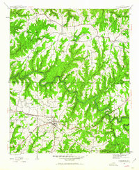
 1947 Guinn Cross Roads1947 Print · USGSFranklin County's interior during the late 1940s reveals a landscape of isolated farmsteads and rural congregations. Genealogists can trace family names and local history through Guinn Cross Roads, Old Nauvoo, and the numerous grounds of Friendship Cem.2 unique versions available
 - 1947 Map of Newburg
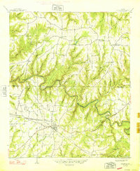
 1947 Newburg1947 Print · USGSNorth Alabama's hill country is captured here in the years following the war, centered on the community of Newburg. Genealogists and historians can trace local landmarks like Kimbrough Chapel, the Templeton Cem, and several early rural school sites.2 unique versions available
 - 1947 Map of Kinlock Spring, 1974 Print
 1947 Kinlock Spring1974 Print · USGSWinston County and its surrounding forest lands are captured here during the mid-twentieth century as federal management and rural life intersected. Researchers can locate early schools and churches like Trapptown Sch, Maxwell Chapel, and the site of an abandoned CCC Camp.
 - 1948 Map of Hackleburg
 1948 Hackleburg1948 Print · USGSHackleburg and the surrounding rural communities of Northwest Alabama are captured here shortly after the war, centered on the Illinois Central line. You can trace early transit routes along the Military Road and locate family landmarks like Lawler Cem and Gravel Hill School.2 unique versions available
 - 1949 Map of Hodges
 1949 Hodges1949 Print · USGSNorthwest Alabama at the end of the 1940s reveals a network of small settlements and family landmarks centered on the Illinois Central railroad. Genealogists can trace local roots through sites like Holly Spring Ch, McCurley Cem, and the village of Hodges.2 unique versions available
 - 1949 Map of Kinlock Spring
 1949 Kinlock Spring1949 Print · USGSIn the late 1940s, this portion of the Bankhead National Forest was a landscape of remote ridges and family settlements. Genealogists can trace rural life through landmarks like Posey Mill, New Bethlehem, and the CCC Camp 931 (Abandoned).
End of results
Showing maps 1-15 of 15
Top cities of Franklin County
- Russellville historical maps
- Red Bay historical maps
- Phil Campbell historical maps
- Vina historical maps
- Hodges historical maps
- Spruce Pine historical maps
Frequently asked questions
- What are the different types of historical maps available for Franklin County?
- What is the oldest map of Franklin County?
- Where can I purchase historical maps of Franklin County for my home or office?
- Where can I download high-res historical maps of Franklin County?
- Are there historical topographic maps available for Franklin County?
- Is there historical aerial imagery available for Franklin County?
- Where are historical maps of Franklin County sourced from?