Old Maps of Geneva County, Alabama for Academic Research
Study the evolution of Geneva County with 157 high-resolution historic maps. Whether you're teaching, researching, or modeling changes in land use, these maps provide essential visual documentation of urban, environmental, and geographic change.
- Analyze long-term change: Track patterns in development, transportation, and natural features.
- Ideal for environmental or urban studies: Support academic projects with primary historical map data.
- Use in the classroom or lab: Educators and researchers rely on these maps to bring historical context to life.
These maps are a powerful tool for teaching, research, and visualizing how Geneva County has changed over the decades.
Geneva County, AL maps
(157)- 1942 Map of Enterprise
 1942 Enterprise1942 Print · USGSSoutheast Alabama is shown at a wartime turning point, just as Camp Rucker was established. Family historians can trace hundreds of rural landmarks, from Oak Grove Ch & Sch to the New Prospect Ch.
 - 1949 Map of Glendale
 1949 Glendale1949 Print · USGSNorthern Walton County in the late 1940s reveals a landscape of isolated turpentine stills and rural congregations. Trace family roots at Halls Still, Darlington, and Limestone Cem while exploring the wetlands of Big Swamp.
 - 1949 Map of Hobbs Crossroads, 1973 Print
 1949 Hobbs Crossroads1973 Print · USGSThe Alabama-Florida state line meets in the late 1940s near rural hubs and bayous. Researchers can trace family sites like McDuffie Cem and find old gathering places like Barker Store or the Poplar Head Ch.
 - 1950 Map of Hobbs Cross Roads
 1950 Hobbs Cross Roads1950 Print · USGSThe Florida-Alabama state line at mid-century was a region of river landings and remote crossroad communities. Genealogists can trace family footprints through sites like McDuffie Cem, Beulah Anna Ch, and the old river access at Old Warehouse Landing.2 unique versions available
 - 1950 Map of Izagora
 1950 Izagora1950 Print · USGSThe Choctawhatchee River valley at the Florida-Alabama border reveals a mid-century landscape of riverfront landings and rural settlements. Trace family roots and local history at Izagora, Curry Ferry, and numerous country churches like Mt Ada Ch.2 unique versions available
 - 1950 Map of Esto, 1970 Print
 1950 Esto1970 Print · USGSThe Florida-Alabama borderlands at the mid-century mark reveal a landscape of crossroads settlements and wetland bays connected by the Louisville and Nashville railroad. Researchers can locate vanished rural landmarks like the Bethlehem School, Double Springs Cemetery, and the Hog and Hominy Road.
 - 1951 Map of Graceville
 1951 Graceville1951 Print · USGSGraceville and the surrounding Florida-Alabama borderlands are captured here during the early fifties, showing a landscape of timber and rail. Researchers can trace family roots through numerous local landmarks like Liberty Hill Ch, Poplar Springs Sch, and Collins Mill.2 unique versions available
 - 1951 Map of Esto
 1951 Esto1951 Print · USGSThe Florida-Alabama borderlands come into focus in the early 1950s, showing a landscape of timbered hills and rural crossroads. Genealogists can trace family footprints at the Bethlehem West Florida Camp Meeting Ground, Holland Crossroads, and Bethany Ch.
 - 1951 Map of Glendale
 1951 Glendale1951 Print · USGSThe Alabama-Florida borderlands come to life in this mid-century survey of the pine-studded interior. Genealogists and local historians can trace family-named landmarks like Braxton Cem and old community hubs including Gaskin, Glendale, and Limestone Ch.2 unique versions available
 - 1952 Map of Campbellton, 1953 Print
 1952 Campbellton1953 Print · USGSJackson County and the Florida-Alabama border are captured here in the early fifties, centered on the rail-fed hub of Campbellton. Genealogists can trace rural community life through numerous local landmarks like Hinson Cem, Shiloh Sch, and Ellaville.2 unique versions available
 - 1953 Map of Andalusia, 1965 Print
 1953 Andalusia1965 Print · USGSSouth Alabama in the mid-twentieth century remains a land of pine forests and river-fed settlements. You can trace the vital rail corridors of the Louisville & Nashville and locate regional centers such as Andalusia, Brewton, and Monroeville.3 unique versions available
 - 1953 Map of Dothan, 1966 Print
 1953 Dothan1966 Print · USGSSoutheast Alabama and Southwest Georgia are captured during a period of massive hydraulic and military expansion in the mid-fifties. Genealogists and historians can trace rural landmarks like Antioch Church and School, the Andrew Jackson Monument, and the early footprint of Fort Rucker Military Reservation.3 unique versions available
 - 1954 Map of Dothan
 1954 Dothan1954 Print · USGSSoutheast Alabama and Southwest Georgia are seen here in the mid-fifties, during a decade of military expansion and rural transition. Genealogists can trace the location of country schools like Little Zion School or the grounds of Kolomoki Mounds State Park.
 - 1954 Map of Tallahassee, 1967 Print
 1954 Tallahassee1967 Print · USGSThe Florida Panhandle and South Georgia are captured here during a period of mid-century growth and military expansion. Researchers can trace the development of Panama City, the footprint of Tyndall Air Force Base, and the rail lines of the Atlantic Coast Line.4 unique versions available
 - 1955 Map of Dothan
 1955 Dothan1955 Print · USGSSoutheast Alabama and Southwest Georgia are captured here in the mid-fifties, showing a landscape of river-port history and growing military bases. Researchers can trace rural life via the Andrew Jackson Monument, Bauxite mines, and the Central of Georgia RR.
 - 1957 Map of Andalusia
 1957 Andalusia1957 Print · USGSSouthern Alabama in the mid-1950s was a landscape defined by timbered stretches and the rhythmic flow of the Alabama River. Researchers can trace the legacy of the rail era through the Central of Georgia tracks and the storied river bluffs at Choctaw Bluff.
 - 1957 Map of Malvern
 1957 Malvern1957 Print · USGSSoutheast Alabama at the edge of the Wiregrass region reveals a landscape of tight-knit farming communities and rural road networks during the late fifties. Genealogists can trace family roots through numerous local landmarks like Malvern Sch, Oak Grove Cem, and Bethlehem Ch.3 unique versions available
 - 1957 Map of Geneva, 1958 Print
 1957 Geneva1958 Print · USGSGeneva and its surrounding river valleys come into focus in the late 1950s, showing a landscape defined by the Choctawhatchee River and rural industry. Genealogists and local historians can trace family-named sites like McDuffie Cem, Vanlandingham Mill, and the Consolation Cem.2 unique versions available
 - 1957 Map of Hartford, 1958 Print
 1957 Hartford1958 Print · USGSSoutheastern Alabama's rural landscape is captured here in the late fifties as small communities like Hartford and Slocomb anchored the tri-county area. Genealogists can locate family landmarks such as Wright Chapel Cem, the Wicksburg Sch, and the Tate Jr High Sch.
 - 1957 Map of Hartford, 1958 Print
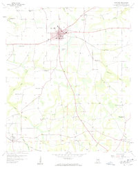 1957 Hartford1958 Print · USGSGeneva County in the late fifties centers on the rail-connected hub of Hartford and the southern settlement of Black. Researchers can trace rural lineages through numerous sites like Millville Ch, Christian Home Ch, and the Tate Jr High Sch.3 unique versions available
 - 1957 Map of Bellwood, 1959 Print
 1957 Bellwood1959 Print · USGSGeneva and Coffee County in the late fifties show a landscape defined by the Choctawhatchee River and its rural creek valleys. Researchers can trace ancestral locations near Bellwood, Consolation Cem, and numerous country churches like Cool Springs Ch.2 unique versions available
 - 1957 Map of Geneva West, 1959 Print
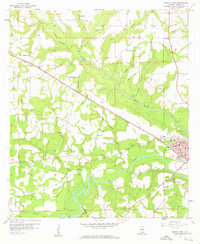 1957 Geneva West1959 Print · USGSGeneva and its rural surroundings are captured here in the late fifties as the town grew near the Pea River confluence. Researchers can trace the Louisville and Nashville rail line through Marl or locate family landmarks like McDuffie Cem and Vaughanville Ch.3 unique versions available
 - 1957 Map of Clayhatchee, 1959 Print
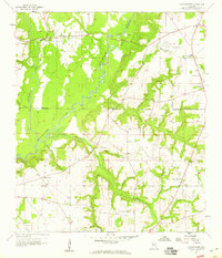 1957 Clayhatchee1959 Print · USGSThe Choctawhatchee River basin in the late fifties shows a landscape of tightly knit farming communities and country churches. Genealogists can trace family footprints through sites like Wicksburg Sch, Shiloh Cem, and Mt Gilead Ch.4 unique versions available
 - 1957 Map of Slocomb, 1959 Print
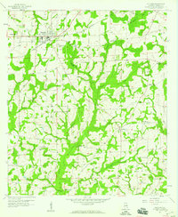 1957 Slocomb1959 Print · USGSGeneva County communities are caught in detail during the late fifties, showing the rural landscape around Slocomb. Family historians can locate numerous local landmarks including Whitaker Ch, Pilgrims Rest Ch, and the Drive-in Theater.3 unique versions available
 - 1957 Map of Geneva East, 1959 Print
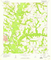 1957 Geneva East1959 Print · USGSSoutheast Alabama is defined by its river-and-rail economy in the late fifties, where the Pea River meets the Choctawhatchee River. Researchers can trace the Louisville and Nashville rail line through Geneva or locate rural landmarks like Oak Grove Sch and Carter Cem.3 unique versions available
Showing maps 1-25 of 157
Top cities of Geneva County
- Geneva historical maps
- Hartford historical maps
- Slocomb historical maps
- Samson historical maps
- Malvern historical maps
- Eunola historical maps
See more
Frequently asked questions
- What are the different types of historical maps available for Geneva County?
- What is the oldest map of Geneva County?
- Where can I purchase historical maps of Geneva County for my home or office?
- Where can I download high-res historical maps of Geneva County?
- Are there historical topographic maps available for Geneva County?
- Is there historical aerial imagery available for Geneva County?
- Where are historical maps of Geneva County sourced from?