Old Maps of Macon County, Alabama for Metal Detecting
Plan your next treasure hunt with 144 historic maps of Macon County. Find old homesites, ghost towns, trails, and gathering spots that may be lost to time — perfect for identifying promising metal detecting locations.
- Locate forgotten sites: Uncover places like long-lost settlements, abandoned rail lines, or gathering spots.
- Plan better hunts: Use map overlays combined with LiDAR or satellite views to narrow in on historically rich areas.
- Made for detectorists: Thousands of hobbyists use these maps to discover relics, coins, and hidden history.
Use these historic maps to boost your research and find new opportunities beneath the surface of Macon County.
Macon County, AL maps
(144)- 1906 Map of Dadeville
 1906 Dadeville1906 Print · USGSThe Tallapoosa River valley is shown at the turn of the century, defined by its numerous river ferries and a burgeoning rail network. Genealogists can trace family roots through rural landmarks like Rocky Ridge Church, Mc Ritchie Mill, and the many river crossings including McCarty Ferry.3 unique versions available
 - 1907 Map of Opelika, 1963 Print
 1907 Opelika1963 Print · USGSEastern Alabama and western Georgia come alive in this early 1900s survey of the rail-and-river economy. Genealogists can trace family names at Mitchell Crossroads, find rural landmarks like the Poor Farm, and locate historic river crossings like Dixon Ferry.
 - 1909 Map of Opelika
 1909 Opelika1909 Print · USGSEastern Alabama and western Georgia are seen here in the first decade of the twentieth century as the river-and-rail economy reached its peak. Genealogists and historians can trace old river crossings like Blanton Ferry, rural post offices such as Antioch Church Huckabee P O, and the path of the Chattahoochee Valley railroad.4 unique versions available
 - 1953 Map of Montgomery, 1964 Print
 1953 Montgomery1964 Print · USGSCentral Alabama's river-and-rail corridor is mapped here in the mid-fifties, showing the vital connections between the capital and the Black Belt. Genealogists and historians can trace rail depots and crossroads from Marion Junction to Wetumpka, alongside landmarks like Craig AFB.4 unique versions available
 - 1955 Map of Phenix City, 1964 Print
 1955 Phenix City1964 Print · USGSPost-war Alabama and Georgia meet along the Chattahoochee River as industry and military installations expand. Trace the rail lines of the Central of Georgia through towns like Opelika, Tuskegee, and Alexander City.3 unique versions available
 - 1956 Map of Montgomery
 1956 Montgomery1956 Print · USGSCentral Alabama in the mid-1950s shows a landscape defined by its great river systems and a booming military aviation presence. Genealogists and historians can trace the rail corridors of the Southern Railway and locate tactical bases like Maxwell AFB and Craig AFB.
 - 1957 Map of Phenix City
 1957 Phenix City1957 Print · USGSThe Alabama-Georgia borderlands are captured here in the mid-fifties, centered on the bustling river crossing at Phenix City and Columbus. Researchers can trace the mid-century footprint of the Fort Benning Military Reservation or locate smaller textile and railroad towns like Langdale and Camp Hill.
 - 1957 Map of Montgomery
 1957 Montgomery1957 Print · USGSCentral Alabama in the mid-fifties is defined by the winding Alabama River and a strategic network of military bases and rail lines. Trace family roots in Montgomery and Selma, or locate landmarks like Craig AFB and the State Capitol before the interstate era.
 - 1958 Map of Phenix City
 1958 Phenix City1958 Print · USGSThe Alabama-Georgia borderlands thrive during the late fifties, anchored by the river-driven industry of Columbus and Phenix City. Researchers can trace the mid-century footprints of Fort Benning, Auburn, and the textile towns of Fairfax and Lanett.
 - 1958 Map of Mount Meigs, 1959 Print
 1958 Mount Meigs1959 Print · USGSMontgomery County was a hive of rail and river activity in the late fifties as the state capital expanded eastward. Researchers can trace family-named sites and rural institutions like Pike Road, Our Lady of Fatima Sch, and the riverside Indian Mounds.2 unique versions available
 - 1971 Map of Little Texas, 1973 Print
 1971 Little Texas1973 Print · USGSMacon County's rural communities and wooded highlands are captured here in the early 1970s, just as modern infrastructure began to shift the landscape. Genealogists and historians can locate numerous country landmarks, from Little Texas and Alliance to Union Cem and Antioch Ch.2 unique versions available
 - 1971 Map of Carrville, 1973 Print
 1971 Carrville1973 Print · USGSNear the border of Tallapoosa and Macon counties in the early seventies, this landscape is defined by small crossroads settlements and creek-side industry. Trace the locations of Reeltown High Sch, the Broach Mill, and local gathering spots like the Drive-in Theater.2 unique versions available
 - 1971 Map of Loachapoka, 1973 Print
 1971 Loachapoka1973 Print · USGSLoachapoka and the rural Lee-Macon county line are seen here in the early seventies, centered on the historic Western Railway of Alabama. Researchers can trace the layout of local education and faith at Loachapoka Jr High Sch, Coster Ch, and the Loachapoka Cem.3 unique versions available
 - 1971 Map of Tuskegee, 1973 Print
 1971 Tuskegee1973 Print · USGSTuskegee and its famed institute are documented here in the early 1970s, showcasing a period of significant institutional and civic growth. Researchers can locate specific sites from the Tuskegee Institute campus to the Veterans Hospital and Moton Field.3 unique versions available
 - 1971 Map of Shorter, 1973 Print
 1971 Shorter1973 Print · USGSThe Tallapoosa River country comes alive in the early seventies, showing a landscape of small towns and gravel works. Trace local history at Tysonville, the Cubahatchee Lookout Tower, and Wolfe High Sch.2 unique versions available
 - 1971 Map of Society Hill, 1973 Print
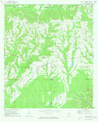 1971 Society Hill1973 Print · USGSSociety Hill stood as a quiet rural crossroads in the early 1970s at the intersection of Lee, Macon, and Russell counties. Genealogists and local historians can trace family ties through numerous landmarks like Cobbs Cem, Society Hill Cem, and Reese Chapel.2 unique versions available
 - 1971 Map of Auburn, 1973 Print
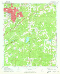 1971 Auburn1973 Print · USGSAuburn and Opelika are shown during a period of significant academic and civic expansion in the early seventies. Local historians can trace the development of Auburn University and locate rural landmarks like Mitchell Crossroads and Sand Hill Ch.2 unique versions available
 - 1971 Map of Notasulga, 1973 Print
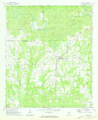 1971 Notasulga1973 Print · USGSNotasulga and its rural Alabama surroundings are captured here in the early 1970s, as the town thrived along the Western Railway of Alabama. Genealogists and local historians can locate many country landmarks, including McRitchie Mill, Bethlehem Cemetery, and Lockets Chapel.2 unique versions available
 - 1971 Map of La Place, 1973 Print
 1971 La Place1973 Print · USGSMacon County in the early seventies shows a landscape where military history and rural tradition meet along the Tallapoosa River. Researchers can locate the Tuskegee Air Force Base and numerous family churches like Bradford Chapel and Elam Ch.2 unique versions available
 - 1971 Map of Hardaway, 1974 Print
 1971 Hardaway1974 Print · USGSMacon County in the early seventies remains a landscape of quiet creek-side settlements and rail stops. Researchers can trace the Seaboard Coast Line through Hardaway or locate family roots at Damascus Ch and Mt Pisgah Cem.2 unique versions available
 - 1971 Map of Thompson, 1974 Print
 1971 Thompson1974 Print · USGSIn the early 1970s, this portion of Bullock County was a landscape of rail-fed settlements and historical borders. Genealogists can trace family names at Haines Chapel Cem and Paulk Cem or locate the Central of Georgia rail line near Thompson.2 unique versions available
 - 1971 Map of Fitzpatrick, 1974 Print
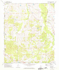 1971 Fitzpatrick1974 Print · USGSBullock County's rural landscape is captured here in the early 1970s, as the railroad network still dictated the pace of local life. Researchers can trace ancestral connections through New Bethel Ch, Panther Cem, and the Old Indian Treaty Bdy near Fitzpatrick.2 unique versions available
 - 1971 Map of Chesson, 1974 Print
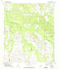 1971 Chesson1974 Print · USGSMacon County's rural landscape is captured here in the early seventies, where rail lines and treaty boundaries still define the local geography. Researchers can trace family roots at Mt Zion Ch, locate the settlement of Chesson, or follow the historic Indian Treaty Boundary.2 unique versions available
 - 1973 Map of Hurtsboro, 1975 Print
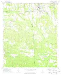 1973 Hurtsboro1975 Print · USGSThe rail crossroads at Hurtsboro remained a vital hub in the 1970s where two major lines intersected. Genealogists can locate several rural landmarks including St Pauls Cem, Enon, and Russell High Sch.
 - 1973 Map of Creek Stand, 1975 Print
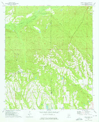 1973 Creek Stand1975 Print · USGSMacon County in the early seventies preserves a landscape of quiet rural settlements and winding swamp drainage. Genealogists can locate family landmarks such as Boromville, Creek Stand Ch, and the Borom Cem tucked among the hills and wetlands.2 unique versions available
Showing maps 1-25 of 144
Top cities of Macon County
Frequently asked questions
- What are the different types of historical maps available for Macon County?
- What is the oldest map of Macon County?
- Where can I purchase historical maps of Macon County for my home or office?
- Where can I download high-res historical maps of Macon County?
- Are there historical topographic maps available for Macon County?
- Is there historical aerial imagery available for Macon County?
- Where are historical maps of Macon County sourced from?