
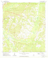
1971 Map of Little Texas
USGS Topo · Published 1973About this map
Tuskegee National Forest defines the northern reaches of this Macon County landscape, where the wooded terrain is drained by Choctafaula Creek and Chewacla Creek. In the early 1970s, this area was a network of rural communities, notably Little Texas and Pleasant Hill, connected by winding roads and a legacy of local institutions. Education and faith centers are prominent, including Nichols Jr High Sch and several churches such as Oak Grove Ch, Union Ch, and Pine Grove Ch.
Find a feature on this map
23 named features on this map. Tap any name to fly to it.
Don’t see what you’re looking for? This feature index may not catch every label — zoom into the map to look around manually.
Map Details
Editions of this 1971 Little Texas Map
2 editions found
Other maps of this area

1906 · Dadeville
USGS Topo · 1:125,000

1907 · Opelika
USGS Topo · 1:125,000

1909 · Opelika
USGS Topo · 1:125,000

1955 · Phenix City
USGS Topo · 1:250,000

1957 · Phenix City
USGS Topo · 1:250,000

1958 · Phenix City
USGS Topo · 1:250,000

1971 · Loachapoka
USGS Topo · 1:24,000

1971 · Tuskegee
USGS Topo · 1:24,000
1971 · Society Hill
USGS Topo · 1:24,000
1971 · Auburn
USGS Topo · 1:24,000