1950s Maps of Madison County, Alabama
Explore 22 historic maps of Madison County from the 1950s. These maps offer a rare glimpse into what life looked like during the 1950s — showing old roads, neighborhoods, homes, and landmarks that have changed or disappeared over time.
Whether you're researching your family's past, planning a metal detecting trip, or studying how Madison County's landscape evolved across the 1950s, these high-resolution maps are a powerful tool for exploring the history of this region.
- Focus on a specific era: All maps on this page are from the 1950s, giving you a focused view of this time period.
- See what’s changed: Compare century-old streets, trails, and buildings to today's modern landscape using overlays and satellite layers.
- Research with precision: Use these maps for genealogy, historical research, land use analysis, or educational projects.
- View, download, or print: Maps are fully viewable online in high resolution, and can be downloaded or printed for your own records.
Start exploring Madison County's history through authentic maps from the 1950s. This is your window into the past.
Madison County, AL maps
(22)- 1950 Map of Paint Rock
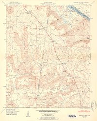
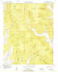
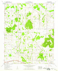
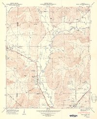 1950 Paint Rock1950 Print · USGSThe Paint Rock River valley in the late 1940s reveals a corridor of rail-and-road activity connecting Jackson and Madison counties. Genealogists can trace family names across Rousseau Cem, the Conyers-Rosenwald School, and the river crossing at Walker Mill Ford.2 unique versions available
 - 1950 Map of Farley
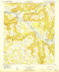
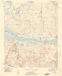
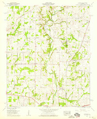
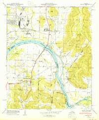 1950 Farley1950 Print · USGSThe Tennessee River valley south of Huntsville is seen here in the mid-twentieth century as military installations began to reshape the landscape. Genealogists can trace family names through numerous burial grounds like Lacey Cem and Russell Cem, or locate rural landmarks like Cherokee School and Laceys Spring.
 - 1950 Map of Huntsville
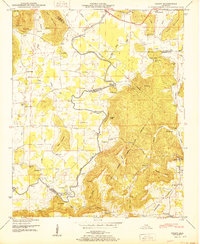
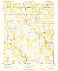
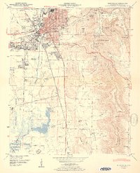 1950 Huntsville1950 Print · USGSHuntsville at the start of the 1950s shows the historic city center just as the military and aerospace sectors began to reshape the Tennessee Valley. Researchers can trace the massive Huntsville Arsenal boundaries, find early schools like Rison Sch, and locate family names at Merrimack Cem or Sivley Cem.2 unique versions available
 - 1950 Map of New Hope
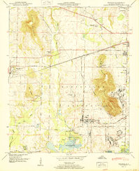
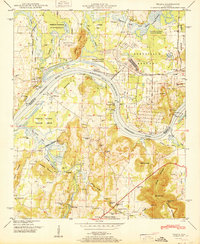
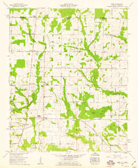
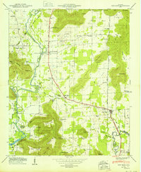 1950 New Hope1950 Print · USGSMadison County's southeastern landscape at mid-century centers on the town of New Hope and the banks of the Flint River. Researchers can trace family history through numerous landmarks like Baker Cem, the Cherokee School, and Owens Cross Roads.2 unique versions available
 - 1950 Map of Newsome Sinks
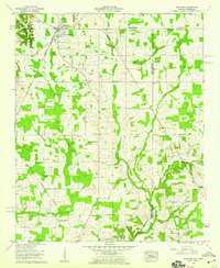
 1950 Newsome Sinks1950 Print · USGSNorthern Alabama at the mid-century reveals a landscape of river coves and highland gaps along the Huntsville Meridian. Genealogists and historians can trace local families at Union Grove Church, Rescue Cem, and the New Horton School.2 unique versions available
 - 1950 Map of Guntersville Dam
 1950 Guntersville Dam1950 Print · USGSThe Tennessee River valley in the late 1940s is captured here at the height of the reservoir era near the border of Madison and Marshall counties. Genealogists and historians can locate rural landmarks such as Neighbors Mill, Union Grove, and the Beach Spring Cem Bean Rock School.2 unique versions available
 - 1950 Map of Grant
 1950 Grant1950 Print · USGSNortheast Alabama at mid-century shows a landscape of river-valley farms and steep ridges at the intersection of three counties. Trace old river crossings at Helium Ford and Fishtrap Ford, or locate family landmarks like Poplar Ridge, Butler Mill, and the D A R Sch.2 unique versions available
 - 1950 Map of Madison
 1950 Madison1950 Print · USGSMadison and the surrounding Alabama countryside are captured here just as the post-war military presence was reshaping the region. Local researchers can trace family lands near Rainbow Mountain or locate ancestral sites like Lincoln Sch and Jamar Cem.2 unique versions available
 - 1951 Map of King Cove
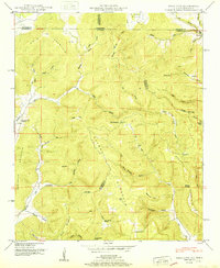 1951 King Cove1951 Print · USGSHighland coves along the Alabama-Tennessee border appear here as they were in the early fifties, a landscape of family-named gaps and hollows. Genealogists can locate several remote burial sites like King Cove Cem and Maxwell Cem or trace the early community at Francisco.2 unique versions available
 - 1951 Map of Maysville
 1951 Maysville1951 Print · USGSMadison County's fertile valleys and mountain coves come to life in the early 1950s as a network of small farming communities and river crossings. Researchers can trace historic industrial sites like Bell Factory or find family landmarks such as Shiloh Ch and McCaleb Mill.2 unique versions available
 - 1951 Map of Meridianville
 1951 Meridianville1951 Print · USGSMadison County at mid-century reveals a network of rural schools and churches branching off the Florida Short Route. Genealogists and historians can trace family sites like Pope Cem and Strong Cem or the grounds of the Alabama Agricultural and Mechanical Institute.2 unique versions available
 - 1951 Map of New Market
 1951 New Market1951 Print · USGSMadison County, Alabama, and the Tennessee borderlands are detailed here in the early fifties, showing a rural landscape defined by the Nashville Chattanooga and St Louis rail line. Researchers can trace family history through dozens of landmarks like Graveyard Hill Cem, Bloucher Ford, and the Old Cherokee Boundary.2 unique versions available
 - 1951 Map of Hollytree
 1951 Hollytree1951 Print · USGSThe Tennessee Valley Authority and USGS recorded this rugged Jackson County landscape in the early postwar era as the mountain communities remained deeply tied to their upland coves. Researchers can trace family origins through several burial sites like Maples Cem and Moon Cem or find old congregation sites such as Pleasant Mount Church.2 unique versions available
 - 1951 Map of Mason Ridge
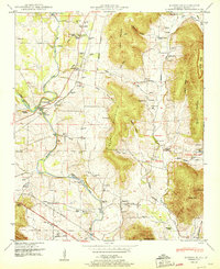
 1951 Mason Ridge1951 Print · USGSThe Tennessee River valley in the early fifties shows a landscape of river landings and reservoir backwaters. Genealogists can locate family burial grounds like Ashford Cem and small settlements such as Bluff City or Echols Crossroads.2 unique versions available
 - 1951 Map of Fisk
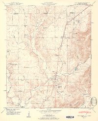
 1951 Fisk1951 Print · USGSMadison County and the Alabama-Tennessee borderlands are seen here in the early fifties as a landscape of rural crossroads and family farms. Researchers can trace ancestral roots through dozens of local landmarks like Hazel Green, Sulphur Springs, and the State Line Cem.
 - 1951 Map of Triana
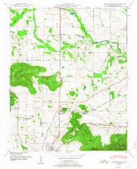
 1951 Triana1951 Print · USGSThe Tennessee River valley at the mid-century shows a landscape transitioning between its rural roots and the growth of the Huntsville area. Researchers can trace historic family landmarks such as Draper Cem and Leadus Sch near the river's edge.2 unique versions available
 - 1956 Map of Gadsden, 1966 Print
 1956 Gadsden1966 Print · USGSNorth Alabama in the mid-1950s shows a region transformed by river engineering and federal industry. Genealogists and local historians can trace the development of the Tennessee Valley through the growth of Huntsville, the sprawling Redstone Arsenal, and the expansive Guntersville Lake.3 unique versions available
 - 1958 Map of Gadsden
 1958 Gadsden1958 Print · USGSNorth Alabama comes alive in the late 1950s as the Tennessee Valley Authority’s massive river projects and the rise of the space industry reshaped the landscape. Researchers can trace the mid-century footprints of Huntsville, Redstone Arsenal, and the riverside rail networks of the Southern railroad.
 - 1958 Map of Jeff, 1959 Print
 1958 Jeff1959 Print · USGSMadison County at the end of the 1950s shows a transition from rural farming tracts to early institutional growth north of Huntsville. Genealogists can locate family names at Hammond Cem or Fowlkes Cem and trace the paths of Pulaski Pike and Nick Davis Road.2 unique versions available
 - 1958 Map of Capshaw, 1959 Print
 1958 Capshaw1959 Print · USGSThe rural border of Limestone and Madison counties is captured here in the late fifties as family farms and small crossroad communities thrived. Researchers can trace the Old Railroad Bed and locate historic sites like Pilgrim Home Church and Nick Davis Cem.3 unique versions available
 - 1958 Map of Toney, 1959 Print
 1958 Toney1959 Print · USGSThe Alabama-Tennessee borderlands appear in the late fifties as a network of rural crossroads and family homesteads. Genealogists can trace community roots through an Old Railroad Bed and landmarks like Friendship State Line Church and Golightly Cem.3 unique versions available
 - 1958 Map of Ardmore, 1959 Print
 1958 Ardmore1959 Print · USGSArdmore and the surrounding borderlands of Alabama and Tennessee appear here during the late fifties as a network of rail-side settlements and rural parishes. Genealogists can trace family landmarks like the Delap-Clement Cem, Wooley Springs Sch, and New Zion Church.4 unique versions available
End of results
Showing maps 1-22 of 22
Top cities of Madison County
- Huntsville historical maps
- Meridianville historical maps
- Moores Mill historical maps
- Harvest historical maps
- Hazel Green historical maps
- Triana historical maps
See more
Frequently asked questions
- What are the different types of historical maps available for Madison County?
- What is the oldest map of Madison County?
- Where can I purchase historical maps of Madison County for my home or office?
- Where can I download high-res historical maps of Madison County?
- Are there historical topographic maps available for Madison County?
- Is there historical aerial imagery available for Madison County?
- Where are historical maps of Madison County sourced from?