1970s Maps of Sweet Water, Alabama
Explore 3 historic maps of Sweet Water from the 1970s. These maps offer a rare glimpse into what life looked like during the 1970s — showing old roads, neighborhoods, homes, and landmarks that have changed or disappeared over time.
Whether you're researching your family's past, planning a metal detecting trip, or studying how Sweet Water's landscape evolved across the 1970s, these high-resolution maps are a powerful tool for exploring the history of this region.
- Focus on a specific era: All maps on this page are from the 1970s, giving you a focused view of this time period.
- See what’s changed: Compare century-old streets, trails, and buildings to today's modern landscape using overlays and satellite layers.
- Research with precision: Use these maps for genealogy, historical research, land use analysis, or educational projects.
- View, download, or print: Maps are fully viewable online in high resolution, and can be downloaded or printed for your own records.
Start exploring Sweet Water's history through authentic maps from the 1970s. This is your window into the past.
Sweet Water, AL maps
(3)- 1978 Map of Sweet Water, 1979 Print
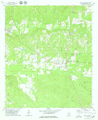 1978 Sweet Water1979 Print · USGSMarengo County remained a landscape of tight-knit rural communities and family landmarks in the late seventies. Researchers can trace ancestral roots through sites like Shiloh Ch, Pruitt Cem, and the old settlement at Dixons Mills.2 unique versions available
 - 1978 Map of Nanafalia, 1979 Print
 1978 Nanafalia1979 Print · USGSThe community of Nanafalia and the surrounding Marengo County timberlands appear here in the late seventies. Family historians can trace rural roots through the St Paul Cem, Hickory Grove Cem, and the old church at Nicholsville.2 unique versions available
 - 1978 Map of Miller, 1979 Print
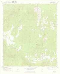 1978 Miller1979 Print · USGSMarengo County, Alabama, is documented here in the late 1970s as a landscape of rural communities and intricate creek systems. Genealogists can locate family landmarks such as Rembert Cem, Campground Ch, and the small settlement of Octagon.
End of results
Showing maps 1-3 of 3
Top cities near Sweet Water
- Thomasville historical maps
- Linden historical maps
- Pennington historical maps
- Thomaston historical maps
- Providence historical maps
- Myrtlewood historical maps
Frequently asked questions
- What are the different types of historical maps available for Sweet Water?
- What is the oldest map of Sweet Water?
- Where can I purchase historical maps of Sweet Water for my home or office?
- Where can I download high-res historical maps of Sweet Water?
- Are there historical topographic maps available for Sweet Water?
- Is there historical aerial imagery available for Sweet Water?
- Where are historical maps of Sweet Water sourced from?