1950s Maps of Shelby County, Alabama
Explore 15 historic maps of Shelby County from the 1950s. These maps offer a rare glimpse into what life looked like during the 1950s — showing old roads, neighborhoods, homes, and landmarks that have changed or disappeared over time.
Whether you're researching your family's past, planning a metal detecting trip, or studying how Shelby County's landscape evolved across the 1950s, these high-resolution maps are a powerful tool for exploring the history of this region.
- Focus on a specific era: All maps on this page are from the 1950s, giving you a focused view of this time period.
- See what’s changed: Compare century-old streets, trails, and buildings to today's modern landscape using overlays and satellite layers.
- Research with precision: Use these maps for genealogy, historical research, land use analysis, or educational projects.
- View, download, or print: Maps are fully viewable online in high resolution, and can be downloaded or printed for your own records.
Start exploring Shelby County's history through authentic maps from the 1950s. This is your window into the past.
Shelby County, AL maps
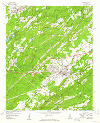
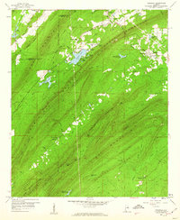
(15)- 1951 Map of Vincent, 1952 Print
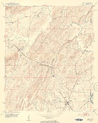 1951 Vincent1952 Print · USGSShelby County at the start of the 1950s remains a landscape of rail-side towns and ridge-country churches. Local historians can trace the paths of the Central of Georgia railroad through Sterrett or locate landmarks like Duncan Chapel and the Elliott Cem.6 unique versions available
 - 1951 Map of Laniers, 1952 Print
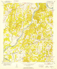 1951 Laniers1952 Print · USGSThe Coosa River valley in the early fifties shows a landscape of river islands and rural Alabama settlements connected by the Atlantic Coast Line railroad. Genealogists can locate family landmarks such as Evening Star Ch Cem, Briarfield Sch, and the community of Laniers.5 unique versions available
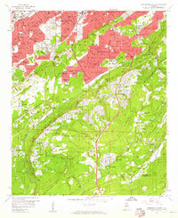
 - 1953 Map of Birmingham, 1964 Print
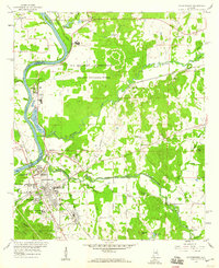
 1953 Birmingham1964 Print · USGSCentral Alabama at mid-century shows a landscape defined by industrial expansion and the iron-rich ridges surrounding Birmingham. Researchers can trace the extensive rail networks of the L & N RR or locate historic federal sites like the Anniston Ordnance Depot.4 unique versions available
 - 1956 Map of Birmingham
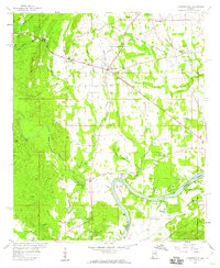
 1956 Birmingham1956 Print · USGSCentral Alabama in the mid-fifties exhibits a landscape of growing cities and deep-rooted industrial corridors. Genealogists and historians can trace the development of suburban Mountain Brook or locate regional hubs like Sylacauga and Jasper.
 - 1957 Map of Birmingham
 1957 Birmingham1957 Print · USGSNorth-Central Alabama in the mid-fifties is an industrial powerhouse centered on the steel valleys and sprawling iron ridges. Genealogists and historians can trace the rail-linked growth of Birmingham and Tuscaloosa, or locate rural landmarks like Talladega College and the Anniston Ordnance Depot.
 - 1958 Map of Childersburg, 1960 Print
 1958 Childersburg1960 Print · USGSChildersburg and the Coosa River valley are shown here during a peak of industrial and military activity in the late fifties. Genealogists can locate family landmarks including Watwood Sch, Mt Zion Cem, and the Alabama Ordnance Works.3 unique versions available
 - 1958 Map of Harpersville, 1960 Print
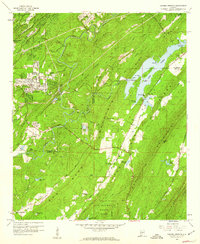
 1958 Harpersville1960 Print · USGSHarpersville and the surrounding Shelby County riverlands are captured here in the late fifties, showcasing a landscape of rail-fed commerce and rural communities. Genealogists can trace family landmarks like Baker Grove Ch, Kidd Cem, and the riverfront settlement of Bailey.5 unique versions available
 - 1959 Map of Leeds, 1960 Print
 1959 Leeds1960 Print · USGSThe industrial corridor of the Cahaba Valley comes to life in the late fifties as rail lines and mines converge. Local researchers can trace the locations of Moton High Sch, Leeds Mineral Well, and early neighborhoods like Henry Ellen or Trussville.4 unique versions available
 - 1959 Map of Westover, 1960 Print
 1959 Westover1960 Print · USGSMid-century Shelby County comes alive in this survey of Westover, where the Atlantic Coast Line railroad and the Florida Short Route meet. Researchers can trace rural life through numerous landmarks like Union Ch, Lesters Chapel, and Hubbard Cem.4 unique versions available
 - 1959 Map of Greenwood, 1960 Print
 1959 Greenwood1960 Print · USGSCentral Alabama's industrial and rural landscape is captured here in the late fifties, showing the interplay between mining operations and family settlements. Genealogists can trace local roots at Sadlers Cem or Lacey's Chapel, while collectors will find interest in the Bessemer Airport and the region's complex rail network.5 unique versions available
 - 1959 Map of Cahaba Heights, 1960 Print
 1959 Cahaba Heights1960 Print · USGSShelby and Jefferson Counties come alive in this late-fifties survey of the ridges and valleys south of Birmingham. Genealogists can locate family landmarks like Wooten Chapel Cem and Harris Cem alongside the expanding community of Cahaba Heights.5 unique versions available
 - 1959 Map of Vandiver, 1960 Print
 1959 Vandiver1960 Print · USGSThe ridges of Shelby County are captured here in the late fifties, showing a rural landscape defined by mountain gaps and rail lines. Genealogists can trace family landmarks like Brasher Cem, Union Hill Ch, and the settlement of Vandiver.5 unique versions available
 - 1959 Map of Birmingham South, 1960 Print
 1959 Birmingham South1960 Print · USGSThe Birmingham suburbs and the Shades Mountain ridgeline are captured here in the late fifties as residential growth transformed the valley. Researchers can trace the mid-century footprints of Howard College, the historic Elmwood Cemetery, and local landmarks like St Josephs Retreat.6 unique versions available
 - 1959 Map of Helena, 1960 Print
 1959 Helena1960 Print · USGSShelby County's ridge-and-valley landscape in the late fifties shows a region balanced between railroad industry and new growth. Genealogists and researchers can trace old family sites at Cumberland Cem, the location of Piney Grove Ch, and the grounds of Indian Springs Sch.7 unique versions available
 - 1959 Map of Chelsea, 1960 Print
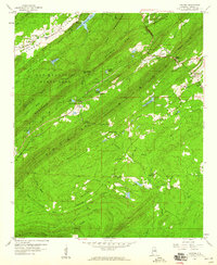 1959 Chelsea1960 Print · USGSShelby County's ridges and gaps are captured here in the late fifties, showcasing the rural landscape before modern suburban expansion. Genealogists and hikers can trace the original footprints of Simmsville, New Hope Sch, and the rugged corridors of The Narrows.7 unique versions available
End of results
Showing maps 1-15 of 15
Top cities of Shelby County
- Alabaster historical maps
- Pelham historical maps
- Helena historical maps
- Calera historical maps
- Chelsea historical maps
- Meadowbrook historical maps
See more
Frequently asked questions
- What are the different types of historical maps available for Shelby County?
- What is the oldest map of Shelby County?
- Where can I purchase historical maps of Shelby County for my home or office?
- Where can I download high-res historical maps of Shelby County?
- Are there historical topographic maps available for Shelby County?
- Is there historical aerial imagery available for Shelby County?
- Where are historical maps of Shelby County sourced from?