Old Maps of Shelby County, Alabama for Metal Detecting
Plan your next treasure hunt with 202 historic maps of Shelby County. Find old homesites, ghost towns, trails, and gathering spots that may be lost to time — perfect for identifying promising metal detecting locations.
- Locate forgotten sites: Uncover places like long-lost settlements, abandoned rail lines, or gathering spots.
- Plan better hunts: Use map overlays combined with LiDAR or satellite views to narrow in on historically rich areas.
- Made for detectorists: Thousands of hobbyists use these maps to discover relics, coins, and hidden history.
Use these historic maps to boost your research and find new opportunities beneath the surface of Shelby County.
Shelby County, AL maps
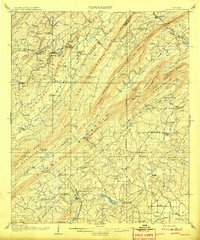
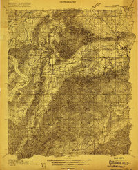
(202)- 1889 Map of Springville
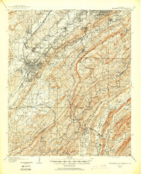
 1889 Springville1889 Print · USGSSt. Clair County and its neighbors are mapped here during the late Victorian era as railroads began to transform the old plantation and river economy. Genealogists can locate family landmarks like Henry's Mill, trace the path of Jackson's Trace, or find the location of old river crossings at Colman's Ferry.
 - 1889 Map of Birmingham
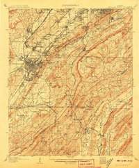
 1889 Birmingham1889 Print · USGSIn the late nineteenth century, the Iron City was a growing urban core surrounded by intensive extraction sites and river crossings. Trace early industrial footprints at the Pratt Mines, Sloss Quarry, and the Old Irondale Furnace.
 - 1890 Map of Bessemer
 1890 Bessemer1890 Print · USGSCentral Alabama emerges as an industrial powerhouse in the late nineteenth century as railroads weave through the ridges of Jefferson and Shelby counties. Genealogists and historians can trace the early footprints of Bessemer, the iron operations at Sloss, and remote landmarks like Woods Ferry.
 - 1890 Map of Talladega
 1890 Talladega1890 Print · USGSTalladega and the surrounding river valleys are captured here in the late nineteenth century as the railroad and river economy flourished. Trace the locations of historic river crossings like Old Kymulga Ferry and local landmarks such as Odens Mill.
 - 1892 Map of Birmingham
 1892 Birmingham1892 Print · USGSBirmingham and the surrounding iron district emerge in the late nineteenth century as a hub of heavy industry and rail expansion. Trace the early footprints of the Sloss Mine, locate river crossings like Doss Ferry, and find family-named landmarks like Hanby Mill.
 - 1892 Map of Springville
 1892 Springville1892 Print · USGSNortheast Alabama at the end of the nineteenth century is a landscape of river crossings and expanding rail lines. Genealogists can trace family footprints at St. Clair Springs, Greensport, and numerous river crossings like Colman's Ferry or Goodwin's Mill.7 unique versions available
 - 1892 Map of Talladega
 1892 Talladega1892 Print · USGSTalladega County and the Coosa River valley are captured here in the late nineteenth century as the regional rail network expanded through the mountains. Researchers can locate old river crossings like Chancelors Ferry, rural landmarks such as Edwards Store, and early hubs like Childersburgh.6 unique versions available
 - 1892 Map of Bessemer
 1892 Bessemer1892 Print · USGSCentral Alabama was at its industrial peak in the late nineteenth century as railroads and iron mines transformed the ridges south of Birmingham. Genealogists and researchers can trace the early foundations of Bessemer, the operations at Smith Mine, and rural crossings like Nunley's Ford.2 unique versions available
 - 1895 Map of Birmingham
 1895 Birmingham1895 Print · USGSBirmingham at the peak of its industrial boom is captured here as the city’s rail and mining networks spread through the surrounding valleys. Researchers can trace early iron production at Old Irondale Furnace or locate family roots at Doss Ferry and Pratt Mines.2 unique versions available
 - 1899 Map of Brookwood
 1899 Brookwood1899 Print · USGSCentral Alabama at the close of the nineteenth century is a landscape of growing mining towns and vital river crossings. Trace the early industrial rail lines like the Birmingham Mineral R. R. and locate family landmarks such as Weaver Mill, Pratt Ferry, and Providence Ch.4 unique versions available
 - 1905 Map of Bessemer Iron District
 1905 Bessemer Iron District1905 Print · USGSJefferson County was at the peak of its iron-mining boom at the turn of the century, centered on the dense rail networks of Bessemer. Genealogists and industrial historians can trace old residential pockets like Wylam and Brighton alongside the Spaulding Mine and numerous rural river crossings.3 unique versions available
 - 1905 Map of Leeds, 1956 Print
 1905 Leeds1956 Print · USGSJefferson County industrial expansion meets early mountain settlements at the start of the century. You can trace the mineral economy through the Alfretta Mines and Lucy Duke Furnace, or locate family roots at Mount Pinson Pinson P.O. and Argo Station.
 - 1906 Map of Vandiver, 1954 Print
 1906 Vandiver1954 Print · USGSShelby and Jefferson counties appear as a network of high ridges and rural valley settlements at the turn of the century. Genealogists can trace family landmarks like Hays Crossroads, Tinney Mill, and the Cave Spring School among the mountains.
 - 1907 Map of Birmingham
 1907 Birmingham1907 Print · USGSJefferson and Blount counties are shown in the early twentieth century as the industrial heart of Alabama was taking shape. Genealogists can trace family roots through named landmarks like Box Schoolhouse, Watson PO, and the coal works at Watts Mines.5 unique versions available
 - 1907 Map of Leeds
 1907 Leeds1907 Print · USGSJefferson County was an industrial and rail hub in the early twentieth century as iron mining and agriculture shaped its valleys. Genealogists can trace family names and early community nodes like Mount Pinson Pinson PO, Alfretta Mines, and Oakgrove Church.3 unique versions available
 - 1907 Map of Bessemer Special
 1907 Bessemer Special1907 Print · USGSJefferson County industrial development is at its peak in the first decade of the century, centered on the heavy rail networks of the Jones Valley. Genealogists and historians can trace early community centers like Hopewell Church and Canaan Church alongside mining sites at Redding and Ware.4 unique versions available
 - 1908 Map of Vandiver
 1908 Vandiver1908 Print · USGSShelby and Jefferson Counties are shown here during a period of mountain-gap settlement and early industrial growth. Trace family roots at Cave Spring School, find old river crossings like De Shazo Mill Ford, and locate the Coosa Tunnel.3 unique versions available
 - 1909 Map of Columbiana, 1968 Print
 1909 Columbiana1968 Print · USGSShelby County at the start of the twentieth century was a vital junction for the Southern and L&N railroads. Local researchers can locate family landmarks like Watson Ford, several rural schools including Summer Hill School, and early churches like Lyon Church.
 - 1910 Map of Montevallo
 1910 Montevallo1910 Print · USGSCentral Alabama’s coal and iron corridor is captured here at a peak of industrial expansion. Researchers can trace the heritage of vanished mining camps and family landmarks from Boothon to the Bibb Furnace (RUINS) and Sessions Chapel.4 unique versions available
 - 1911 Map of Columbiana
 1911 Columbiana1911 Print · USGSCentral Alabama's industrial landscape is captured here just after the first decade of the century, showing a region deeply connected by rail and river. Genealogists can trace family names at Woods Ferry or locate old community hubs like Summer Hill School and Kingdom Church.2 unique versions available
 - 1915 Map of Gantts Quarry
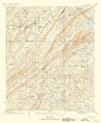
 1915 Gantts Quarry1915 Print · USGSTalladega and Shelby counties appear here during the height of the early twentieth-century marble boom. Researchers can trace the rail-driven economy near Sylacauga and locate family landmarks like Oak Grove Church, Gantts Quarry, and Center Hill School.4 unique versions available
 - 1917 Map of Gantts Quarry
 1917 Gantts Quarry1917 Print · USGSThe marble-rich corridor between the Coosa River and Sylacauga is captured here during the height of the early twentieth-century quarrying boom. Researchers can trace the rail-and-river economy through landmarks like Gantts Quarry, Mc Gowan Ferry, and Eureka Quarry.3 unique versions available
 - 1934 Map of Blocton
 1934 Blocton1934 Print · USGSCentral Alabama's coal and rail corridor comes to life in the 1930s, showing the intersection of the Cahaba River and intensive industrial development. Researchers can locate old mining sites like Hill Creek Mine and numerous rural landmarks including Rock Institute Sch and Ada Chapel.3 unique versions available
 - 1940 Map of Blocton
 1940 Blocton1940 Print · USGSCentral Alabama's mining and river country is captured here just before the Second World War, centered on the coal hubs of Bibb County. Researchers can trace family roots through numerous rural landmarks like Mt Olivet Ch, Gray Hill Sch, and the rail junction at Blocton Junc.2 unique versions available
 - 1951 Map of Vincent, 1952 Print
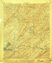
 1951 Vincent1952 Print · USGSShelby County at the start of the 1950s remains a landscape of rail-side towns and ridge-country churches. Local historians can trace the paths of the Central of Georgia railroad through Sterrett or locate landmarks like Duncan Chapel and the Elliott Cem.6 unique versions available
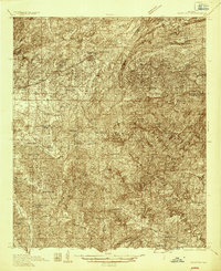
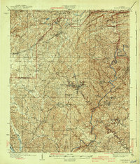
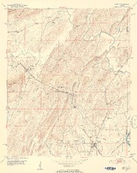
Showing maps 1-25 of 202
Top cities of Shelby County
- Alabaster historical maps
- Pelham historical maps
- Helena historical maps
- Calera historical maps
- Chelsea historical maps
- Meadowbrook historical maps
See more
Frequently asked questions
- What are the different types of historical maps available for Shelby County?
- What is the oldest map of Shelby County?
- Where can I purchase historical maps of Shelby County for my home or office?
- Where can I download high-res historical maps of Shelby County?
- Are there historical topographic maps available for Shelby County?
- Is there historical aerial imagery available for Shelby County?
- Where are historical maps of Shelby County sourced from?