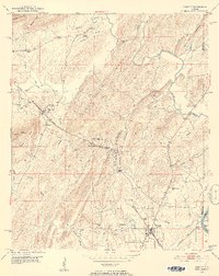
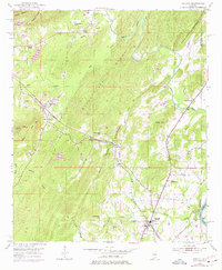
1951 Map of Vincent
USGS Topo · Published 1952About this map
The Central of Georgia and Atlantic Coast Line railroads anchor the industrial and social geography of this Shelby County region in the early 1950s. The town of Vincent serves as a primary hub near the Coosa River, while smaller settlements like Sterrett and Calcis are positioned along the rail corridors and ridges. A distinct industrial presence is noted at the Quarry near Calcis, nestled between Black Mountain and Glover Mtn.
Find a feature on this map
44 named features on this map. Tap any name to fly to it.
Don’t see what you’re looking for? This feature index may not catch every label — zoom into the map to look around manually.
Map Details
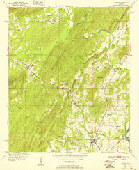
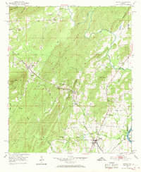
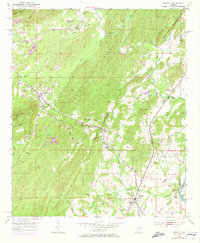
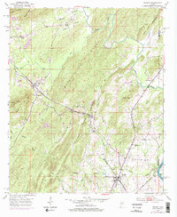
Editions of this 1951 Vincent Map
6 editions found
Other maps of this area

1889 · Springville
USGS Topo · 1:125,000

1889 · Birmingham
USGS Topo · 1:125,000

1890 · Bessemer
USGS Topo · 1:125,000

1890 · Talladega
USGS Topo · 1:125,000

1892 · Birmingham
USGS Topo · 1:125,000

1892 · Springville
USGS Topo · 1:125,000

1892 · Talladega
USGS Topo · 1:125,000

1892 · Bessemer
USGS Topo · 1:125,000

1895 · Birmingham
USGS Topo · 1:125,000

1905 · Leeds
USGS Topo · 1:62,500