1970s Maps of Chelsea, Alabama
Explore 5 historic maps of Chelsea from the 1970s. These maps offer a rare glimpse into what life looked like during the 1970s — showing old roads, neighborhoods, homes, and landmarks that have changed or disappeared over time.
Whether you're researching your family's past, planning a metal detecting trip, or studying how Chelsea's landscape evolved across the 1970s, these high-resolution maps are a powerful tool for exploring the history of this region.
- Focus on a specific era: All maps on this page are from the 1970s, giving you a focused view of this time period.
- See what’s changed: Compare century-old streets, trails, and buildings to today's modern landscape using overlays and satellite layers.
- Research with precision: Use these maps for genealogy, historical research, land use analysis, or educational projects.
- View, download, or print: Maps are fully viewable online in high resolution, and can be downloaded or printed for your own records.
Start exploring Chelsea's history through authentic maps from the 1970s. This is your window into the past.
Chelsea, AL maps
(5)- 1975 Map of Westover, 1977 Print
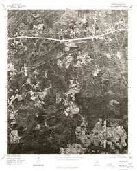 1975 Westover1977 Print · USGSShelby County emerges in the mid-seventies through this detailed aerial survey, showing the rural landscape around Westover. Researchers can trace the development of local road networks and identify specific cleared homesteads and pastures in the era before modern expansion.
 - 1975 Map of Cahaba Heights, 1977 Print
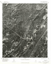 1975 Cahaba Heights1977 Print · USGSThe suburbs of Shelby County are frozen in the mid-seventies, showing the transition from wooded ridges to residential neighborhoods. Researchers can trace the early footprints of Mountain Brook and the growing streets of Cahaba Heights as they looked decades ago.
 - 1975 Map of Columbiana NE, 1977 Print
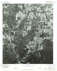 1975 Columbiana NE1977 Print · USGSShelby County transitions into its modern landscape in the mid-seventies, captured here through detailed aerial photo-imagery. Researchers can trace the residential expansion of Columbiana and the winding course of the Coosa River along the eastern edge.
 - 1975 Map of Chelsea, 1977 Print
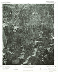
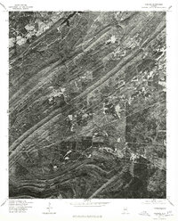 1975 Chelsea1977 Print · USGSShelby County land patterns are captured in high-detail aerial imagery during the mid-seventies, showing the region before major modern expansion. Genealogists and local historians can trace early property boundaries and road networks around Chelsea and New Hope.
 - 1975 Map of Columbiana NW, 1977 Print
 1975 Columbiana NW1977 Print · USGSCovers Chelsea, including Alabaster, Calera, and other nearby areas
End of results
Showing maps 1-5 of 5
Top cities near Chelsea
- Birmingham historical maps
- Hoover historical maps
- Hoover historical maps
- Vestavia Hills historical maps
- Alabaster historical maps
- Homewood historical maps
See more
Top neighborhoods of Chelsea
Frequently asked questions
- What are the different types of historical maps available for Chelsea?
- What is the oldest map of Chelsea?
- Where can I purchase historical maps of Chelsea for my home or office?
- Where can I download high-res historical maps of Chelsea?
- Are there historical topographic maps available for Chelsea?
- Is there historical aerial imagery available for Chelsea?
- Where are historical maps of Chelsea sourced from?