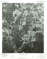
1975 Map of Columbiana NE
USGS Topo · Published 1977About this map
Columbiana serves as the focal point of this 1975 orthophotoquad, which uses aerial imagery to document the rural and suburban character of Shelby County. Unlike a standard topographic line map, this photographic record reveals the exact textures of the landscape, from the dense timber stands that cover much of the terrain to the clear-cut patterns of local forestry and agriculture. To the east, the Coosa River marks a primary geographic boundary, its winding course and banks visible in high-contrast detail. This imagery was produced by the Geological Survey in cooperation with the Soil Conservation Service, capturing the road networks radiating out from the town center and the patchwork of land use that defined the region in the mid-1970s.
Find a feature on this map
2 named features on this map. Tap any name to fly to it.
Don’t see what you’re looking for? This feature index may not catch every label — zoom into the map to look around manually.
Map Details
Editions of this 1975 Columbiana NE Map
This is the sole edition of this map. No revisions or reprints were ever made.
Other maps of this area

1890 · Bessemer
USGS Topo · 1:125,000

1890 · Talladega
USGS Topo · 1:125,000

1892 · Talladega
USGS Topo · 1:125,000

1892 · Bessemer
USGS Topo · 1:125,000

1906 · Vandiver
USGS Topo · 1:62,500

1908 · Vandiver
USGS Topo · 1:62,500

1909 · Columbiana
USGS Topo · 1:62,500

1911 · Columbiana
USGS Topo · 1:62,500

1915 · Gantts Quarry
USGS Topo · 1:48,000

1917 · Gantts Quarry
USGS Topo · 1:62,500