Old Maps of St. Clair County, Alabama for Hiking & Exploration
Hike through history with 163 historic maps of St. Clair County. Explore old trails, ghost towns, and forgotten backroads — perfect for outdoor adventurers and local explorers.
- Rediscover forgotten places: Map out old mining camps, roads, and footpaths that no longer exist on modern maps.
- Layer with modern tools: Combine with LiDAR or satellite views to plan hikes through historical terrain.
- Made for exploration: Popular among hikers, overlanders, and local history lovers.
Use these maps to find adventure and explore the hidden past of St. Clair County.
St. Clair County, AL maps
(163)- 1889 Map of Springville
 1889 Springville1889 Print · USGSSt. Clair County and its neighbors are mapped here during the late Victorian era as railroads began to transform the old plantation and river economy. Genealogists can locate family landmarks like Henry's Mill, trace the path of Jackson's Trace, or find the location of old river crossings at Colman's Ferry.
 - 1889 Map of Birmingham
 1889 Birmingham1889 Print · USGSIn the late nineteenth century, the Iron City was a growing urban core surrounded by intensive extraction sites and river crossings. Trace early industrial footprints at the Pratt Mines, Sloss Quarry, and the Old Irondale Furnace.
 - 1890 Map of Talladega
 1890 Talladega1890 Print · USGSTalladega and the surrounding river valleys are captured here in the late nineteenth century as the railroad and river economy flourished. Trace the locations of historic river crossings like Old Kymulga Ferry and local landmarks such as Odens Mill.
 - 1892 Map of Birmingham
 1892 Birmingham1892 Print · USGSBirmingham and the surrounding iron district emerge in the late nineteenth century as a hub of heavy industry and rail expansion. Trace the early footprints of the Sloss Mine, locate river crossings like Doss Ferry, and find family-named landmarks like Hanby Mill.
 - 1892 Map of Springville
 1892 Springville1892 Print · USGSNortheast Alabama at the end of the nineteenth century is a landscape of river crossings and expanding rail lines. Genealogists can trace family footprints at St. Clair Springs, Greensport, and numerous river crossings like Colman's Ferry or Goodwin's Mill.7 unique versions available
 - 1892 Map of Talladega
 1892 Talladega1892 Print · USGSTalladega County and the Coosa River valley are captured here in the late nineteenth century as the regional rail network expanded through the mountains. Researchers can locate old river crossings like Chancelors Ferry, rural landmarks such as Edwards Store, and early hubs like Childersburgh.6 unique versions available
 - 1895 Map of Birmingham
 1895 Birmingham1895 Print · USGSBirmingham at the peak of its industrial boom is captured here as the city’s rail and mining networks spread through the surrounding valleys. Researchers can trace early iron production at Old Irondale Furnace or locate family roots at Doss Ferry and Pratt Mines.2 unique versions available
 - 1905 Map of Leeds, 1956 Print
 1905 Leeds1956 Print · USGSJefferson County industrial expansion meets early mountain settlements at the start of the century. You can trace the mineral economy through the Alfretta Mines and Lucy Duke Furnace, or locate family roots at Mount Pinson Pinson P.O. and Argo Station.
 - 1907 Map of Birmingham
 1907 Birmingham1907 Print · USGSJefferson and Blount counties are shown in the early twentieth century as the industrial heart of Alabama was taking shape. Genealogists can trace family roots through named landmarks like Box Schoolhouse, Watson PO, and the coal works at Watts Mines.5 unique versions available
 - 1907 Map of Leeds
 1907 Leeds1907 Print · USGSJefferson County was an industrial and rail hub in the early twentieth century as iron mining and agriculture shaped its valleys. Genealogists can trace family names and early community nodes like Mount Pinson Pinson PO, Alfretta Mines, and Oakgrove Church.3 unique versions available
 - 1943 Map of Talladega, 1972 Print
 1943 Talladega1972 Print · USGSTalladega and its mountain ridges are captured here during the early years of the Second World War, showing a landscape defined by rail and rural industry. Researchers can trace family roots through numerous country landmarks like Reynolds Mill, the County Training School, and Winterboro.2 unique versions available
 - 1946 Map of Talladega
 1946 Talladega1946 Print · USGSTalladega and its surrounding hill country are captured here in the mid-1940s as a vital railroad and milling crossroads. Genealogists can locate family landmarks like Allison Mills, Antioch Ch, and the Mardisville Sch among the rural settlements.2 unique versions available
 - 1947 Map of Cox Gap, 1948 Print
 1947 Cox Gap1948 Print · USGSSt. Clair County's ridge-and-valley landscape is captured here in the years following World War II, when rural life centered on small mountain gaps and creek-side churches. Genealogists can locate family landmarks like Bethany Ch, Ashville, and the remote Gum Springs Ch.5 unique versions available
 - 1947 Map of Dunaway Mountain, 1953 Print
 1947 Dunaway Mountain1953 Print · USGSThe Etowah County countryside near Gadsden is captured here just after World War II, showing a landscape transitioning from military use to civil expansion. Researchers can trace the grounds of Camp Sibert (Abandoned) or locate local landmarks like Listers Ferry (Abandoned) and Old Harmony Ch.3 unique versions available
 - 1947 Map of Ragland, 1953 Print
 1947 Ragland1953 Print · USGSIn the late 1940s, the Coosa River valley was a landscape of deep-rooted rural communities and growing military installations. Genealogists can trace family landmarks like Rhodes Chapel and old mills such as Martins Mill or Francis Mill.3 unique versions available
 - 1947 Map of Ragland, 1953 Print
 1947 Ragland1953 Print · USGSPost-war St. Clair County comes to life as the Coosa River winds through Emory Bend. Genealogists and historians can trace community roots at Rhodes Chapel, Robinson Sch, and the industrial sidings of the Seaboard Air Line in Ragland.4 unique versions available
 - 1947 Map of Riverside, 1953 Print
 1947 Riverside1953 Print · USGSRiverside and the riverbanks of St. Clair and Talladega counties appear here just after the war, when the railroad and river still dictated the local economy. Genealogists can locate family landmarks like Seddon Cem, Idelia Sch, and the riverside Lock No 5 (Abandoned).4 unique versions available
 - 1947 Map of Francis Mill, 1953 Print
 1947 Francis Mill1953 Print · USGSCalhoun and Talladega counties appear just after the war, showing a landscape transitioning between traditional milling and major military installations. Researchers can locate family landmarks like Bailey Springs Sch, Refuge Ch, and the site of Francis Mill.4 unique versions available
 - 1947 Map of Steele, 1953 Print
 1947 Steele1953 Print · USGSNorthern St. Clair County appears here in the immediate post-war years as military installations give way to rural life. Researchers can trace the boundaries of Camp Sibert, find old family church sites like Deerman Chapel, and follow the Southern rail line through Steele.3 unique versions available
 - 1947 Map of Steele, 1953 Print
 1947 Steele1953 Print · USGSMid-century Alabama life centered on the river and rail corridors between Gadsden and Ashville. Genealogists can locate family landmarks like Morgans Crossroad, Old Harmony Ch Cem, and the decommissioned Camp Sibert.2 unique versions available
 - 1949 Map of Ohatchee, 1953 Print
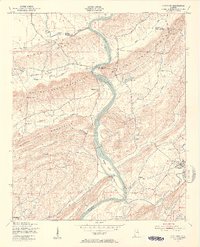 1949 Ohatchee1953 Print · USGSThe Coosa River valley in the late 1940s shows a landscape of steep ridges and tight-knit river settlements along the Calhoun and St. Clair county lines. Local historians can trace the paths of the Seaboard Air Line and find sites like Francis Ferry, Greensport, and Ten Island Ch.5 unique versions available
 - 1951 Map of Vincent, 1952 Print
 1951 Vincent1952 Print · USGSShelby County at the start of the 1950s remains a landscape of rail-side towns and ridge-country churches. Local historians can trace the paths of the Central of Georgia railroad through Sterrett or locate landmarks like Duncan Chapel and the Elliott Cem.6 unique versions available
 - 1951 Map of Laniers, 1952 Print
 1951 Laniers1952 Print · USGSThe Coosa River valley in the early fifties shows a landscape of river islands and rural Alabama settlements connected by the Atlantic Coast Line railroad. Genealogists can locate family landmarks such as Evening Star Ch Cem, Briarfield Sch, and the community of Laniers.5 unique versions available
 - 1953 Map of Birmingham, 1964 Print
 1953 Birmingham1964 Print · USGSCentral Alabama at mid-century shows a landscape defined by industrial expansion and the iron-rich ridges surrounding Birmingham. Researchers can trace the extensive rail networks of the L & N RR or locate historic federal sites like the Anniston Ordnance Depot.4 unique versions available
 - 1956 Map of Birmingham
 1956 Birmingham1956 Print · USGSCentral Alabama in the mid-fifties exhibits a landscape of growing cities and deep-rooted industrial corridors. Genealogists and historians can trace the development of suburban Mountain Brook or locate regional hubs like Sylacauga and Jasper.
Showing maps 1-25 of 163
Top cities of St. Clair County
- Moody historical maps
- Pell City historical maps
- Margaret historical maps
- Odenville historical maps
- Springville historical maps
- Argo historical maps
See more
Frequently asked questions
- What are the different types of historical maps available for St. Clair County?
- What is the oldest map of St. Clair County?
- Where can I purchase historical maps of St. Clair County for my home or office?
- Where can I download high-res historical maps of St. Clair County?
- Are there historical topographic maps available for St. Clair County?
- Is there historical aerial imagery available for St. Clair County?
- Where are historical maps of St. Clair County sourced from?