Old Maps of Walker County, Alabama for Hiking & Exploration
Hike through history with 183 historic maps of Walker County. Explore old trails, ghost towns, and forgotten backroads — perfect for outdoor adventurers and local explorers.
- Rediscover forgotten places: Map out old mining camps, roads, and footpaths that no longer exist on modern maps.
- Layer with modern tools: Combine with LiDAR or satellite views to plan hikes through historical terrain.
- Made for exploration: Popular among hikers, overlanders, and local history lovers.
Use these maps to find adventure and explore the hidden past of Walker County.
Walker County, AL maps
(183)- 1889 Map of Birmingham
 1889 Birmingham1889 Print · USGSIn the late nineteenth century, the Iron City was a growing urban core surrounded by intensive extraction sites and river crossings. Trace early industrial footprints at the Pratt Mines, Sloss Quarry, and the Old Irondale Furnace.
 - 1892 Map of Birmingham
 1892 Birmingham1892 Print · USGSBirmingham and the surrounding iron district emerge in the late nineteenth century as a hub of heavy industry and rail expansion. Trace the early footprints of the Sloss Mine, locate river crossings like Doss Ferry, and find family-named landmarks like Hanby Mill.
 - 1893 Map of Jasper
 1893 Jasper1893 Print · USGSNorthern Alabama’s coal and timber country comes into focus in the 1890s as railroads began to penetrate the river valleys. Genealogists and historians can trace family-named river crossings like Miller Ferry and Baltimore Ford or early industry at Gamble Mines.5 unique versions available
 - 1895 Map of Birmingham
 1895 Birmingham1895 Print · USGSBirmingham at the peak of its industrial boom is captured here as the city’s rail and mining networks spread through the surrounding valleys. Researchers can trace early iron production at Old Irondale Furnace or locate family roots at Doss Ferry and Pratt Mines.2 unique versions available
 - 1907 Map of Birmingham
 1907 Birmingham1907 Print · USGSJefferson and Blount counties are shown in the early twentieth century as the industrial heart of Alabama was taking shape. Genealogists can trace family roots through named landmarks like Box Schoolhouse, Watson PO, and the coal works at Watts Mines.5 unique versions available
 - 1935 Map of Port Birmingham
 1935 Port Birmingham1935 Print · USGSThe coal and power corridor of the Black Warrior River is captured here in the mid-1930s, showing a landscape defined by mines and industrial camps. Genealogists can locate family sites at Pennsylvania Camp, Satterfield Cem, or the Barney Mine community.
 - 1938 Map of Port Birmingham
 1938 Port Birmingham1938 Print · USGSThe river-and-rail industry of the Black Warrior coalfields is captured here in the late 1930s. Genealogists and historians can trace the foundations of local commerce at Port Birmingham and locate vanished river crossings like Underwood Ferry or the Atwood Ferry.4 unique versions available
 - 1949 Map of Cordova, 1967 Print
 1949 Cordova1967 Print · USGSWalker County during the late 1940s shows a complex network of river bends and rail lines centered on Cordova. Researchers can trace old family settlements and rural landmarks like Gardiners Gin, Wesley Ch, and the crossing at Benoit.4 unique versions available
 - 1949 Map of Parrish, 1967 Print
 1949 Parrish1967 Print · USGSWalker County during the late 1940s reveals a landscape shaped by coal and rail around the junctions of Parrish and Oakman. Researchers can trace the development of small mining hamlets like Standard or locate rural landmarks like Old Liberty Hill Church and the Pleasant Field School.2 unique versions available
 - 1949 Map of Sipsey, 1969 Print
 1949 Sipsey1969 Print · USGSWalker County at the close of the 1940s reveals a landscape shaped by the winding Mulberry Fork and the arrival of industrial mining. Genealogists and historians can trace old schools and churches like Wheeler Sch and New Canaan Ch or locate family sites at Drummond Cem.5 unique versions available
 - 1949 Map of Cold Springs, 1969 Print
 1949 Cold Springs1969 Print · USGSCullman County life in the late 1940s centers on the ridge-top settlements and creek valleys near the Sipsey Fork. Researchers can trace rural lineages through numerous country landmarks like Cold Springs, Drummond Sch, and the Banking Grounds.5 unique versions available
 - 1949 Map of Townley, 1969 Print
 1949 Townley1969 Print · USGSWalker County during the late 1940s is defined by the intersections of the Bankhead Highway and coal-country rail lines. Genealogists and local historians can trace rural family life through landmarks like Union Hill Church, Palmer Sch, and Manasco Cem.3 unique versions available
 - 1949 Map of Jasper, 1969 Print
 1949 Jasper1969 Print · USGSWalker County during the mid-century industrial peak reveals a landscape defined by coal and the convergence of major rail lines. Researchers can trace family roots at Oak Hill Cem, locate the old Frisco Quarters, or find the historic Walker County Airport.2 unique versions available
 - 1949 Map of Oakman, 1972 Print
 1949 Oakman1972 Print · USGSThe Walker County coal and rail landscape comes alive in this post-war survey of the Oakman area. Researchers can trace the SOUTHERN railroad through the hills to locate Coal Valley, the Patton Hill Fire Tower, and local landmarks like Infant Hill Cemetery.2 unique versions available
 - 1949 Map of Manchester, 1972 Print
 1949 Manchester1972 Print · USGSWalker County during the late 1940s shows a landscape of small mining and farming settlements connected by the Alabama Central Railroad. Genealogists can locate family landmarks like Old Bennett Cem, Macedonia Sch, and the rural community at Five Points.2 unique versions available
 - 1949 Map of Nauvoo, 1973 Print
 1949 Nauvoo1973 Print · USGSPost-war Walker County comes to life in this detailed survey of the plateau country. Researchers can trace family roots through numerous local landmarks like Keeton Cem, Old Zion Ch, and the rural Nix Sch.2 unique versions available
 - 1949 Map of Sunlight, 1973 Print
 1949 Sunlight1973 Print · USGSWalker County at the end of the 1940s reveals a landscape of winding creek valleys and emerging coal extraction. Researchers can trace family history at sites like Blooming Grove Cem, the settlement of Sunlight, and Philadelphia Ch.3 unique versions available
 - 1949 Map of Tutwiler School, 1973 Print
 1949 Tutwiler School1973 Print · USGSThe hill country of Walker and Tuscaloosa Counties is captured here in the late 1940s as the river economy transitions. Researchers can trace rural lineages through sites like Tutwiler School, Cedar Creek Ch, and old settlements such as Browntown and Three Forks.3 unique versions available
 - 1949 Map of Wiley, 1973 Print
 1949 Wiley1973 Print · USGSThe rural borderlands of Fayette, Walker, and Tuscaloosa Counties are captured here in the late 1940s just as the regional landscape was maturing. Genealogists can trace family roots through landmarks like Brandon Sch, Flatwoods Cem, and Rock Springs Ch.3 unique versions available
 - 1950 Map of Nauvoo
 1950 Nauvoo1950 Print · USGSThe northern forest lands and rural settlements of Walker and Winston counties are detailed in this mid-century survey. Genealogists and local historians can trace the early layout of Nauvoo and its connection to the expansive William B Bankhead National Forest.2 unique versions available
 - 1950 Map of Manchester
 1950 Manchester1950 Print · USGSWalker County during the mid-century period shows a landscape of rural schoolhouses and forest management just north of Jasper. Researchers can trace the Alabama Central RR (Abandoned) and locate vanished local landmarks like Hudson Settlement and the Bankhead Farmstead Sch.2 unique versions available
 - 1951 Map of Jasper
 1951 Jasper1951 Print · USGSJasper and its surrounding coal-country communities are captured in the early 1950s as industry and aviation began to reshape the Walker County landscape. Genealogists and local historians can trace family roots at Oak Hill Cem, visit Snoddy Chapel, or locate schools like Scottsville Sch.2 unique versions available
 - 1951 Map of Cold Springs
 1951 Cold Springs1951 Print · USGSCullman and Walker Counties are shown here just after mid-century as a landscape of rural ridge-top churches and river-bottom crossings. Genealogists can locate family landmarks like Addington Chapel, McKinley Chapel, and the community of Cold Springs.2 unique versions available
 - 1951 Map of Parrish
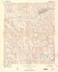 1951 Parrish1951 Print · USGSWalker County in the early fifties shows a landscape of coal mining and rural settlements shaped by the Southern railroad. Researchers can trace family history at Old Liberty Hill Church, Ernest Chapel, and the community of Parrish.2 unique versions available
 - 1951 Map of Tutwiler School
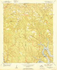 1951 Tutwiler School1951 Print · USGSThe borderlands of Walker and Tuscaloosa counties are documented here in the early fifties, showcasing a rural landscape shaped by the Black Warrior River. Genealogists can locate family landmarks like Tutwiler School, Browntown, and Reynolds Sch.2 unique versions available
Showing maps 1-25 of 183
Top cities of Walker County
- Jasper historical maps
- Sumiton historical maps
- Dora historical maps
- Carbon Hill historical maps
- Cordova historical maps
- Parrish historical maps
See more
Frequently asked questions
- What are the different types of historical maps available for Walker County?
- What is the oldest map of Walker County?
- Where can I purchase historical maps of Walker County for my home or office?
- Where can I download high-res historical maps of Walker County?
- Are there historical topographic maps available for Walker County?
- Is there historical aerial imagery available for Walker County?
- Where are historical maps of Walker County sourced from?