Old Maps of Wilcox County, Alabama for Academic Research
Study the evolution of Wilcox County with 179 high-resolution historic maps. Whether you're teaching, researching, or modeling changes in land use, these maps provide essential visual documentation of urban, environmental, and geographic change.
- Analyze long-term change: Track patterns in development, transportation, and natural features.
- Ideal for environmental or urban studies: Support academic projects with primary historical map data.
- Use in the classroom or lab: Educators and researchers rely on these maps to bring historical context to life.
These maps are a powerful tool for teaching, research, and visualizing how Wilcox County has changed over the decades.
Wilcox County, AL maps
(179)- 1953 Map of Montgomery, 1964 Print
 1953 Montgomery1964 Print · USGSCentral Alabama's river-and-rail corridor is mapped here in the mid-fifties, showing the vital connections between the capital and the Black Belt. Genealogists and historians can trace rail depots and crossroads from Marion Junction to Wetumpka, alongside landmarks like Craig AFB.4 unique versions available
 - 1953 Map of Andalusia, 1965 Print
 1953 Andalusia1965 Print · USGSSouth Alabama in the mid-twentieth century remains a land of pine forests and river-fed settlements. You can trace the vital rail corridors of the Louisville & Nashville and locate regional centers such as Andalusia, Brewton, and Monroeville.3 unique versions available
 - 1956 Map of Montgomery
 1956 Montgomery1956 Print · USGSCentral Alabama in the mid-1950s shows a landscape defined by its great river systems and a booming military aviation presence. Genealogists and historians can trace the rail corridors of the Southern Railway and locate tactical bases like Maxwell AFB and Craig AFB.
 - 1957 Map of Montgomery
 1957 Montgomery1957 Print · USGSCentral Alabama in the mid-fifties is defined by the winding Alabama River and a strategic network of military bases and rail lines. Trace family roots in Montgomery and Selma, or locate landmarks like Craig AFB and the State Capitol before the interstate era.
 - 1957 Map of Andalusia
 1957 Andalusia1957 Print · USGSSouthern Alabama in the mid-1950s was a landscape defined by timbered stretches and the rhythmic flow of the Alabama River. Researchers can trace the legacy of the rail era through the Central of Georgia tracks and the storied river bluffs at Choctaw Bluff.
 - 1957 Map of Carlowville, 1958 Print
 1957 Carlowville1958 Print · USGSThe Alabama River dominates this mid-century landscape of Dallas and Wilcox Counties, where rural life centered on the river's bends and the region's fertile soils. Genealogists can trace family roots through numerous landmarks like Snow Hill Institute, Boykin Cem, and the old settlement at Portland.2 unique versions available
 - 1957 Map of Braggs, 1958 Print
 1957 Braggs1958 Print · USGSSouthern Alabama in the late fifties was a region of tight-knit rural communities and family farmsteads. Genealogists and historians can trace the exact locations of local landmarks like the Berlin Normal Sch, Mt Moriah Ch, and the Louisville and Nashville rail stop at Minter (Minters Sta).2 unique versions available
 - 1968 Map of Thomaston East, 1971 Print
 1968 Thomaston East1971 Print · USGSMarengo County during the late sixties is captured here in detail, showing a landscape of rural settlements and railroad corridors. Researchers can trace the Louisville and Nashville line and locate community landmarks like Bethel Hill Ch, St Johns Sch, and the town of McKinley.
 - 1968 Map of Central Mills, 1971 Print
 1968 Central Mills1971 Print · USGSDallas and Perry counties are shown here in the late sixties, where the timber and rail economy shaped rural life. Genealogists can trace family landmarks and community centers like Central Mills, Shady Grove Ch, and the small settlement of Blalock.3 unique versions available
 - 1973 Map of Coy, 1977 Print
 1973 Coy1977 Print · USGSWilcox County life in the early seventies centered on the sweeping bends of the Alabama River and its industrial rail connections. Genealogists and local historians can trace rural communities through landmarks like Yellow Bluff, Nellie, and several country churches like St Emanuel Ch.
 - 1973 Map of Fulton East, 1977 Print
 1973 Fulton East1977 Print · USGSClarke County's rural timber and rail lands are shown here in the early seventies as the SOUTHERN railroad connected small communities. Genealogists and local historians can locate Henley Cem, Salem Ch Cem, and the historic OLD INDIAN TREATY BDY.
 - 1973 Map of Hybart, 1977 Print
 1973 Hybart1977 Print · USGSThe Alabama River and Claiborne Lake dominate this 1970s view of the Monroe and Wilcox County line during a period of rural transition. Trace family roots at Packards Bend, Monroe Sch, or old river sites like Kings Log Landing.
 - 1973 Map of Pine Hill, 1977 Print
 1973 Pine Hill1977 Print · USGSWilcox County in the early seventies shows a landscape defined by traditional rail junctions and the broad Alabama River. Genealogists and local historians can trace family locations at Enon Cems, Liberty Ch, and the settlement of Culpeper.
 - 1973 Map of Camden South, 1977 Print
 1973 Camden South1977 Print · USGSThe area surrounding Camden during the early 1970s reveals a landscape of rural community and regional infrastructure. Trace family history at Gravel Hill Ch or McIntosh Cem, and follow the Louisville and Nashville rail line.2 unique versions available
 - 1973 Map of Thomasville, 1977 Print
 1973 Thomasville1977 Print · USGSThomasville and its surrounding rail-side communities are captured here in the early 1970s as the town expanded near the SOUTHERN line. Genealogists and historians can trace family roots through numerous sites like Finley Crossing, Danzy Cem, and the historic Old Indian Treaty Bdy.2 unique versions available
 - 1973 Map of Lower Peach Tree, 1977 Print
 1973 Lower Peach Tree1977 Print · USGSThe Alabama River corridor near Lower Peach Tree is captured here during the 1970s as the river system adapted to the creation of Claiborne Lake. Genealogists can locate family landmarks like New Mt Moriah Ch, Kennedy Cem, and the historic Indian Treaty Bdy.
 - 1973 Map of Vredenburgh, 1977 Print
 1973 Vredenburgh1977 Print · USGSVredenburgh and the surrounding Alabama timberlands are captured here in the early seventies during the height of the regional rail era. Genealogists and local historians can trace family sites like Mt Zion Cem, the settlement at Bellview, and churches such as Wayman Chapel.2 unique versions available
 - 1974 Map of Crumptonia, 1977 Print
 1974 Crumptonia1977 Print · USGSThe Alabama River lowlands in the mid-1970s show a landscape shaped by the William "Bill" Dannelly Reservoir and rural creek valleys. Genealogists can locate family landmarks such as Hardy Young Cem, Aimwell Ch, and the settlement of Crumptonia.
 - 1974 Map of Catherine, 1977 Print
 1974 Catherine1977 Print · USGSWilcox and Dallas County communities thrive along the Southern rail corridor in the mid-1970s. Genealogists can trace family names through numerous sites like Catherine Academy, Prairie Bluff Cem, and the old settlement of Rehoboth.
 - 1974 Map of Lee Long Bridge, 1977 Print
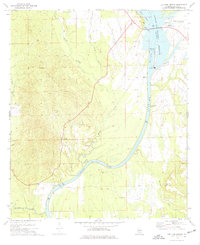 1974 Lee Long Bridge1977 Print · USGSThe Alabama River and its reservoirs define this Wilcox County landscape during the mid-seventies, just as river navigation and power infrastructure were modernizing. Researchers can trace local heritage through numerous family and church landmarks like Mendenhall Cem, Holy Cross Sch, and Jerusalem Ch.
 - 1974 Map of Camden North, 1977 Print
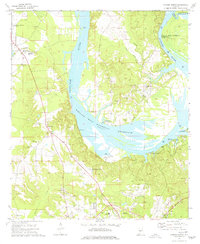 1974 Camden North1977 Print · USGSWilcox County life in the mid-seventies is centered on the wide waters of the Alabama River and the tight-knit communities of Gees Bend. Genealogists and historians can locate numerous rural burial sites and landmarks like Old St Francis Cem, Boykin, and the Lower Coastal Plains Experimental Farm.
 - 1978 Map of Surginer, 1979 Print
 1978 Surginer1979 Print · USGSMarengo and Wilcox Counties remained a landscape of quiet crossroads and creek-side settlements in the late seventies. Family researchers can trace the placement of local landmarks like Wesley Chapel, Arbor Cem, and the old rail siding at Magnolia Terminal.2 unique versions available
 - 1978 Map of Flatwood, 1979 Print
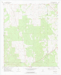 1978 Flatwood1979 Print · USGSMarengo and Wilcox counties appear here in the late seventies, showing a rural landscape defined by creek drainages and rail history. You can trace the Southern line alongside the Old Red Railroad Grade and locate the Goose Creek Cem.
 - 1978 Map of Kimbrough, 1979 Print
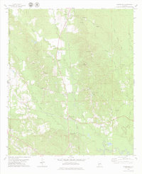 1978 Kimbrough1979 Print · USGSWilcox County’s rural rail and river landscape is captured here in the late 1970s, centered on the crossing of the Southern and St Louis-San Francisco lines. Researchers can trace family sites like Epiphany Sch, Thornhill Cem, and the settlement of Anne Manie.
 - 1981 Map of Rosebud
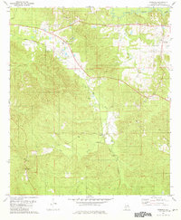 1981 Rosebud1981 Print · USGSWilcox County's rural heartland is captured here in the early 1980s, centered on the Louisville and Nashville rail line. Researchers can trace family sites near St Mary Ch, the lookout above Fatama, and the small community of Rosebud.
Showing maps 1-25 of 179
Top cities of Wilcox County
- Camden historical maps
- Pine Hill historical maps
- Boykin historical maps
- Yellow Bluff historical maps
- Pine Apple historical maps
- Oak Hill historical maps
Frequently asked questions
- What are the different types of historical maps available for Wilcox County?
- What is the oldest map of Wilcox County?
- Where can I purchase historical maps of Wilcox County for my home or office?
- Where can I download high-res historical maps of Wilcox County?
- Are there historical topographic maps available for Wilcox County?
- Is there historical aerial imagery available for Wilcox County?
- Where are historical maps of Wilcox County sourced from?