2020s Maps of Excursion Inlet, Alaska
Explore 5 historic maps of Excursion Inlet from the 2020s. These maps offer a rare glimpse into what life looked like during the 2020s — showing old roads, neighborhoods, homes, and landmarks that have changed or disappeared over time.
Whether you're researching your family's past, planning a metal detecting trip, or studying how Excursion Inlet's landscape evolved across the 2020s, these high-resolution maps are a powerful tool for exploring the history of this region.
- Focus on a specific era: All maps on this page are from the 2020s, giving you a focused view of this time period.
- See what’s changed: Compare century-old streets, trails, and buildings to today's modern landscape using overlays and satellite layers.
- Research with precision: Use these maps for genealogy, historical research, land use analysis, or educational projects.
- View, download, or print: Maps are fully viewable online in high resolution, and can be downloaded or printed for your own records.
Start exploring Excursion Inlet's history through authentic maps from the 2020s. This is your window into the past.
Excursion Inlet, AK maps
(5)- 2021 Map of Juneau B-4 NW, 2021 Print
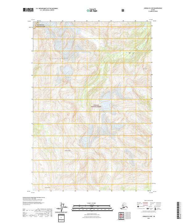 2021 Juneau B-4 NW2021 Print · USGSCoastal mountains and protected wilderness dominate this recent survey of the Haines area. Trace the boundaries between Glacier Bay National Park and the Tongass National Forest or locate peaks like Mt Golub and the Chilkat Range.
 - 2021 Map of Juneau B-5 SE, 2021 Print
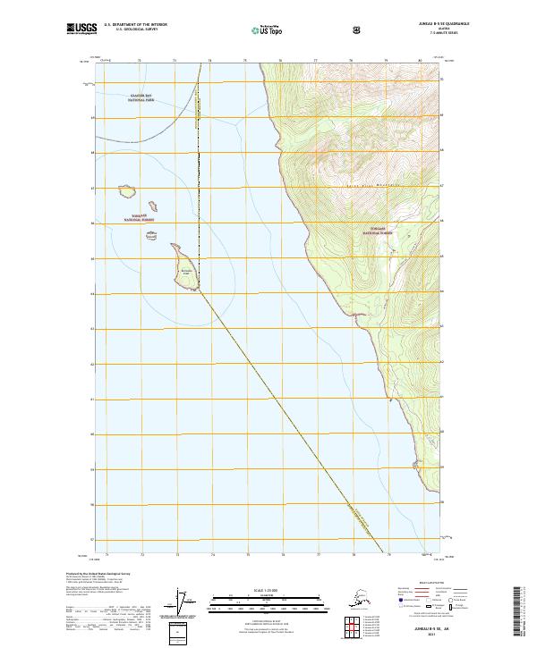 2021 Juneau B-5 SE2021 Print · USGSThe northern reaches of Icy Strait meet the wilderness of the panhandle in 2021. Researchers can trace the rugged coastal boundary of Glacier Bay National Park and follow paths like the Annx Line Trl near Homeshore.
 - 2021 Map of Juneau B-5 NE, 2021 Print
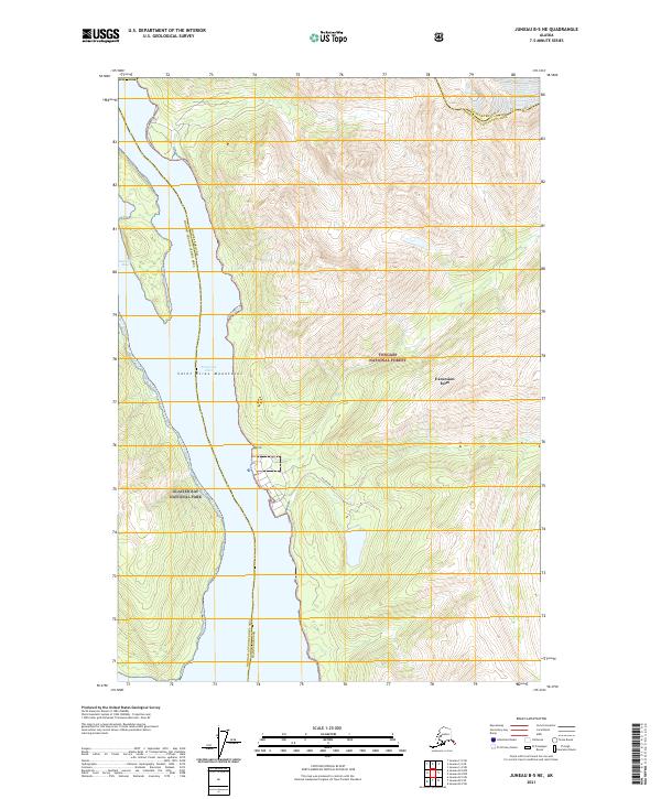 2021 Juneau B-5 NE2021 Print · USGSThe coastal wilderness of Southeast Alaska is documented here as it appeared in the early 2020s. Researchers can trace the maritime boundaries of Glacier Bay National Park and the settlement of Excursion Inlet along the Sawmill Bay shoreline.
 - 2021 Map of Juneau B-4 SW, 2021 Print
 2021 Juneau B-4 SW2021 Print · USGSSoutheast Alaska's coastal wilderness comes into sharp focus during this recent survey of the Haines Borough coastline. Researchers can trace remote routes like the West Swanson Trl or locate landmarks such as Leech Lake and the peaks of Shuk Da Doogú.
 - 2021 Map of Juneau C-5 SE, 2021 Print
 2021 Juneau C-5 SE2021 Print · USGSIn the southeastern Alaskan panhandle during the early twenty-first century, this survey shows where the Saint Elias Mountains meet. Trace the vast boundaries of Glacier Bay National Park and the Tongass National Forest across this unpopulated wilderness.
End of results
Showing maps 1-5 of 5
Top cities near Excursion Inlet
Frequently asked questions
- What are the different types of historical maps available for Excursion Inlet?
- What is the oldest map of Excursion Inlet?
- Where can I purchase historical maps of Excursion Inlet for my home or office?
- Where can I download high-res historical maps of Excursion Inlet?
- Are there historical topographic maps available for Excursion Inlet?
- Is there historical aerial imagery available for Excursion Inlet?
- Where are historical maps of Excursion Inlet sourced from?