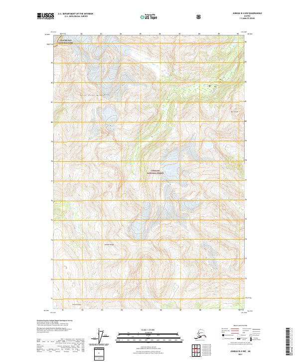
2021 Map of Juneau B-4 NW
USGS Topo · Published 2021About this map
Saint Elias Mountains define the high terrain of this coastal Alaskan landscape, where the northern reaches of the Tongass National Forest meet the protected wilderness of Glacier Bay National Park. This survey captures the convergence of several major geographic systems, including the peaks of the Chilkat Range and the distinctive height of Mt Golub. The map illustrates the complex hydrography and elevation typical of the region, including the area marked Shuk Da Doogu. By documenting the modern boundaries of national forests and parklands, this sheet provides a detailed look at the contemporary land management and natural topography of the Haines area, where glaciers and mountain ranges dictate the flow of the landscape.
Find a feature on this map
10 named features on this map. Tap any name to fly to it.
Don’t see what you’re looking for? This feature index may not catch every label — zoom into the map to look around manually.
Map Details
Editions of this 2021 Juneau B-4 NW Map
This is the sole edition of this map. No revisions or reprints were ever made.
Other maps of this area

1948 · Juneau C-5
USGS Topo · 1:63,360

1948 · Juneau B-4
USGS Topo · 1:63,360

1948 · Juneau C-4
USGS Topo · 1:63,360

1948 · Juneau B-5
USGS Topo · 1:63,360

1949 · Juneau C-4
USGS Topo · 1:63,360

1949 · Juneau B-4
USGS Topo · 1:63,360

1950 · Juneau B-5
USGS Topo · 1:63,360

1951 · Juneau
USGS Topo · 1:250,000

1962 · Juneau
USGS Topo · 1:250,000
1996 · Juneau B-4
USGS Topo · 1:63,360