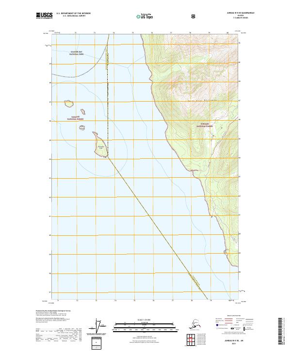
2021 Map of Juneau B-5 SE
USGS Topo · Published 2021About this map
The Glacier Bay National Park and Tongass National Forest boundaries converge along the shoreline of N. Icy Strait in this coastal Alaskan landscape. The terrain is dominated by the steep slopes of the Saint Elias Mountains, which drop sharply toward the water's edge. This 2021 survey shows a shoreline defined by the Homeshore and West Line tracks, illustrating the limited corridor of human travel between the high mountain peaks and the sea.
Find a feature on this map
18 named features on this map. Tap any name to fly to it.
Don’t see what you’re looking for? This feature index may not catch every label — zoom into the map to look around manually.
Map Details
Editions of this 2021 Juneau B-5 SE Map
This is the sole edition of this map. No revisions or reprints were ever made.
Other maps of this area

1948 · Juneau B-4
USGS Topo · 1:63,360

1948 · Juneau A-4
USGS Topo · 1:63,360

1948 · Juneau B-5
USGS Topo · 1:63,360

1949 · Juneau B-4
USGS Topo · 1:63,360

1950 · Juneau B-5
USGS Topo · 1:63,360

1951 · Juneau
USGS Topo · 1:250,000

1951 · Juneau A-5
USGS Topo · 1:63,360

1962 · Juneau
USGS Topo · 1:250,000
1994 · Juneau A-5
USGS Topo · 1:63,360
1995 · Juneau A-4
USGS Topo · 1:63,360