Old Maps of Excursion Inlet, Alaska for Academic Research
Study the evolution of Excursion Inlet with 18 high-resolution historic maps. Whether you're teaching, researching, or modeling changes in land use, these maps provide essential visual documentation of urban, environmental, and geographic change.
- Analyze long-term change: Track patterns in development, transportation, and natural features.
- Ideal for environmental or urban studies: Support academic projects with primary historical map data.
- Use in the classroom or lab: Educators and researchers rely on these maps to bring historical context to life.
These maps are a powerful tool for teaching, research, and visualizing how Excursion Inlet has changed over the decades.
Excursion Inlet, AK maps
(18)- 1948 Map of Juneau C-5, 1956 Print
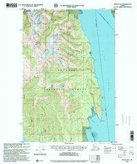
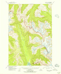 1948 Juneau C-51956 Print · USGSThe Chilkat Range and Glacier Bay wilderness are captured here during the late 1940s, highlighting the border of the Tongass National Forest. Researchers can trace the rugged divide from Volcanic Peak down to the Tidal Flat at Excursion Inlet.2 unique versions available
 - 1948 Map of Juneau B-4, 1956 Print
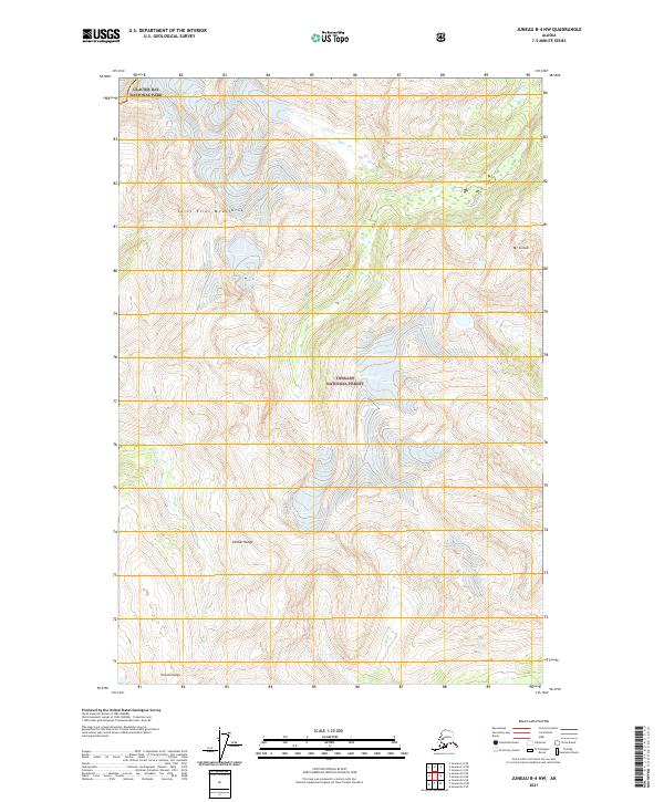
 1948 Juneau B-41956 Print · USGSSoutheast Alaska’s coastal wilderness is captured in the late 1940s, showing the meeting of mountain and sea before modern infrastructure. Trace the shoreline of Lynn Canal to find isolated landmarks like Pt Howard, Lincoln Island, and the Lynn Sisters.2 unique versions available
 - 1948 Map of Juneau B-5, 1956 Print
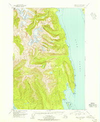
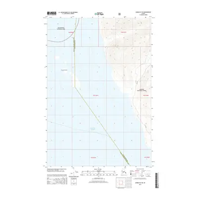
 1948 Juneau B-51956 Print · USGSCoastal life in Southeast Alaska at the end of the 1940s centers on the deep waters of Excursion Inlet and the edge of Glacier Bay National Monument. Researchers can find early maritime landmarks like the Aero Light and trace local history at the Indian Cem and Military Cem.
 - 1949 Map of Juneau B-4, 1974 Print
 1949 Juneau B-41974 Print · USGSCoastal wilderness in the Chilkat Range appears here as it was surveyed shortly after the war, showing a landscape defined by water and rock rather than roads. Researchers can trace the maritime geography of Lynn Canal and landmarks like Mount Golub and Lincoln Island.2 unique versions available
 - 1950 Map of Juneau B-5, 1968 Print
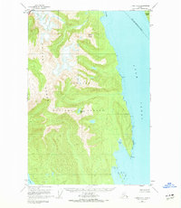
 1950 Juneau B-51968 Print · USGSSoutheast Alaska’s coastal wilderness comes into focus in the mid-twentieth century as maritime commerce and federal conservation intersect. Researchers can locate the Cannery at Excursion Inlet and trace heritage sites like the Indian Cem.2 unique versions available
 - 1951 Map of Juneau
 1951 Juneau1951 Print · USGSJuneau and the industrial waterfront of the Gastineau Channel are shown here at the start of the 1950s. Researchers can trace the mid-century footprint of Juneau, the mining history of Treadwell, and remote maritime outposts like Hoonah and Gustavus.4 unique versions available
 - 1962 Map of Juneau, 1966 Print
 1962 Juneau1966 Print · USGSSoutheast Alaska in the early sixties showcases a maritime landscape defined by the Tongass National Forest and the peaks of the Coast Mountains. Trace the footprints of coastal industry at Treadwell, Thane, and the regional hub of Juneau.7 unique versions available
 - 1996 Map of Juneau B-4, 2000 Print
 1996 Juneau B-42000 Print · USGSCoastal wilderness and the heights of the Chilkat Range are documented in the late nineties as they border the City and Borough of Juneau. Trace the intersection of Glacier Bay National Park and the Tongass National Forest along Lynn Canal.
 - 2015 Map of Juneau B-4 SW, 2015 Print
 2015 Juneau B-4 SW2015 Print · USGSCovers Excursion Inlet, including Haines, United States, and other nearby areas
 - 2015 Map of Juneau B-5 NE, 2015 Print
 2015 Juneau B-5 NE2015 Print · USGSCovers Excursion Inlet, including Unorganized Borough, Haines, and other nearby areas
 - 2015 Map of Juneau B-4 NW, 2015 Print
 2015 Juneau B-4 NW2015 Print · USGSCovers Excursion Inlet, including Unorganized Borough, Haines, and other nearby areas
 - 2015 Map of Juneau B-5 SE, 2015 Print
 2015 Juneau B-5 SE2015 Print · USGSCovers Excursion Inlet, including Unorganized Borough, Haines, and other nearby areas
 - 2017 Map of Juneau C-5 SE, 2017 Print
 2017 Juneau C-5 SE2017 Print · USGSCovers Excursion Inlet, including Unorganized Borough, Haines, and other nearby areas
 - 2021 Map of Juneau B-4 NW, 2021 Print
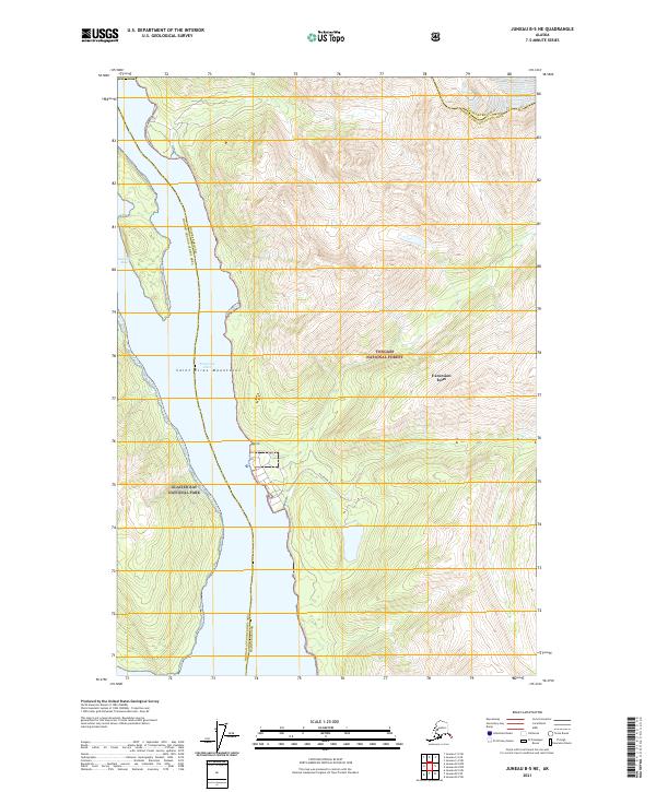
 2021 Juneau B-4 NW2021 Print · USGSCoastal mountains and protected wilderness dominate this recent survey of the Haines area. Trace the boundaries between Glacier Bay National Park and the Tongass National Forest or locate peaks like Mt Golub and the Chilkat Range.
 - 2021 Map of Juneau B-5 SE, 2021 Print
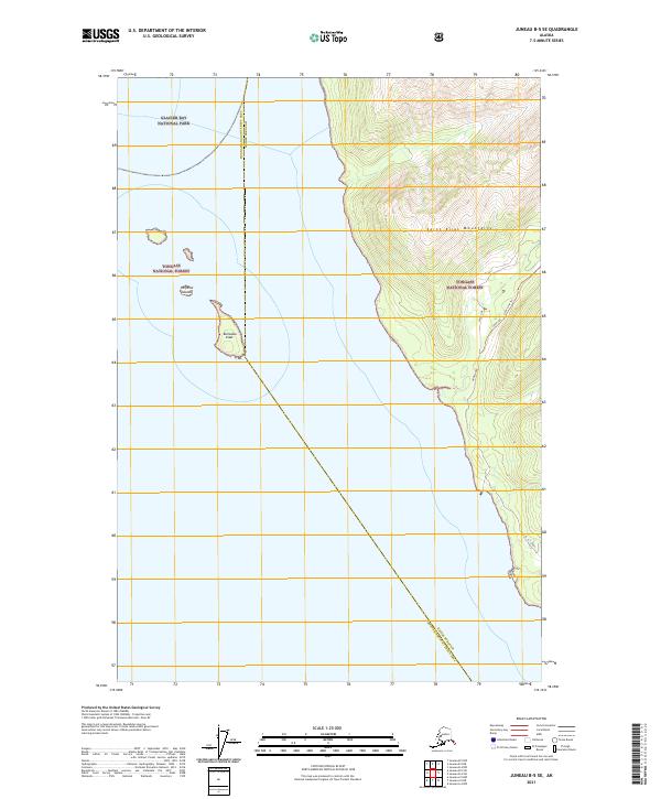 2021 Juneau B-5 SE2021 Print · USGSThe northern reaches of Icy Strait meet the wilderness of the panhandle in 2021. Researchers can trace the rugged coastal boundary of Glacier Bay National Park and follow paths like the Annx Line Trl near Homeshore.
 - 2021 Map of Juneau B-5 NE, 2021 Print
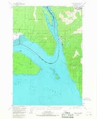
 2021 Juneau B-5 NE2021 Print · USGSThe coastal wilderness of Southeast Alaska is documented here as it appeared in the early 2020s. Researchers can trace the maritime boundaries of Glacier Bay National Park and the settlement of Excursion Inlet along the Sawmill Bay shoreline.
 - 2021 Map of Juneau B-4 SW, 2021 Print
 2021 Juneau B-4 SW2021 Print · USGSSoutheast Alaska's coastal wilderness comes into sharp focus during this recent survey of the Haines Borough coastline. Researchers can trace remote routes like the West Swanson Trl or locate landmarks such as Leech Lake and the peaks of Shuk Da Doogú.
 - 2021 Map of Juneau C-5 SE, 2021 Print
 2021 Juneau C-5 SE2021 Print · USGSIn the southeastern Alaskan panhandle during the early twenty-first century, this survey shows where the Saint Elias Mountains meet. Trace the vast boundaries of Glacier Bay National Park and the Tongass National Forest across this unpopulated wilderness.
End of results
Showing maps 1-18 of 18
Top cities near Excursion Inlet
Frequently asked questions
- What are the different types of historical maps available for Excursion Inlet?
- What is the oldest map of Excursion Inlet?
- Where can I purchase historical maps of Excursion Inlet for my home or office?
- Where can I download high-res historical maps of Excursion Inlet?
- Are there historical topographic maps available for Excursion Inlet?
- Is there historical aerial imagery available for Excursion Inlet?
- Where are historical maps of Excursion Inlet sourced from?