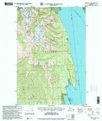
1996 Map of Juneau B-4
USGS Topo · Published 2000About this map
The Chilkat Range dominates the western half of this 1996 revision, where the heights of Mount Golub and other unnamed peaks define the edge of Glacier Bay National Park. This coastal wilderness is bounded by the expansive Lynn Canal to the east and the waters of Icy Strait to the south. The map illustrates a complex landscape of glacial terrain and dense timber within the Tongass National Forest, segmented by the administrative boundary between the Haines Borough and the City and Borough of Juneau. While largely undeveloped, modern infrastructure is noted near the shoreline of Howard Bay, including a Microwave Tower and a Helipad. These features, along with small inland bodies like Teardrop Lake, highlight the intersection of mid-century topographic data with late-century aerial planimetry in this remote maritime corridor.
Find a feature on this map
14 named features on this map. Tap any name to fly to it.
Don’t see what you’re looking for? This feature index may not catch every label — zoom into the map to look around manually.
Map Details
Editions of this 1996 Juneau B-4 Map
This is the sole edition of this map. No revisions or reprints were ever made.
Other maps of this area

1947 · Juneau B-3
USGS Topo · 1:63,360

1948 · Juneau C-5
USGS Topo · 1:63,360

1948 · Juneau B-4
USGS Topo · 1:63,360

1948 · Juneau A-3
USGS Topo · 1:63,360

1948 · Juneau C-4
USGS Topo · 1:63,360

1948 · Juneau A-4
USGS Topo · 1:63,360

1948 · Juneau B-5
USGS Topo · 1:63,360

1949 · Juneau B-3
USGS Topo · 1:62,500

1949 · Juneau C-4
USGS Topo · 1:63,360

1949 · Juneau B-4
USGS Topo · 1:63,360