
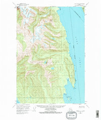
1949 Map of Juneau B-4
USGS Topo · Published 1974About this map
The Chilkat Range dominates this mid-century topographic survey, where steep peaks descend into the deep waters of the Lynn Canal. This coastal Alaskan environment, protected as part of the Tongass National Forest, is defined by its verticality and lack of human infrastructure. The map records a wilderness landscape where significant landmarks are primarily natural features, such as the prominent Mount Golub and the isolated Teardrop Lake. Along the eastern shoreline, the interface between land and sea is marked by extensive Tidal Flat areas and points such as Pt Howard. The boundary for the City and Borough of Juneau cuts across the water toward Lincoln Island, illustrating the expansive administrative reaches in this region during the post-war era.
Find a feature on this map
11 named features on this map. Tap any name to fly to it.
Don’t see what you’re looking for? This feature index may not catch every label — zoom into the map to look around manually.
Map Details
Editions of this 1949 Juneau B-4 Map
2 editions found
Other maps of this area

1947 · Juneau B-3
USGS Topo · 1:63,360

1948 · Juneau C-5
USGS Topo · 1:63,360

1948 · Juneau B-4
USGS Topo · 1:63,360

1948 · Juneau A-3
USGS Topo · 1:63,360

1948 · Juneau C-4
USGS Topo · 1:63,360

1948 · Juneau A-4
USGS Topo · 1:63,360

1948 · Juneau B-5
USGS Topo · 1:63,360

1949 · Juneau B-3
USGS Topo · 1:62,500

1949 · Juneau C-4
USGS Topo · 1:63,360

1950 · Juneau A-3
USGS Topo · 1:63,360