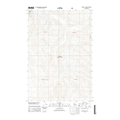
2015 Map of Juneau B-4 NW
USGS Topo · Published 2015About this map
Mt Golub stands as a prominent high point in this 2015 survey of the northern Chilkat Range within the Alaskan panhandle. The terrain represents a high-elevation wilderness area where the protected boundaries of Glacier Bay NP and Tongass National Forest meet. This map illustrates the sheer vertical complexity of the coastal mountains before they descend toward the inlets, highlighting the lack of human infrastructure in favor of raw topographical relief. The absence of roads or settlements emphasizes the remote character of these federal lands, serving as a baseline for the region’s glacial and alpine environment in the early twenty-first century.
Find a feature on this map
8 named features on this map. Tap any name to fly to it.
Don’t see what you’re looking for? This feature index may not catch every label — zoom into the map to look around manually.
Map Details
Editions of this 2015 Juneau B-4 NW Map
This is the sole edition of this map. No revisions or reprints were ever made.
Other maps of this area

1948 · Juneau C-5
USGS Topo · 1:63,360

1948 · Juneau B-4
USGS Topo · 1:63,360

1948 · Juneau C-4
USGS Topo · 1:63,360

1948 · Juneau B-5
USGS Topo · 1:63,360

1949 · Juneau C-4
USGS Topo · 1:63,360

1949 · Juneau B-4
USGS Topo · 1:63,360

1950 · Juneau B-5
USGS Topo · 1:63,360

1951 · Juneau
USGS Topo · 1:250,000

1962 · Juneau
USGS Topo · 1:250,000
1996 · Juneau B-4
USGS Topo · 1:63,360