1950s Maps of Kodiak Island, Alaska
Explore 124 historic maps of Kodiak Island from the 1950s. These maps offer a rare glimpse into what life looked like during the 1950s — showing old roads, neighborhoods, homes, and landmarks that have changed or disappeared over time.
Whether you're researching your family's past, planning a metal detecting trip, or studying how Kodiak Island's landscape evolved across the 1950s, these high-resolution maps are a powerful tool for exploring the history of this region.
- Focus on a specific era: All maps on this page are from the 1950s, giving you a focused view of this time period.
- See what’s changed: Compare century-old streets, trails, and buildings to today's modern landscape using overlays and satellite layers.
- Research with precision: Use these maps for genealogy, historical research, land use analysis, or educational projects.
- View, download, or print: Maps are fully viewable online in high resolution, and can be downloaded or printed for your own records.
Start exploring Kodiak Island's history through authentic maps from the 1950s. This is your window into the past.
Kodiak Island, AK maps
(124)- 1950 Map of Kodiak A-3
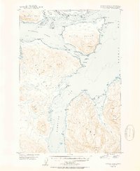
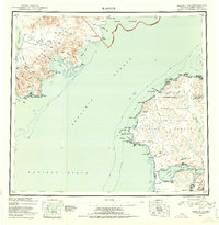
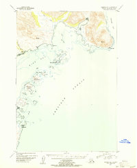
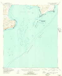
 1950 Kodiak A-31950 Print · USGSThe waters surrounding Sitkalidak Island are captured here during the post-war mapping of the Alaskan coast. Maritime researchers and historians can trace navigational landmarks like Cape Barnabas, Table Island, and the early boundaries of the Kodiak National Wildlife Refuge.
 - 1950 Map of Kodiak B-3
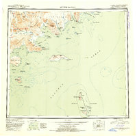
 1950 Kodiak B-31950 Print · USGSKodiak Island in the late 1940s reveals a rugged maritime landscape where remote industrial sites and fading settlements meet the sea. Maritime historians and genealogists can trace the Kodiak Fisheries Cannery on Shearwater Bay or the site of Eagle Harbor.2 unique versions available
 - 1950 Map of Kodiak D-3
 1950 Kodiak D-31950 Print · USGSThe Kodiak archipelago in the mid-century reveals a wild coastal landscape of deep fjords and mountainous islands. Maritime historians and researchers can trace the intricate shoreline from Whale Island to the peaks of Sharatin Mountain and Barabara Cove.2 unique versions available
 - 1951 Map of Kodiak D-1
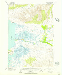
 1951 Kodiak D-11951 Print · USGSCoastal Kodiak Island comes to life in the early post-war years, showcasing the maritime infrastructure and island outposts of the era. Maritime historians and researchers can trace local landmarks like Woody Island, the Hamin Rocks Light, and Hutchinson Road.2 unique versions available
 - 1951 Map of Kaguyak
 1951 Kaguyak1951 Print · USGSThe southern tip of Kodiak Island and the Trinity Islands are mapped here in the early fifties, showing a remote maritime landscape. Researchers can trace coastal features such as Kaguyak, Cape Sitkinak, and the expansive Albatross Bank.2 unique versions available
 - 1951 Map of Kodiak B-1 and B-2
 1951 Kodiak B-1 and B-21951 Print · USGSKodiak Island coastal terrain and maritime features are documented here in the early fifties. Genealogists and researchers can trace the shoreline of Pasagshak Bay and locate landmarks like Narrow Cape and Ugak Island.2 unique versions available
 - 1951 Map of Kodiak D-2
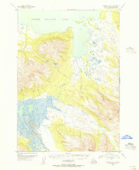
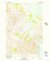
 1951 Kodiak D-21951 Print · USGSKodiak Island during the early Cold War years shows a landscape heavily influenced by strategic defense and maritime trade. Researchers can trace the bounds of the Fort Greeley Military Reservation, locate the village of Uzinki, and follow the winding Pillar Mountain Road.2 unique versions available
 - 1951 Map of Trinity Islands
 1951 Trinity Islands1951 Print · USGSThe southwestern tip of Kodiak Island and the Trinity Islands are captured in the early fifties, detailing a remote landscape of fishing outposts and wildlife preserves. Researchers can trace the coastal layout of Akhiok, locate the Cannery near Alitak, and explore the topography of Sitkinak Island.
 - 1951 Map of Kodiak C-1
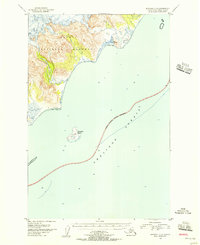
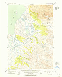
 1951 Kodiak C-11951 Print · USGSKodiak Island's northeastern coast and its mid-century maritime features appear here just after the war years. Researchers can trace landforms from Cape Chiniak to Boyer Peak and locate the remote Airstrip and Sacramento River.2 unique versions available
 - 1951 Map of Mt Katmai, 1952 Print
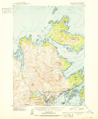
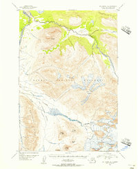
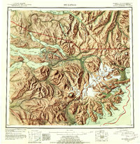 1951 Mt Katmai1952 Print · USGSThe Alaska Peninsula at mid-century reveals a landscape of volcanic upheaval and empty settlements following the Great Eruption. Researchers can trace the vanished communities of Savonoski and Katmai Village or locate the Novarupta Volcano.11 unique versions available
 - 1951 Map of Karluk, 1952 Print
 1951 Karluk1952 Print · USGSThe Kodiak archipelago and the rugged Katmai coast are shown in the early fifties before statehood. Genealogists and historians can trace the early industrial footprint of the Cannery at Larsen Bay and the isolated settlement at Karluk.
 - 1951 Map of Seldovia, 1952 Print
 1951 Seldovia1952 Print · USGSThe lower Kenai Peninsula appears here in the early fifties as a network of coastal outposts and maritime landing sites. Researchers can trace early settlements like Seldovia, locate family-named points such as Millers Landing, and explore the limits of the Kenai National Moose Range.8 unique versions available
 - 1951 Map of Sutwik Island, 1953 Print
 1951 Sutwik Island1953 Print · USGSThe Alaska Peninsula at mid-century remains a wild frontier defined by the Aleutian Range and remote island chains. Trace early survey points and coastal features from Meshik Lake to the isolated Chowiet Island and Sutwik Island.4 unique versions available
 - 1951 Map of Mount Katmai A-3, 1956 Print
 1951 Mount Katmai A-31956 Print · USGSThe Alaska coastline near the Shelikof Strait is documented here during the early fifties, before statehood. Researchers can locate the Katmai Village Site and trace the drainage of the Katmai River through the Barrier Range.2 unique versions available
 - 1951 Map of Afognak C-6, 1956 Print
 1951 Afognak C-61956 Print · USGSCoastal Alaska in the early fifties shows a landscape of transition where the wilderness of the Katmai National Monument meets the sea. Researchers can trace the locations of former settlements like Kaguyak and Swikshak along the Shelikof Strait.2 unique versions available
 - 1951 Map of Ugashik B-1, 1956 Print
 1951 Ugashik B-11956 Print · USGSThe Alaska Peninsula coast meets the maritime world of the mid-twentieth century here, where sheltered bays provided essential refuge for coastal travelers. Researchers can trace remote landmarks like Lee Cabin and the navigational Light at Cape Igvak near Wide Bay.3 unique versions available
 - 1951 Map of Mount Katmai B-4, 1956 Print
 1951 Mount Katmai B-41956 Print · USGSKatmai National Monument in the early fifties reveals a dynamic landscape of volcanic peaks and glaciers within the Alaska Range. Geologists and researchers can trace the drainages of the Valley of Ten Thousand Smokes and peaks like Novarupta Volcano and Baked Mountain.4 unique versions available
 - 1951 Map of Ugashik B-3, 1956 Print
 1951 Ugashik B-31956 Print · USGSThe Alaska Peninsula in the early fifties remains a wilderness of interconnected waterways and sharp ridges. Researchers can trace the winding paths of the Dog Salmon River and Figure Eight Creek or locate secluded basins like Elizabeth Lake.3 unique versions available
 - 1951 Map of Afognak C-5, 1956 Print
 1951 Afognak C-51956 Print · USGSThe Shelikof Strait coastline and the early boundaries of Katmai National Monument are documented here in the early fifties. Researchers can locate the isolated Fox Farm (Aband) on Kiukpalik Island and trace the extensive Tidal Flats along the shore.2 unique versions available
 - 1951 Map of Ugashik C-1, 1956 Print
 1951 Ugashik C-11956 Print · USGSThe Alaska Peninsula in the early fifties shows a landscape defined by coastal outposts and high mountain passes. Trace the legacy of resource exploration at the Oil Camp or locate the village site of Kanatak near Portage Bay.2 unique versions available
 - 1951 Map of Ugashik C-2, 1956 Print
 1951 Ugashik C-21956 Print · USGSThe Alaska Peninsula in the early fifties was a land of volcanic extremes and remote waterways. Researchers can trace the geothermal activity near Mt Peulik and the early layout of Ugashik where it meets Upper Ugashik Lake.2 unique versions available
 - 1951 Map of Karluk D-6, 1956 Print
 1951 Karluk D-61956 Print · USGSBecharof Lake and the winding Kejulik River dominate this early 1950s survey of the Alaska Peninsula. Local historians and researchers can trace the remote shoreline of Severson Peninsula and locate an isolated Cabin near the mouth of the Kejulik River.4 unique versions available
 - 1951 Map of Karluk C-4 and C-5, 1956 Print
 1951 Karluk C-4 and C-51956 Print · USGSThe Alaska Peninsula's jagged coastline meets the Shelikof Strait in the early fifties. Researchers can trace remote coastal markers and early survey points like Cape Aklek, Cape Kekurnoi, and a lone Cabin on the shore.2 unique versions available
 - 1951 Map of Afognak D-4, 1956 Print
 1951 Afognak D-41956 Print · USGSThe maritime wilderness of the Alaska-Third Judicial Division is captured here in the early 1950s. Trace the protected shoreline of Katmai National Monument and the navigational hazards surrounding Cape Douglas and Douglas Reef.2 unique versions available
 - 1951 Map of Karluk D-4, 1956 Print
 1951 Karluk D-41956 Print · USGSThe remote Alaska Peninsula coastline comes into focus in the early fifties, showing the pristine interface of mountains and sea. Trace the early boundaries of Katmai National Monument and locate landmarks like Mt Kubugakli and a lone coastal Cabin.2 unique versions available
Showing maps 1-25 of 124
Top cities of Kodiak Island
- Kodiak historical maps
- Old Harbor historical maps
- Port Lions historical maps
- Ouzinkie historical maps
- Akhiok historical maps
- Larsen Bay historical maps
Frequently asked questions
- What are the different types of historical maps available for Kodiak Island?
- What is the oldest map of Kodiak Island?
- Where can I purchase historical maps of Kodiak Island for my home or office?
- Where can I download high-res historical maps of Kodiak Island?
- Are there historical topographic maps available for Kodiak Island?
- Is there historical aerial imagery available for Kodiak Island?
- Where are historical maps of Kodiak Island sourced from?