Old Maps of Liarsville Gold Rush Trail Camp & Salmon Bake, Alaska for Academic Research
Study the evolution of Liarsville Gold Rush Trail Camp & Salmon Bake with 8 high-resolution historic maps. Whether you're teaching, researching, or modeling changes in land use, these maps provide essential visual documentation of urban, environmental, and geographic change.
- Analyze long-term change: Track patterns in development, transportation, and natural features.
- Ideal for environmental or urban studies: Support academic projects with primary historical map data.
- Use in the classroom or lab: Educators and researchers rely on these maps to bring historical context to life.
These maps are a powerful tool for teaching, research, and visualizing how Liarsville Gold Rush Trail Camp & Salmon Bake has changed over the decades.
Liarsville Gold Rush Trail Camp & Salmon Bake, AK maps
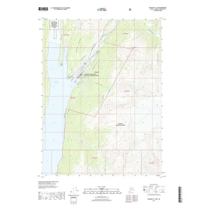
(8)- 1949 Map of Skagway B-1, 1964 Print
 1949 Skagway B-11964 Print · USGSSkagway at the midpoint of the century remains a vital link between the sea and the interior, dominated by its maritime and rail infrastructure. Researchers can trace the White Pass and Yukon Route railway and find local landmarks like Reid Falls and the Ferry Terminal.3 unique versions available
 - 1951 Map of Skagway B-1, 1952 Print
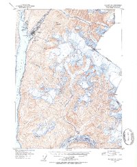 1951 Skagway B-11952 Print · USGSSkagway and the head of Taiya Inlet are captured here in the early 1950s as a vital transportation hub. Trace the White Pass and Yukon Route and find local landmarks like Reid Falls, Lower Dewey Lake, and the town Powder House.2 unique versions available
 - 1952 Map of Skagway, 1953 Print
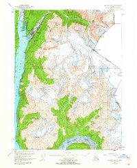
 1952 Skagway1953 Print · USGSThe northern reaches of the Alaska Panhandle come alive in the early fifties, showing the vital rail and road links to the Yukon. Trace the historic White Pass & Yukon Route or locate remote camps like Pleasant Camp and Klukwan.4 unique versions available
 - 1961 Map of Skagway, 1967 Print
 1961 Skagway1967 Print · USGSThe northern reaches of the Panhandle and the rugged border with British Columbia come into focus in the early sixties. Researchers can trace the historic Chilkoot Trail, the White Pass and Yukon Railway, and coastal outposts like Klukwan.4 unique versions available
 - 1991 Map of Skagway B-1 NW
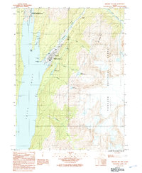 1991 Skagway B-1 NW1991 Print · USGSThe head of Taiya Inlet comes into focus in the early 1990s as Skagway balances its gold rush history with modern transit. Trace the White Pass and Yukon Railway and find landmarks like the Gold Rush Cemetery and Reid Falls.
 - 2004 Map of Skagway B-1, 2007 Print
 2004 Skagway B-12007 Print · USGSSkagway and the surrounding coastal peaks are shown at a time when its gold rush legacy was preserved through federal parklands. Trace the historic White Pass and Yukon Route and find landmarks like the Gold Rush Cem and Liarsville.
 - 2017 Map of Skagway B-1 NW, 2017 Print
 2017 Skagway B-1 NW2017 Print · USGSCovers Liarsville Gold Rush Trail Camp & Salmon Bake, including Skagway, Skagway, and other nearby areas
 - 2021 Map of Skagway B-1 NW, 2021 Print
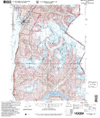
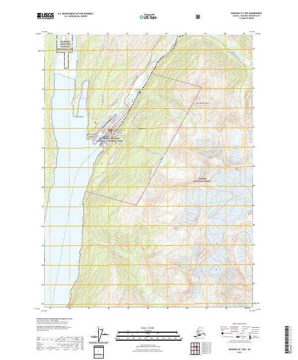 2021 Skagway B-1 NW2021 Print · USGSThe northern gateway to the Yukon remains defined by its gold rush heritage in the early twenty-first century. Researchers can trace the historic streets of Skagway, find the Gold Rush Cem, and locate landmarks like the McCabe Building.
End of results
Showing maps 1-8 of 8
Top cities near Liarsville Gold Rush Trail Camp & Salmon Bake
Frequently asked questions
- What are the different types of historical maps available for Liarsville Gold Rush Trail Camp & Salmon Bake?
- What is the oldest map of Liarsville Gold Rush Trail Camp & Salmon Bake?
- Where can I purchase historical maps of Liarsville Gold Rush Trail Camp & Salmon Bake for my home or office?
- Where can I download high-res historical maps of Liarsville Gold Rush Trail Camp & Salmon Bake?
- Are there historical topographic maps available for Liarsville Gold Rush Trail Camp & Salmon Bake?
- Is there historical aerial imagery available for Liarsville Gold Rush Trail Camp & Salmon Bake?
- Where are historical maps of Liarsville Gold Rush Trail Camp & Salmon Bake sourced from?