1950s Maps of Dot Lake, Alaska
Explore 13 historic maps of Dot Lake from the 1950s. These maps offer a rare glimpse into what life looked like during the 1950s — showing old roads, neighborhoods, homes, and landmarks that have changed or disappeared over time.
Whether you're researching your family's past, planning a metal detecting trip, or studying how Dot Lake's landscape evolved across the 1950s, these high-resolution maps are a powerful tool for exploring the history of this region.
- Focus on a specific era: All maps on this page are from the 1950s, giving you a focused view of this time period.
- See what’s changed: Compare century-old streets, trails, and buildings to today's modern landscape using overlays and satellite layers.
- Research with precision: Use these maps for genealogy, historical research, land use analysis, or educational projects.
- View, download, or print: Maps are fully viewable online in high resolution, and can be downloaded or printed for your own records.
Start exploring Dot Lake's history through authentic maps from the 1950s. This is your window into the past.
Dot Lake, AK maps
(13)- 1950 Map of Tanacross
 1950 Tanacross1950 Print · USGSEastern Alaska's interior in the mid-twentieth century was a landscape of pioneering roads and traditional river settlements. Genealogists and historians can locate the Tetlin Indian Reservation, the early layout of Tok Junction, and remote outposts like Fortymile House.2 unique versions available
 - 1950 Map of Mount Hayes, 1955 Print
 1950 Mount Hayes1955 Print · USGSThe Alaska Interior in the early fifties shows a landscape of high peaks and essential roadhouse stops along the primitive highway system. Genealogists and historians can trace old travel routes and outposts like Rapids Roadhouse, Donnelly, and Paxson.2 unique versions available
 - 1951 Map of Mount Hayes
 1951 Mount Hayes1951 Print · USGSIn the Alaska Range during the early fifties, the interior road network relied on isolated outposts and high-mountain passes. Researchers can trace the path of the Richardson Highway through Isabel Pass and find historic stops like Rapids Roadhouse and Millers Roadhouse.2 unique versions available
 - 1951 Map of Tanacross B-6, 1952 Print
 1951 Tanacross B-61952 Print · USGSThe Alaska interior during the early fifties reveals a landscape shaped by strategic infrastructure and river geography. Trace the original path of the Alaska Highway and the Pipe Line as they navigate the valley between the Alaska Range and the Tanana River.2 unique versions available
 - 1954 Map of Mount Hayes B-1
 1954 Mount Hayes B-11954 Print · USGSAlaska’s interior wilderness in the mid-1950s is defined by its massive ice fields and braided river systems. Geologists and researchers can trace the movement of the Robertson Glacier and the hydrology of the West Fork Robertson River.
 - 1954 Map of Tanacross C-6, 1958 Print
 1954 Tanacross C-61958 Print · USGSSoutheast Fairbanks was undergoing significant infrastructure expansion in the mid-fifties as energy and transit corridors were formalized. Researchers can trace the path of the Aboveground Pipeline and Alaska Highway past Tower Bluffs Rapids and a remote Cabin.
 - 1954 Map of Mount Hayes C-1, 1958 Print
 1954 Mount Hayes C-11958 Print · USGSThe Tanana River valley and the critical Alaska Highway corridor are captured here during the mid-fifties. Researchers can locate remote settlements like Indian Village and Dot Lake alongside early infrastructure including the Aboveground Pipeline.
 - 1955 Map of Mount Hayes C-2, 1958 Print
 1955 Mount Hayes C-21958 Print · USGSInterior Alaska in the mid-fifties is captured here along the critical Alaska Highway corridor during a period of infrastructure expansion. Researchers can trace the early path of the aboveground pipeline and the logistical Bureau of Public Roads Camp set against the Macomb Plateau.4 unique versions available
 - 1955 Map of Mount Hayes C-1, 1960 Print
 1955 Mount Hayes C-11960 Print · USGSThe Alaska interior along the Tanana River comes into focus during the mid-fifties as the highway corridor begins to modernize. Genealogists and historians can locate the Dot Lake settlement and Indian Village, or trace early infrastructure like the Telephone Line and Pipeline.4 unique versions available
 - 1955 Map of Tanacross C-6, 1962 Print
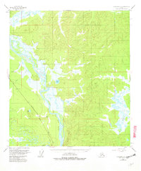 1955 Tanacross C-61962 Print · USGSSoutheast Fairbanks is shown during the mid-fifties when river navigation and the new highway system intersected. You can trace the Aboveground Alaska Pipeline Highway past landmarks like Tower Bluffs and the remote Cabin near Mansfield Creek.5 unique versions available
 - 1955 Map of Mount Hayes B-1, 1963 Print
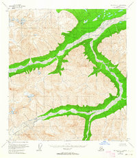 1955 Mount Hayes B-11963 Print · USGSAlaska's interior wilderness appears here in the mid-fifties, an era of high-altitude peaks and glacial drainage before any human infrastructure reached this terrain. Trace the sprawling reach of the Robertson Glacier as it feeds the braided Robertson River and the West Fork.2 unique versions available
 - 1955 Map of Mount Hayes, 1966 Print
 1955 Mount Hayes1966 Print · USGSSoutheast Fairbanks and the Alaska Range are captured in the mid-1950s during the expansion of the interior highway system. Researchers can trace early settlements and military outposts like Donnelly, Black Rapids, and the expansive grounds of Fort Greely.4 unique versions available
 - 1956 Map of Tanacross, 1968 Print
 1956 Tanacross1968 Print · USGSThe Tanana Valley in the mid-fifties is captured here as a vital hub where the Alaska Highway met the Glenn Highway. Researchers can trace the layout of Tetlin Indian Reservation, the old Mansfield Village, and the remote Mitchell Ranch.5 unique versions available
End of results
Showing maps 1-13 of 13
Frequently asked questions
- What are the different types of historical maps available for Dot Lake?
- What is the oldest map of Dot Lake?
- Where can I purchase historical maps of Dot Lake for my home or office?
- Where can I download high-res historical maps of Dot Lake?
- Are there historical topographic maps available for Dot Lake?
- Is there historical aerial imagery available for Dot Lake?
- Where are historical maps of Dot Lake sourced from?