2000s (21st Century) Maps of Manokotak, Alaska
Explore 4 historic maps of Manokotak from the 2000s (21st Century). These maps offer a rare glimpse into what life looked like during the 2000s — showing old roads, neighborhoods, homes, and landmarks that have changed or disappeared over time.
Whether you're researching your family's past, planning a metal detecting trip, or studying how Manokotak's landscape evolved across the 2000s, these high-resolution maps are a powerful tool for exploring the history of this region.
- Focus on a specific era: All maps on this page are from the 2000s, giving you a focused view of this time period.
- See what’s changed: Compare century-old streets, trails, and buildings to today's modern landscape using overlays and satellite layers.
- Research with precision: Use these maps for genealogy, historical research, land use analysis, or educational projects.
- View, download, or print: Maps are fully viewable online in high resolution, and can be downloaded or printed for your own records.
Start exploring Manokotak's history through authentic maps from the 2000s. This is your window into the past.
Manokotak, AK maps
(4)- 2019 Map of Goodnews Bay A-1 SE, 2019 Print
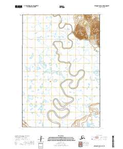
 2019 Goodnews Bay A-1 SE2019 Print · USGSThe Dillingham Census Area in the late twenty-teens is a landscape of expansive waterways and isolated settlements. Researchers can trace the meandering Igushik River as it winds toward Manokotak and identify the shores of Amanka Lake.
 - 2019 Map of Dillingham A-8 SW, 2019 Print
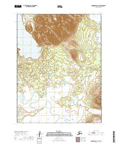
 2019 Dillingham A-8 SW2019 Print · USGSCoastal Alaska near Dillingham is documented in this 2019 survey, showcasing the isolated settlement of Manokotak and its surrounding river systems. Researchers can trace the winding path of the Weary River and locate the prominent peak of Gnarled Mtn.
 - 2019 Map of Nushagak Bay D-4 NE, 2019 Print
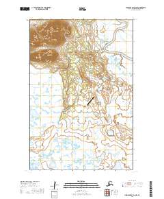
 2019 Nushagak Bay D-4 NE2019 Print · USGSThe village of Manokotak is shown in this 2019 survey as it transitions from the high tundra slopes to the marshy river basin. Trace the local road network including Manokotak Heights Road and the winding course of the Igushik River.
 - 2019 Map of Nushagak Bay D-3 NW, 2019 Print
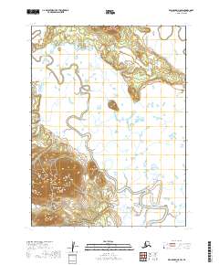
 2019 Nushagak Bay D-3 NW2019 Print · USGSManokotak sits along the meandering Weary River in the late 2010s, surrounded by a complex landscape of tundra and wetlands. Researchers can trace local infrastructure and landmarks like Acorn Peak, Manokotak Airport, and the Manokotak Heights Road.
End of results
Showing maps 1-4 of 4
Frequently asked questions
- What are the different types of historical maps available for Manokotak?
- What is the oldest map of Manokotak?
- Where can I purchase historical maps of Manokotak for my home or office?
- Where can I download high-res historical maps of Manokotak?
- Are there historical topographic maps available for Manokotak?
- Is there historical aerial imagery available for Manokotak?
- Where are historical maps of Manokotak sourced from?