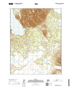
2019 Map of Goodnews Bay A-1 SE
USGS Topo · Published 2019About this map
Manokotak sits near the southeastern corner of this terrain, where the foothills descend into a complex network of wetlands and watercourses. The landscape is defined by the massive expanse of Amanka Lake in the northwest, which feeds into a drainage system dominated by the meandering paths of the Igushik River and the Weary River. This survey reveals the hydrological structure of the Dillingham Census Area, showing how these significant water bodies dictate the habitable land and transport corridors in this part of Alaska. The transition from the high ridges of t12s r58w and t12s r59w down to the river valleys illustrates the geographic isolation and environmental constraints that have shaped local settlement patterns and subsistence activities.
Find a feature on this map
8 named features on this map. Tap any name to fly to it.
Don’t see what you’re looking for? This feature index may not catch every label — zoom into the map to look around manually.
Map Details
Editions of this 2019 Goodnews Bay A-1 SE Map
This is the sole edition of this map. No revisions or reprints were ever made.
Other maps of this area

1945 · Nushagak Bay
USGS Topo · 1:250,000

1948 · Nushagak Bay D-4
USGS Topo · 1:63,360

1948 · Nushagak Bay D-3
USGS Topo · 1:63,360

1949 · Nushagak Bay
USGS Topo · 1:250,000

1951 · Dillingham
USGS Topo · 1:250,000

1951 · Goodnews
USGS Topo · 1:250,000

1951 · Nushagak Bay
USGS Topo · 1:250,000

1952 · Nushagak Bay D-3
USGS Topo · 1:63,360

1952 · Nushagak Bay D-4
USGS Topo · 1:63,360

1952 · Dillingham A-8
USGS Topo · 1:63,360