Old Maps of Manokotak, Alaska for Hiking & Exploration
Hike through history with 18 historic maps of Manokotak. Explore old trails, ghost towns, and forgotten backroads — perfect for outdoor adventurers and local explorers.
- Rediscover forgotten places: Map out old mining camps, roads, and footpaths that no longer exist on modern maps.
- Layer with modern tools: Combine with LiDAR or satellite views to plan hikes through historical terrain.
- Made for exploration: Popular among hikers, overlanders, and local history lovers.
Use these maps to find adventure and explore the hidden past of Manokotak.
Manokotak, AK maps
(18)- 1945 Map of Nushagak Bay, 1954 Print
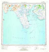
 1945 Nushagak Bay1954 Print · USGSNushagak Bay and the sprawling Alaskan coastline are captured in the mid-1940s, highlighting a landscape defined by salmon fishing and tidal waters. Researchers can locate remote outposts like Old Saltery, the busy Nushagak Cannery, and the coastal settlement of Clarks Point.
 - 1948 Map of Nushagak Bay D-4, 1975 Print
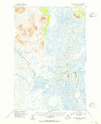
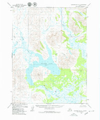
 1948 Nushagak Bay D-41975 Print · USGSThe Igushik River winds through the coastal wetlands of southwestern Alaska in the late 1940s. Researchers can trace the early layout of Manokotak, find the settlement of Tuklung, and locate the isolated Landing Strip used by bush pilots.
 - 1948 Map of Nushagak Bay D-3, 1975 Print
 1948 Nushagak Bay D-31975 Print · USGSCoastal Alaska in the late forties is defined here by the vast tidal reaches of Nushagak Bay and its winding river systems. Researchers can trace the shifting mudflats and survey markers like VABM 49 Snake near the mouth of the Snake River.2 unique versions available
 - 1949 Map of Nushagak Bay
 1949 Nushagak Bay1949 Print · USGSCoastal Alaska at the height of the mid-century salmon industry reveals a landscape of isolated canneries and subsistence camps. You can trace the shorelines to find sites like Nushagak Cannery, the Old Saltery, and the remote Igushik Cannery along the river.2 unique versions available
 - 1951 Map of Dillingham, 1952 Print
 1951 Dillingham1952 Print · USGSDillingham and the Bristol Bay river systems are captured here in the early fifties, showing a remote landscape linked by water and seasonal camps. Researchers can trace early settlements and post offices at New Stuyahok, Ekwok, and Kvichak.
 - 1951 Map of Goodnews, 1953 Print
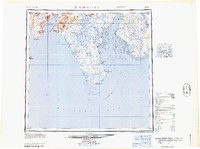
 1951 Goodnews1953 Print · USGSSouthwest Alaska’s coastal bays and mountain lakes are captured here just after the war, showing the area's shifting settlement patterns. Trace the coastline from Kwinhagak to Goodnews, or locate interior landmarks like the Placer Mine and Nuyakuk Lake.6 unique versions available
 - 1951 Map of Nushagak Bay, 1955 Print
 1951 Nushagak Bay1955 Print · USGSBristol Bay's eastern coastline is captured here in the early fifties, highlighting the salmon fishing and canning hubs of the era. Genealogists and historians can trace coastal settlements like Ekuk and Nushagak or locate the Igushik (Site).7 unique versions available
 - 1952 Map of Nushagak Bay D-3, 1955 Print
 1952 Nushagak Bay D-31955 Print · USGSNushagak Bay and its tidal river systems are documented here in the early fifties, capturing the remote coastal geography of the Alaska Territory. Researchers can trace the industrial footprint of the isolated Cannery and locate landmarks like Acorn Peak and Igushik Ridge.
 - 1952 Map of Nushagak Bay D-4, 1955 Print
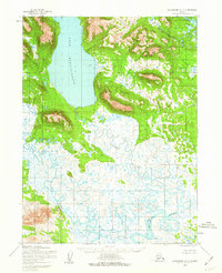
 1952 Nushagak Bay D-41955 Print · USGSThe Nushagak Bay region in the early fifties was a landscape of winding waterways and isolated coastal settlements. Researchers can trace the path of the Igushik River and locate historic community sites at Manokotak and Tuklung.
 - 1952 Map of Dillingham A-8, 1963 Print
 1952 Dillingham A-81963 Print · USGSSouthwest Alaska during the early fifties reveals a landscape defined by the shifting waters of Lake Nunavaugaluk. Researchers can trace the meandering Snake River and locate remote Cabins along the water's edge.2 unique versions available
 - 1954 Map of Dillingham, 1967 Print
 1954 Dillingham1967 Print · USGSBristol Bay's interior river systems are mapped here in the mid-1950s, showing a landscape defined by water and winter travel. Researchers can trace remote settlements like Koliganek and Levelock or find family landmarks along the Nushagak River and Lake Aleknagik.3 unique versions available
 - 1964 Map of Nushagak Bay
 1964 Nushagak Bay1964 Print · USGSNushagak Bay and the Bristol Bay coastline appear in mid-century detail, capturing the seasonal fishing hubs and maritime hazards of the era. Researchers can trace historic cannery sites, coastal settlements like Ekuk, and the shifting sands of Ship Channel or Etolin Pt.
 - 1979 Map of Goodnews Bay A-1
 1979 Goodnews Bay A-11979 Print · USGSDillingham, Alaska, is shown in the late 1970s as a complex wilderness of interconnected lakes and rivers. Genealogists and historians can trace the locations of former settlements like Yacherk (Site) and Sparks (Site) near the Igushik River.2 unique versions available
 - 1979 Map of Goodnews Bay
 1979 Goodnews Bay1979 Print · USGSCoastal villages and massive mountain ranges define the southwestern Alaska wilderness during the late seventies. Researchers can trace remote routes like the Winter Trail and locate isolated outposts at Platinum and Goodnews Bay near Cape Newenham.2 unique versions available
 - 2019 Map of Goodnews Bay A-1 SE, 2019 Print
 2019 Goodnews Bay A-1 SE2019 Print · USGSThe Dillingham Census Area in the late twenty-teens is a landscape of expansive waterways and isolated settlements. Researchers can trace the meandering Igushik River as it winds toward Manokotak and identify the shores of Amanka Lake.
 - 2019 Map of Dillingham A-8 SW, 2019 Print
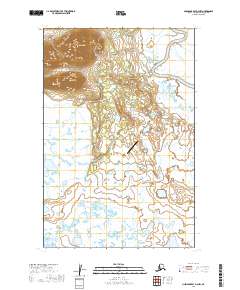
 2019 Dillingham A-8 SW2019 Print · USGSCoastal Alaska near Dillingham is documented in this 2019 survey, showcasing the isolated settlement of Manokotak and its surrounding river systems. Researchers can trace the winding path of the Weary River and locate the prominent peak of Gnarled Mtn.
 - 2019 Map of Nushagak Bay D-4 NE, 2019 Print
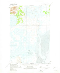
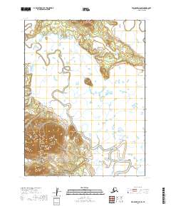
 2019 Nushagak Bay D-4 NE2019 Print · USGSThe village of Manokotak is shown in this 2019 survey as it transitions from the high tundra slopes to the marshy river basin. Trace the local road network including Manokotak Heights Road and the winding course of the Igushik River.
 - 2019 Map of Nushagak Bay D-3 NW, 2019 Print
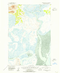
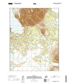
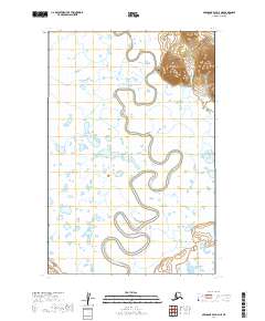
 2019 Nushagak Bay D-3 NW2019 Print · USGSManokotak sits along the meandering Weary River in the late 2010s, surrounded by a complex landscape of tundra and wetlands. Researchers can trace local infrastructure and landmarks like Acorn Peak, Manokotak Airport, and the Manokotak Heights Road.
End of results
Showing maps 1-18 of 18
Frequently asked questions
- What are the different types of historical maps available for Manokotak?
- What is the oldest map of Manokotak?
- Where can I purchase historical maps of Manokotak for my home or office?
- Where can I download high-res historical maps of Manokotak?
- Are there historical topographic maps available for Manokotak?
- Is there historical aerial imagery available for Manokotak?
- Where are historical maps of Manokotak sourced from?