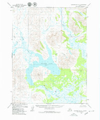
1979 Map of Goodnews Bay A-1
USGS Topo · Published 1979About this map
Aman Ka Lake dominates this Alaskan landscape, sitting at an Elevation 38 within a complex network of glacial-fed waterways. The terrain is defined by the sharp rise of Sugtutlik Peak and the winding courses of the Weary River and Ongoke River. This 1970s survey captures a wilderness largely devoid of modern roads, emphasizing instead the historical footprint of indigenous or early settlement sites.
Find a feature on this map
14 named features on this map. Tap any name to fly to it.
Don’t see what you’re looking for? This feature index may not catch every label — zoom into the map to look around manually.
Map Details
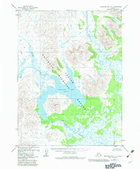
Editions of this 1979 Goodnews Bay A-1 Map
2 editions found
Other maps of this area

1945 · Nushagak Bay
USGS Topo · 1:250,000

1948 · Nushagak Bay D-4
USGS Topo · 1:63,360

1948 · Nushagak Bay D-3
USGS Topo · 1:63,360

1949 · Nushagak Bay
USGS Topo · 1:250,000

1950 · Nushagak Bay D-5
USGS Topo · 1:63,360

1951 · Dillingham
USGS Topo · 1:250,000

1951 · Goodnews
USGS Topo · 1:250,000

1951 · Nushagak Bay
USGS Topo · 1:250,000

1952 · Nushagak Bay D-3
USGS Topo · 1:63,360

1952 · Nushagak Bay D-4
USGS Topo · 1:63,360