1960s Maps of Yakutat, Alaska
Explore 9 historic maps of Yakutat from the 1960s. These maps offer a rare glimpse into what life looked like during the 1960s — showing old roads, neighborhoods, homes, and landmarks that have changed or disappeared over time.
Whether you're researching your family's past, planning a metal detecting trip, or studying how Yakutat's landscape evolved across the 1960s, these high-resolution maps are a powerful tool for exploring the history of this region.
- Focus on a specific era: All maps on this page are from the 1960s, giving you a focused view of this time period.
- See what’s changed: Compare century-old streets, trails, and buildings to today's modern landscape using overlays and satellite layers.
- Research with precision: Use these maps for genealogy, historical research, land use analysis, or educational projects.
- View, download, or print: Maps are fully viewable online in high resolution, and can be downloaded or printed for your own records.
Start exploring Yakutat's history through authentic maps from the 1960s. This is your window into the past.
Yakutat, AK maps
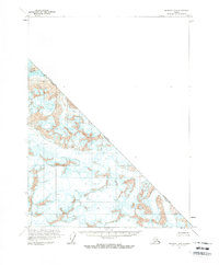
(9)- 1961 Map of Mount Fairweather D-7, 1965 Print
 1961 Mount Fairweather D-71965 Print · USGSCoastal Alaska in the early sixties is captured here as the Grand Plateau Glacier meets the sea. Genealogists and historians can trace the early Glacier Bay National Monument border and study hydrographic soundings in the Gulf of Alaska.2 unique versions available
 - 1961 Map of Skagway A-7, 1966 Print
 1961 Skagway A-71966 Print · USGSCoastal Alaska and the British Columbia border meet among high peaks and ice fields in the early sixties. Researchers can trace the international boundary through Grand Pacific Glacier and identify remote summits like Mt Watson and Mt Turner.2 unique versions available
 - 1961 Map of Mount Fairweather D-6, 1966 Print
 1961 Mount Fairweather D-61966 Print · USGSCoastal Alaska in the early sixties remains a wilderness of ice and water within Glacier Bay National Monument. Researchers can trace the massive reach of Desolation Glacier and the shoreline of Glacier Bay before the modern era of park management.2 unique versions available
 - 1961 Map of Mount Fairweather D-5, 1966 Print
 1961 Mount Fairweather D-51966 Print · USGSThe high peaks of the Saint Elias Mountains stand along the international boundary in the early 1960s. Researchers can trace the massive reach of the Margerie Glacier and Fairweather Glacier or locate summits like Mount Fairweather.2 unique versions available
 - 1961 Map of Skagway B-8, 1966 Print
 1961 Skagway B-81966 Print · USGSThe remote international boundary between Alaska and British Columbia is documented here in the early sixties. Researchers can trace the rugged line of the Canada United States border as it crosses the Alsek River and fields of crevasses.2 unique versions available
 - 1961 Map of Icy Bay, 1966 Print
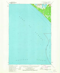
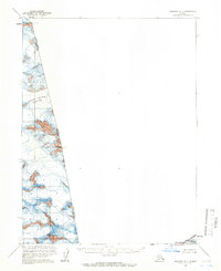
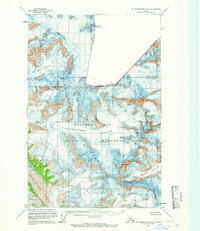
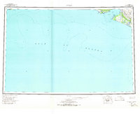 1961 Icy Bay1966 Print · USGSThe maritime wilderness of the Alaskan coast is documented in the early 1960s, showing the massive Malaspina Glacier meeting the sea. Researchers can trace isolated outposts like cabins near Claybluff Pt and exploration landmarks such as a drill hole by Riou Bay.3 unique versions available
 - 1961 Map of Skagway A-8, 1966 Print
 1961 Skagway A-81966 Print · USGSCoastal Alaska in the early sixties remains a wilderness of ice and dramatic topography. This survey allows researchers to trace the mid-century margins of Alsek Glacier and Grand Plateau Glacier and locate dangerous crevasses.2 unique versions available
 - 1961 Map of Mt Fairweather, 1966 Print
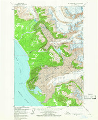
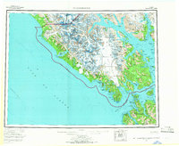 1961 Mt Fairweather1966 Print · USGSSoutheast Alaska’s coastal wilderness is documented here during the mid-twentieth century, showcasing the expansive ice fields of Glacier Bay National Monument. Researchers can trace the complex shorelines of Lituya Bay, locate remote peaks like Mt Crillon, and study the island passages of Cross Sound.4 unique versions available
 - 1961 Map of Skagway, 1967 Print
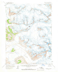
 1961 Skagway1967 Print · USGSThe northern reaches of the Panhandle and the rugged border with British Columbia come into focus in the early sixties. Researchers can trace the historic Chilkoot Trail, the White Pass and Yukon Railway, and coastal outposts like Klukwan.4 unique versions available
End of results
Showing maps 1-9 of 9
Top cities of Yakutat
Frequently asked questions
- What are the different types of historical maps available for Yakutat?
- What is the oldest map of Yakutat?
- Where can I purchase historical maps of Yakutat for my home or office?
- Where can I download high-res historical maps of Yakutat?
- Are there historical topographic maps available for Yakutat?
- Is there historical aerial imagery available for Yakutat?
- Where are historical maps of Yakutat sourced from?