1980s Maps of Yakutat, Alaska
Explore 44 historic maps of Yakutat from the 1980s. These maps offer a rare glimpse into what life looked like during the 1980s — showing old roads, neighborhoods, homes, and landmarks that have changed or disappeared over time.
Whether you're researching your family's past, planning a metal detecting trip, or studying how Yakutat's landscape evolved across the 1980s, these high-resolution maps are a powerful tool for exploring the history of this region.
- Focus on a specific era: All maps on this page are from the 1980s, giving you a focused view of this time period.
- See what’s changed: Compare century-old streets, trails, and buildings to today's modern landscape using overlays and satellite layers.
- Research with precision: Use these maps for genealogy, historical research, land use analysis, or educational projects.
- View, download, or print: Maps are fully viewable online in high resolution, and can be downloaded or printed for your own records.
Start exploring Yakutat's history through authentic maps from the 1980s. This is your window into the past.
Yakutat, AK maps
(44)- 1984 Map of Bering Glacier A-8
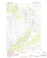 1984 Bering Glacier A-81984 Print · USGSThe coastal wilderness near Yakutat was a dynamic glacial environment in the early eighties. Researchers can trace the terminus of the Bering Glacier and identify landmarks like Cape Suckling, the Suckling Hills, and the Okalee River.2 unique versions available
 - 1984 Map of Bering Glacier A-6
 1984 Bering Glacier A-61984 Print · USGSCoastal Alaska's dynamic glacial frontier is captured here in the mid-1980s as the massive Bering Glacier meets the sea. Researchers can trace the shifting paths of the Kaliakh River and Tsiu River or locate remote landmarks like Hanna Lake.
 - 1984 Map of Bering Glacier A-7
 1984 Bering Glacier A-71984 Print · USGSCoastal Alaska's dynamic glacial front is captured here in the mid-1980s, where the ice meets the sea. Researchers can trace the massive Bering Glacier terminus and the winding paths of the Seal River and Tashalich River.
 - 1984 Map of Bering Glacier A-5
 1984 Bering Glacier A-51984 Print · USGSCoastal Alaska's glaciated terrain meets the sea in the early 1980s, revealing a landscape defined by braided river systems and mountain ridges. Trace the paths of the Kulieth River and Duktoth River as they flow past Sunshine Point.2 unique versions available
 - 1984 Map of Bering Glacier A-4, 1987 Print
 1984 Bering Glacier A-41987 Print · USGSThe Alaskan coast near the Bering Glacier in the 1980s reveals a wild terrain of glacial outwash and braided river systems. Map collectors and researchers can trace the shifting paths of the Tsiu River and Kaliakh River or locate the solitary Drill Hole set against the Grindall Hills.
 - 1985 Map of Mount Saint Elias A-7
 1985 Mount Saint Elias A-71985 Print · USGSThe Alaska-Yukon borderland was a realm of massive ice and high peaks during the mid-eighties. Researchers and explorers can trace the vast reach of the Malaspina Glacier, the heights of Mount Owen, and the crossing at Pinnacle Pass.
 - 1985 Map of Mount Saint Elias B-7
 1985 Mount Saint Elias B-71985 Print · USGSThe high peaks of the Saint Elias Mountains define this mid-eighties survey of the international border. Researchers can trace the massive ice flows of the Augusta Glacier and Cascade Glacier near the summit of Mount Augusta.
 - 1985 Map of Mount Saint Elias A-5
 1985 Mount Saint Elias A-51985 Print · USGSCoastal Alaska and the Yukon border met in the mid-eighties amidst the massive ice fields of Wrangell - Saint Elias National Park. Researchers can trace the historic ice fronts of Turner Glacier and Valerie Glacier as they reach Disenchantment Bay.
 - 1985 Map of Yakutat D-6
 1985 Yakutat D-61985 Print · USGSThe Alaskan wilderness in the mid-eighties was a landscape of massive ice fields and newly established federal preserves. Geologists and researchers can trace the movement of the Malaspina Glacier and identify coastal features like Schooner Beach and Malaspina Lake.
 - 1985 Map of Bering Glacier B-1
 1985 Bering Glacier B-11985 Print · USGSThe high Saint Elias Mountains are documented here in the mid-1980s as they span the international boundary between Alaska and Canada. Geologists and mountaineers can trace the massive Bagley Icefield and locate peaks like Mount Huxley and Table Mtn.
 - 1985 Map of Mount Saint Elias B-4
 1985 Mount Saint Elias B-41985 Print · USGSThe high Alaskan ice fields and the international frontier come into focus during the mid-1980s. Trace the path of the Hubbard Glacier through the Wrangell-Saint Elias National Park and along the Canada United States border.
 - 1985 Map of Bering Glacier B-5
 1985 Bering Glacier B-51985 Print · USGSThe massive Bering Glacier and its surrounding peaks are captured in this mid-1980s survey. Geologists and researchers can trace the movement of ice across Barkley Ridge and follow the paths of the Kulthieth River.
 - 1985 Map of Icy Bay D-1
 1985 Icy Bay D-11985 Print · USGSThe frozen landscape of the Alaskan coast is captured here in the mid-1980s, where massive ice fields meet the tide. Researchers can trace the glacial moraines of the Malaspina Glacier and the shifting channels of the Yahtse River and Yana Stream.
 - 1985 Map of Bering Glacier B-6
 1985 Bering Glacier B-61985 Print · USGSThe immense ice fields of the Gulf of Alaska coast are documented here in the early eighties, showcasing a wilderness shaped by glacial movement. Researchers can trace the massive Bering Glacier and the peaks of the Robinson Mountains near McIntosh Peak.
 - 1985 Map of Mount Saint Elias A-4
 1985 Mount Saint Elias A-41985 Print · USGSThe high ice fields of the Alaska-Yukon border are captured in the mid-1980s, documenting a remote wilderness of massive glaciers and coastal peaks. Researchers can trace the sprawling Hubbard Glacier as it meets Disenchantment Bay near Mount Seattle.
 - 1985 Map of Yakutat C-6
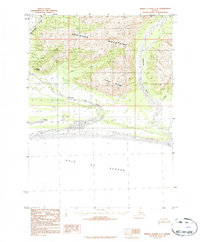
 1985 Yakutat C-61985 Print · USGSThe northern reaches of the Gulf of Alaska meet the coastal wilderness in the mid-1980s. Researchers can trace the shoreline of Yakutat Bay and locate landmarks like the Malaspina SW Base and Osar Stream.
 - 1985 Map of Bering Glacier C-5
 1985 Bering Glacier C-51985 Print · USGSSoutheast Alaska in the mid-1980s is seen here as a world of ice and rock within the recently established Wrangell-Saint Elias National Park. Researchers can trace the massive Bagley Icefield and the flow of the Tana Glacier across this roadless expanse.
 - 1985 Map of Bering Glacier B-7
 1985 Bering Glacier B-71985 Print · USGSCoastal Alaska during the mid-eighties was a wilderness of ice and rock, shaped by the massive flow of the Bering Glacier. Researchers can trace the extensive Moraine fields and locate landmark summits like the Khitrov Hills.
 - 1985 Map of Mount Saint Elias A-8
 1985 Mount Saint Elias A-81985 Print · USGSCoastal Alaska's frozen frontier is captured here in the mid-1980s, showing the intersection of massive ice fields and the international border. Researchers can trace the reach of the Malaspina Glacier and find remote landmarks like Moore Nunatak and Oily Lake.
 - 1985 Map of Yakutat C-8
 1985 Yakutat C-81985 Print · USGSThe northern reaches of the Gulf of Alaska are captured here in the mid-1980s, revealing a primitive coastline shaped by ice and tide. Researchers can trace the boundaries of the Wrangell-Saint Elias National Park and locate natural landmarks like Cape Sitkagi and Sitkagi Bluffs.
 - 1985 Map of Yakutat C-7
 1985 Yakutat C-71985 Print · USGSThe Alaskan coastline near Yakutat met the massive ice fields of the Wrangell-Saint Elias region in the mid-eighties. Researchers can trace the glacial terminus of the Malaspina Glacier and locate coastal landmarks like Point Manby and Alder Stream.
 - 1985 Map of Bering Glacier B-4
 1985 Bering Glacier B-41985 Print · USGSIn the mid-eighties, this provisional survey captured the frozen expanse of the Wrangell-Saint Elias National Park. Researchers can trace the massive flow of the Bering Glacier and the high elevations of the Robinson Mountains.
 - 1985 Map of Yakutat D-8
 1985 Yakutat D-81985 Print · USGSThe icy coastline of Southeast Alaska in the 1980s is preserved here, showing the intersection of the glacial front and the sea. Researchers can trace the extensive Moraine fields and the pristine reaches of the Wrangell - Saint Elias National Park as they border the Gulf of Alaska.
 - 1985 Map of Yakutat C-1
 1985 Yakutat C-11985 Print · USGSSoutheast Alaska’s high mountain wilderness is documented here in the mid-eighties as it appeared during a period of significant federal land conservation. Researchers can trace the massive Glacier systems and the international boundary line between Canada and the United States through the Tongass National Forest.
 - 1985 Map of Mount Saint Elias B-3
 1985 Mount Saint Elias B-31985 Print · USGSThe international border between Alaska and the Yukon Territory is defined by high-altitude peaks in the mid-1980s. Researchers can trace the rugged line between the United States and Canada through Mount Alverstone and the Alverstone Glacier.
Showing maps 1-25 of 44
Top cities of Yakutat
Frequently asked questions
- What are the different types of historical maps available for Yakutat?
- What is the oldest map of Yakutat?
- Where can I purchase historical maps of Yakutat for my home or office?
- Where can I download high-res historical maps of Yakutat?
- Are there historical topographic maps available for Yakutat?
- Is there historical aerial imagery available for Yakutat?
- Where are historical maps of Yakutat sourced from?