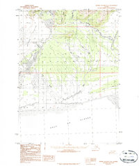
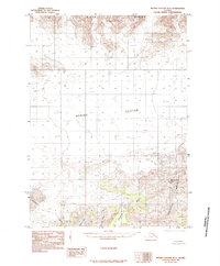
1984 Map of Bering Glacier A-6
USGS Topo · Published 1984About this map
The massive Bering Glacier dominates the northwestern corner of this remote Alaskan coastal landscape, its moraines and sand flats spreading toward the Gulf of Alaska. The terrain is defined by a complex network of glacial outflows and braided river systems, including the Tsiu River and the Kaliakh River, which carve through the Grindle Hills and around Donald Ridge. This 1984 provisional edition highlights the dynamic nature of the shoreline, where the Tsiuat River and Chiuki River meet expansive sand deposits before reaching the sea. A single Drill Hole noted near the West Fork suggests early resource exploration in this otherwise unpopulated wilderness, while landmarks like Hanna Lake and Kulthieth Creek provide essential reference points for navigating the shifting glacial topography.
Find a feature on this map
21 named features on this map. Tap any name to fly to it.
Don’t see what you’re looking for? This feature index may not catch every label — zoom into the map to look around manually.
Map Details
Editions of this 1984 Bering Glacier A-6 Map
This is the sole edition of this map. No revisions or reprints were ever made.
Other maps of this area

1950 · Bering Glacier
USGS Topo · 1:250,000

1950 · Icy Bay
USGS Topo · 1:250,000

1951 · Icy Bay
USGS Topo · 1:250,000

1951 · Bering Glacier
USGS Topo · 1:250,000

1959 · Bering Glacier
USGS Topo · 1:250,000

1961 · Icy Bay
USGS Topo · 1:250,000
1984 · Bering Glacier A-7
USGS Topo · 1:63,360
1984 · Bering Glacier A-5
USGS Topo · 1:63,360
1985 · Bering Glacier B-5
USGS Topo · 1:63,360
1985 · Bering Glacier B-6
USGS Topo · 1:63,360