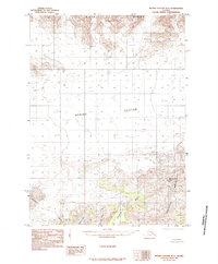
1985 Map of Bering Glacier B-6
USGS Topo · Published 1985About this map
Bering Glacier dominates this landscape, its massive ice flow and lateral moraines shaping the geography of this Gulf of Alaska coastal region. This 1985 provisional edition, compiled from early 1970s aerial photography, captures the intricate glacial margins and outwash features that define the territory before more modern shifts. To the south and east, the Robinson Mountains rise sharply, punctuated by McIntosh Peak and the high elevations of Waxell Ridge. The glacial influence extends to the complex hydrology of the lowlands, where the Kosakuts River drains toward the coast and Hanna Lake sits tucked against the Grindle Hills. The absence of roads or established settlements underscores the sheer scale of the natural terrain, providing a precise record of the Donald Ridge and surrounding ice fields in the late twentieth century.
Find a feature on this map
8 named features on this map. Tap any name to fly to it.
Don’t see what you’re looking for? This feature index may not catch every label — zoom into the map to look around manually.
Map Details
Editions of this 1985 Bering Glacier B-6 Map
This is the sole edition of this map. No revisions or reprints were ever made.
Other maps of this area

1950 · Bering Glacier
USGS Topo · 1:250,000

1951 · Bering Glacier
USGS Topo · 1:250,000

1959 · Bering Glacier
USGS Topo · 1:250,000
1984 · Bering Glacier A-6
USGS Topo · 1:63,360
1984 · Bering Glacier A-7
USGS Topo · 1:63,360
1984 · Bering Glacier A-5
USGS Topo · 1:63,360
1985 · Bering Glacier C-7
USGS Topo · 1:63,360
1985 · Bering Glacier B-5
USGS Topo · 1:63,360
1985 · Bering Glacier C-5
USGS Topo · 1:63,360
1985 · Bering Glacier B-7
USGS Topo · 1:63,360